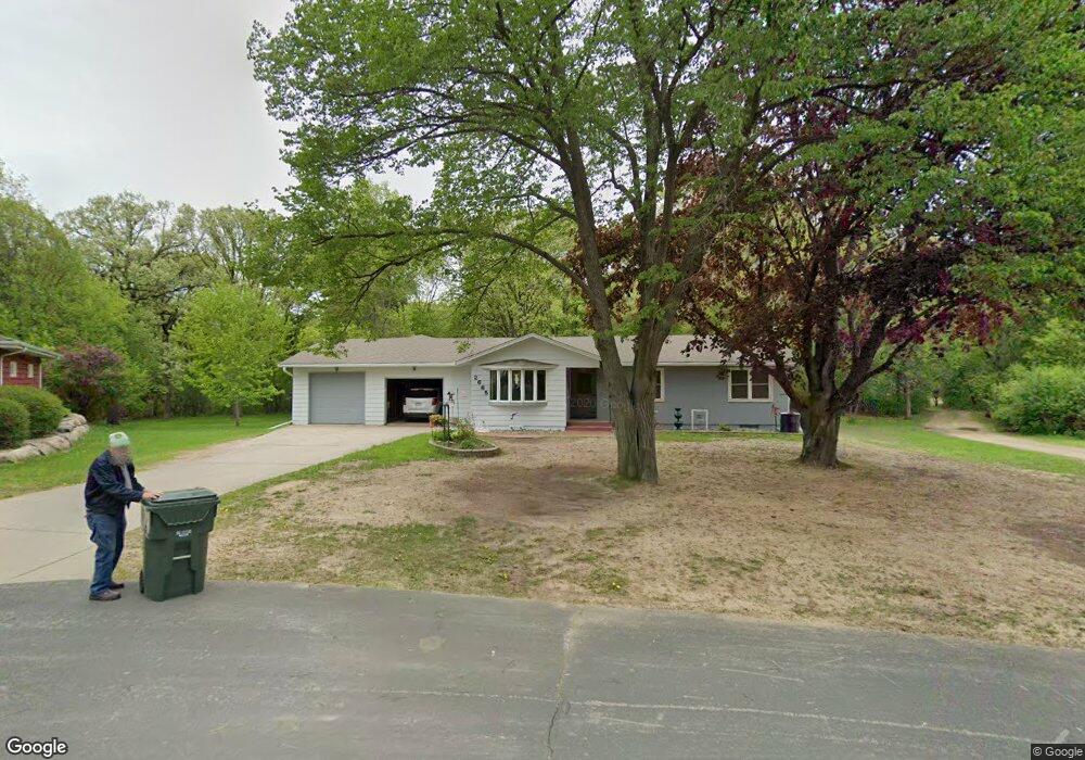
2665 132nd Ct W Rosemount, MN 55068
Estimated Value: $335,000 - $395,429
3
Beds
3
Baths
2,037
Sq Ft
$179/Sq Ft
Est. Value
About This Home
This home is located at 2665 132nd Ct W, Rosemount, MN 55068 and is currently estimated at $363,857, approximately $178 per square foot. 2665 132nd Ct W is a home located in Dakota County with nearby schools including Red Pine Elementary School, Rosemount Middle School, and Rosemount Senior High School.
Ownership History
Date
Name
Owned For
Owner Type
Purchase Details
Closed on
Jun 15, 2021
Sold by
Ahrens Edwin J
Bought by
Younger Austin Robert
Current Estimated Value
Home Financials for this Owner
Home Financials are based on the most recent Mortgage that was taken out on this home.
Original Mortgage
$270,750
Outstanding Balance
$245,359
Interest Rate
2.96%
Mortgage Type
New Conventional
Estimated Equity
$118,498
Create a Home Valuation Report for This Property
The Home Valuation Report is an in-depth analysis detailing your home's value as well as a comparison with similar homes in the area
Home Values in the Area
Average Home Value in this Area
Purchase History
| Date | Buyer | Sale Price | Title Company |
|---|---|---|---|
| Younger Austin Robert | $285,000 | Edina Realty Title Inc | |
| Younger Austin Austin | $285,000 | -- |
Source: Public Records
Mortgage History
| Date | Status | Borrower | Loan Amount |
|---|---|---|---|
| Open | Younger Austin Robert | $270,750 | |
| Closed | Younger Austin Austin | $270,750 |
Source: Public Records
Tax History Compared to Growth
Tax History
| Year | Tax Paid | Tax Assessment Tax Assessment Total Assessment is a certain percentage of the fair market value that is determined by local assessors to be the total taxable value of land and additions on the property. | Land | Improvement |
|---|---|---|---|---|
| 2024 | $3,886 | $371,800 | $113,800 | $258,000 |
| 2023 | $3,886 | $361,100 | $115,100 | $246,000 |
| 2022 | $3,148 | $340,900 | $114,600 | $226,300 |
| 2021 | $3,062 | $285,400 | $99,700 | $185,700 |
| 2020 | $3,188 | $272,600 | $94,900 | $177,700 |
| 2019 | $2,889 | $272,600 | $90,400 | $182,200 |
| 2018 | $2,721 | $260,300 | $86,100 | $174,200 |
| 2017 | $2,874 | $239,100 | $82,000 | $157,100 |
| 2016 | $2,743 | $241,200 | $87,700 | $153,500 |
| 2015 | $2,577 | $210,626 | $78,823 | $131,803 |
| 2014 | -- | $196,892 | $73,789 | $123,103 |
| 2013 | -- | $187,627 | $67,757 | $119,870 |
Source: Public Records
Map
Nearby Homes
- 2645 132nd Ct W
- 13290 Cadogan Way
- 13420 Cadogan Way
- 13433 Brick Path
- 13341 Cadogan Way
- 13360 Cadogan Way
- 13351 Cadogan Way
- 13370 Cadogan Way
- 13380 Cadogan Way
- 13371 Cadogan Way
- 2574 136th St W Unit 102
- 13635 Brick Path
- 13638 Brass Pkwy Unit 32
- 13692 Brookview Path
- 2300 136th Ct W
- 2373 136th Ct W
- 13464 Coachford Ave
- 2337 136th Ct W
- 2301 136th St W
- 13382 Couchtown Ct
- 2675 132nd Ct W
- 2685 132nd Ct W
- 2684 132nd Ct W
- 2693 132nd Ct W
- 2694 132nd Ct W
- 2686 132nd Ct W
- 2635 132nd Ct W
- 2771 Bonaire Path W
- 2604 132nd Ct W
- 2625 132nd Ct W
- 2655 132nd Ct W
- 2813 Bonaire Path W
- 13088 S Robert Trail
- 13100 S Robert Trail
- 2615 132nd Ct W
- 2800 130th St W
- 2605 Bonaire Path W
- 13246 Brass Pkwy
- 13260 Brass Pkwy
- 13274 Brass Pkwy