Estimated Value: $262,000 - $347,000
3
Beds
1
Bath
1,064
Sq Ft
$274/Sq Ft
Est. Value
About This Home
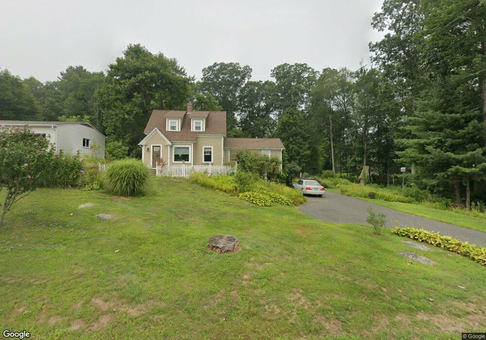
This home is located at 267 Palmer Rd, Ware, MA 01082 and is currently estimated at $291,901, approximately $274 per square foot. 267 Palmer Rd is a home located in Hampshire County with nearby schools including Stanley M. Koziol Elementary School, Ware Middle School, and Ware Junior/Senior High School.
Ownership History
Date
Name
Owned For
Owner Type
Purchase Details
Closed on
Aug 5, 2010
Sold by
Driscoll Nancy J and Mcquaid Nancy J
Bought by
Driscoll Tr Nancy J and Driscoll Robert J
Current Estimated Value
Purchase Details
Closed on
Dec 22, 1997
Sold by
Fielding Marie A
Bought by
Mcquaid Nancy J
Create a Home Valuation Report for This Property
The Home Valuation Report is an in-depth analysis detailing your home's value as well as a comparison with similar homes in the area
Home Values in the Area
Average Home Value in this Area
Purchase History
| Date | Buyer | Sale Price | Title Company |
|---|---|---|---|
| Driscoll Tr Nancy J | -- | -- | |
| Mcquaid Nancy J | $58,500 | -- |
Source: Public Records
Mortgage History
| Date | Status | Borrower | Loan Amount |
|---|---|---|---|
| Open | Mcquaid Nancy J | $25,000 | |
| Previous Owner | Mcquaid Nancy J | $13,000 | |
| Previous Owner | Mcquaid Nancy J | $60,300 | |
| Previous Owner | Mcquaid Nancy J | $10,000 |
Source: Public Records
Tax History Compared to Growth
Tax History
| Year | Tax Paid | Tax Assessment Tax Assessment Total Assessment is a certain percentage of the fair market value that is determined by local assessors to be the total taxable value of land and additions on the property. | Land | Improvement |
|---|---|---|---|---|
| 2025 | $2,533 | $168,200 | $47,500 | $120,700 |
| 2024 | $2,446 | $149,800 | $44,800 | $105,000 |
| 2023 | $2,513 | $145,600 | $43,100 | $102,500 |
| 2022 | $2,429 | $125,600 | $40,000 | $85,600 |
| 2021 | $2,371 | $117,500 | $40,000 | $77,500 |
| 2020 | $2,284 | $110,700 | $40,000 | $70,700 |
| 2019 | $2,237 | $110,700 | $40,000 | $70,700 |
| 2018 | $2,158 | $104,200 | $38,900 | $65,300 |
| 2017 | $2,081 | $100,200 | $38,900 | $61,300 |
| 2016 | $2,025 | $100,200 | $38,900 | $61,300 |
| 2015 | $1,969 | $100,200 | $38,900 | $61,300 |
| 2014 | $1,935 | $105,700 | $39,500 | $66,200 |
Source: Public Records
Map
Nearby Homes
- 201 West St
- LOT 3 Monson Turnpike Rd
- 28 Gould St
- 201 Belchertown Rd
- 14 Laurel Dr
- 87 W Main St
- 375 Belchertown Rd
- 23 West St Unit 25
- 7 Webb Ct
- 67 Babcock Tavern Rd
- 44 South St
- Lot 16 Coldbrook Dr
- Lot 20 Coldbrook Dr
- Lot 22 Coldbrook Dr
- Lot 13 Coldbrook Dr
- Lot 25 Coldbrook Dr
- 48 North St Unit 1
- 36 Pleasant St
- 22 Church St
- 31-33 Aspen St