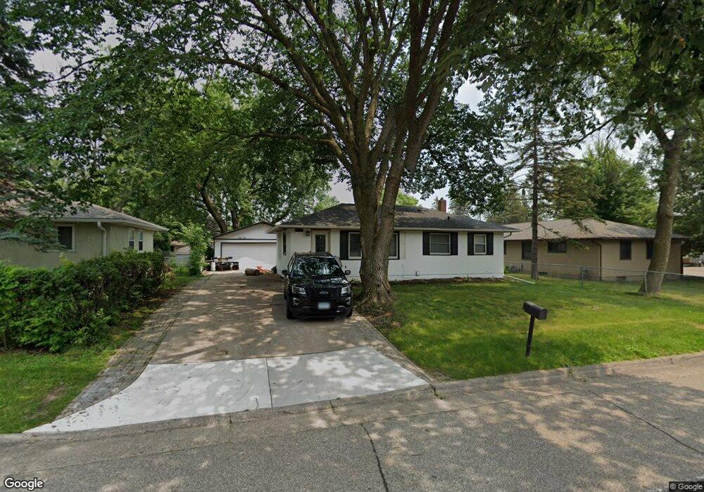
2676 Mcknight Rd N Saint Paul, MN 55109
Estimated Value: $295,000 - $335,000
3
Beds
2
Baths
60
Sq Ft
$5,217/Sq Ft
Est. Value
About This Home
This home is located at 2676 Mcknight Rd N, Saint Paul, MN 55109 and is currently estimated at $313,046, approximately $5,217 per square foot. 2676 Mcknight Rd N is a home located in Ramsey County with nearby schools including Richardson Elementary School, John Glenn Middle School, and Christ Lutheran School.
Ownership History
Date
Name
Owned For
Owner Type
Purchase Details
Closed on
Jun 7, 2016
Sold by
Anderson Derek R and Anderson Allyson J
Bought by
Anderson Allyson J and Anderson Derek R
Current Estimated Value
Home Financials for this Owner
Home Financials are based on the most recent Mortgage that was taken out on this home.
Original Mortgage
$147,537
Outstanding Balance
$116,846
Interest Rate
3.42%
Mortgage Type
FHA
Estimated Equity
$196,200
Purchase Details
Closed on
Mar 16, 2011
Sold by
Us Bank Na
Bought by
Anderson Derek R
Purchase Details
Closed on
Jul 19, 2001
Sold by
Johnson Sandra L
Bought by
Jensen Gregory T and Jensen Rosanne M
Purchase Details
Closed on
Dec 5, 1997
Sold by
Johnson Dana James and Johnson Mary Jo
Bought by
Johnson Sandra L
Create a Home Valuation Report for This Property
The Home Valuation Report is an in-depth analysis detailing your home's value as well as a comparison with similar homes in the area
Home Values in the Area
Average Home Value in this Area
Purchase History
| Date | Buyer | Sale Price | Title Company |
|---|---|---|---|
| Anderson Allyson J | -- | Partners Title Llc | |
| Anderson Derek R | $73,000 | -- | |
| Jensen Gregory T | $175,400 | -- | |
| Johnson Sandra L | $104,900 | -- |
Source: Public Records
Mortgage History
| Date | Status | Borrower | Loan Amount |
|---|---|---|---|
| Open | Anderson Allyson J | $147,537 |
Source: Public Records
Tax History Compared to Growth
Tax History
| Year | Tax Paid | Tax Assessment Tax Assessment Total Assessment is a certain percentage of the fair market value that is determined by local assessors to be the total taxable value of land and additions on the property. | Land | Improvement |
|---|---|---|---|---|
| 2025 | $3,970 | $311,600 | $51,300 | $260,300 |
| 2023 | $3,970 | $287,700 | $51,300 | $236,400 |
| 2022 | $3,512 | $304,300 | $51,300 | $253,000 |
| 2021 | $3,330 | $244,400 | $51,300 | $193,100 |
| 2020 | $3,188 | $235,300 | $51,300 | $184,000 |
| 2019 | $3,288 | $213,900 | $51,300 | $162,600 |
| 2018 | $2,946 | $218,800 | $51,300 | $167,500 |
| 2017 | $2,660 | $196,300 | $51,300 | $145,000 |
| 2016 | $2,348 | $0 | $0 | $0 |
| 2015 | $2,030 | $161,300 | $51,300 | $110,000 |
| 2014 | $1,900 | $0 | $0 | $0 |
Source: Public Records
Map
Nearby Homes
- 2285 17th Ave E
- 2701 Gerald Ave
- 2327 17th Ave E
- 2333 17th Ave E
- 2339 17th Ave E
- 2345 17th Ave E
- 2735 Delaware Ave
- 2739 Chippewa Ave
- 2529 2nd St N
- 2330 12th Ave E
- 2112 Radatz Ave
- 2321 Beam Ave
- 2800 1st St N
- 2237 Maple Ln E
- 2340 Standridge Ave
- 2631 Margaret St N
- 2911 Bartelmy Ln
- 2547 14th Ave E
- 2974 Winthrop Dr
- 2603 17th Ave E
- 2676 2676 McKnight Rd N
- 2267 Mohawk Rd E
- 2682 Mcknight Rd N
- 2688 Mcknight Rd N
- 2283 Mohawk Rd E
- 2677 Apache Rd N
- 2677 2677 Apache Rd N
- 2683 Apache Rd N
- 2253 Mohawk Rd E
- 2694 Mcknight Rd N
- 2681 Mcknight Rd N
- 2280 Mohawk Rd E
- 2691 Apache Rd N
- 2687 Mcknight Rd N
- 2252 Mohawk Rd E
- 2245 Mohawk Rd E
- 2245 2245 Mohawk-Road-e
- 2267 17th Ave E
- 2700 Mcknight Rd N
- 2286 Mohawk Rd E