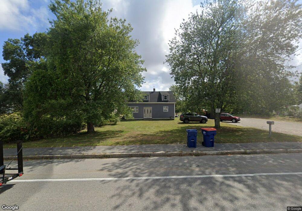
2677 Cranberry Hwy Wareham, MA 02571
Estimated Value: $410,000 - $632,000
3
Beds
1
Bath
1,803
Sq Ft
$272/Sq Ft
Est. Value
About This Home
This home is located at 2677 Cranberry Hwy, Wareham, MA 02571 and is currently estimated at $490,654, approximately $272 per square foot. 2677 Cranberry Hwy is a home located in Plymouth County.
Ownership History
Date
Name
Owned For
Owner Type
Purchase Details
Closed on
Nov 27, 2012
Sold by
Nsp Residential Llc
Bought by
Gabriel Michael A
Current Estimated Value
Home Financials for this Owner
Home Financials are based on the most recent Mortgage that was taken out on this home.
Original Mortgage
$109,500
Outstanding Balance
$74,959
Interest Rate
3.42%
Mortgage Type
New Conventional
Estimated Equity
$415,695
Purchase Details
Closed on
May 23, 2012
Sold by
Fnma
Bought by
Nsp Residential Llc
Purchase Details
Closed on
Oct 6, 2011
Sold by
Gabriel Michael A and Bank Of America Na
Bought by
Federal National Mortgage Association
Purchase Details
Closed on
Jun 7, 2004
Sold by
Hayes Constance J and Gabriel-Card Judy
Bought by
Gabriel Michael A
Create a Home Valuation Report for This Property
The Home Valuation Report is an in-depth analysis detailing your home's value as well as a comparison with similar homes in the area
Purchase History
| Date | Buyer | Sale Price | Title Company |
|---|---|---|---|
| Gabriel Michael A | $109,500 | -- | |
| Gabriel Michael A | $109,500 | -- | |
| Gabriel Michael A | $109,500 | -- | |
| Nsp Residential Llc | $81,500 | -- | |
| Nsp Residential Llc | $81,500 | -- | |
| Federal National Mortgage Association | $331,703 | -- | |
| Federal National Mortgage Association | $331,703 | -- | |
| Gabriel Michael A | $170,000 | -- | |
| Gabriel Michael A | $170,000 | -- |
Source: Public Records
Mortgage History
| Date | Status | Borrower | Loan Amount |
|---|---|---|---|
| Open | Gabriel Michael A | $109,500 | |
| Closed | Gabriel Michael A | $109,500 |
Source: Public Records
Tax History
| Year | Tax Paid | Tax Assessment Tax Assessment Total Assessment is a certain percentage of the fair market value that is determined by local assessors to be the total taxable value of land and additions on the property. | Land | Improvement |
|---|---|---|---|---|
| 2025 | $3,939 | $378,000 | $99,400 | $278,600 |
| 2024 | $4,118 | $366,700 | $77,800 | $288,900 |
| 2023 | $3,903 | $324,400 | $70,700 | $253,700 |
| 2022 | $3,559 | $270,000 | $70,700 | $199,300 |
| 2021 | $3,502 | $260,400 | $70,700 | $189,700 |
| 2020 | $3,326 | $250,800 | $70,700 | $180,100 |
| 2019 | $3,053 | $229,700 | $68,600 | $161,100 |
| 2018 | $2,806 | $205,900 | $68,600 | $137,300 |
| 2017 | $2,689 | $199,900 | $68,600 | $131,300 |
| 2016 | $2,563 | $189,400 | $67,000 | $122,400 |
| 2015 | $2,475 | $189,400 | $67,000 | $122,400 |
| 2014 | $2,289 | $178,100 | $63,700 | $114,400 |
Source: Public Records
Map
Nearby Homes
- 2697 Cranberry Hwy Unit 21
- 2697 Cranberry Hwy Unit 28
- 35 Willard St
- 2711 Cranberry Hwy
- 2645 Cranberry Hwy Unit A
- 110 Mayflower Ridge Dr
- 2 Oakdale St
- 156 Sandwich Rd
- 437 Main St
- 10 Oak St
- 45 Main St Unit 38
- 12 Linwood Ave
- 0 Charge Pond Rd
- 1 Nimrod Way
- 2838 Cranberry Hwy
- 4 Ross Ave
- 124 Minot Ave Unit 1
- 7 Knowles Ave
- 9 Old Glen Charlie Rd
- 91 Agawam Lake Shore Dr
- 2673 Cranberry Hwy
- 2681 Cranberry Hwy
- 2683 Cranberry Hwy
- 2683 Cranberry Hwy
- 2667 Cranberry Hwy Unit C-1
- 2667 Cranberry Hwy Unit Metal Bldg
- 2667 Cranberry Hwy
- 2667 Cranberry Hwy Unit 10
- 2667 Cranberry Hwy Unit 1
- 2667 Cranberry Hwy Unit 2
- 2667 Cranberry Hwy Unit 7
- 2667 Cranberry Hwy Unit 5
- 2667 Cranberry Hwy Unit 6
- 2667 Cranberry Hwy Unit 8
- 2667 Cranberry Hwy Unit 4
- 2669 Cranberry Hwy
- 2688 Cranberry Hwy
- 2679 Cranberry Hwy
- 2679 Cranberry Hwy
- 2703 Cranberry Hwy