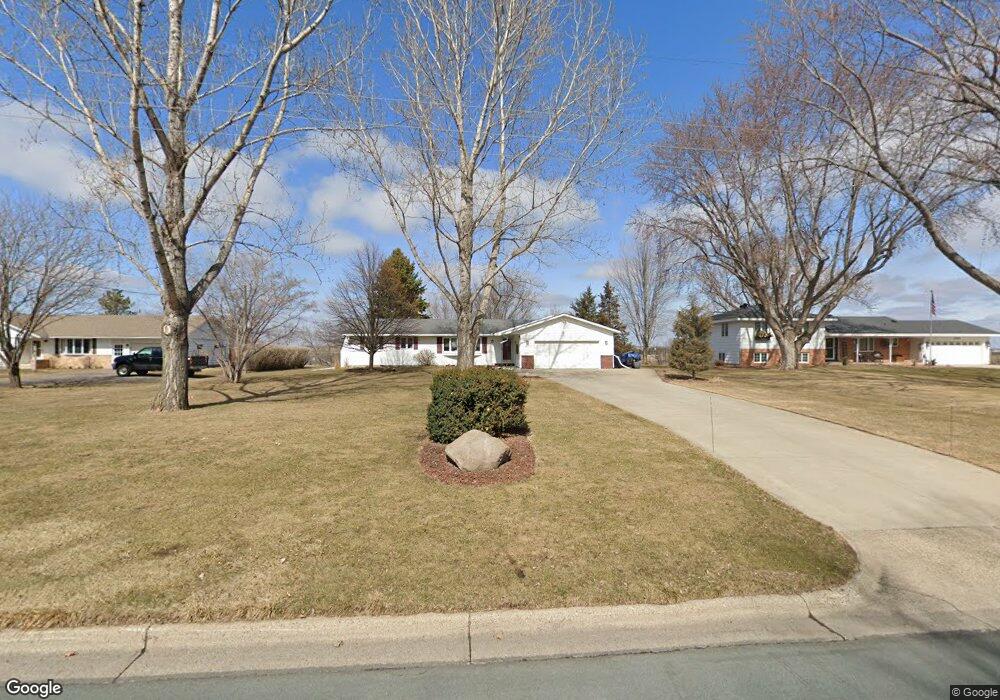
2679 Hauer Trail Shakopee, MN 55379
Estimated Value: $368,000 - $414,000
3
Beds
2
Baths
1,361
Sq Ft
$293/Sq Ft
Est. Value
About This Home
This home is located at 2679 Hauer Trail, Shakopee, MN 55379 and is currently estimated at $398,154, approximately $292 per square foot. 2679 Hauer Trail is a home located in Scott County with nearby schools including Sun Path Elementary School, Shakopee West Middle School, and Shakopee Senior High School.
Ownership History
Date
Name
Owned For
Owner Type
Purchase Details
Closed on
Jan 30, 2025
Sold by
Block Joanne
Bought by
Block Deven
Current Estimated Value
Home Financials for this Owner
Home Financials are based on the most recent Mortgage that was taken out on this home.
Original Mortgage
$373,117
Outstanding Balance
$370,143
Interest Rate
6.72%
Mortgage Type
FHA
Estimated Equity
$28,011
Purchase Details
Closed on
Oct 25, 1996
Sold by
Fox Doris M
Bought by
Block David R and Block Joanne R
Create a Home Valuation Report for This Property
The Home Valuation Report is an in-depth analysis detailing your home's value as well as a comparison with similar homes in the area
Home Values in the Area
Average Home Value in this Area
Purchase History
| Date | Buyer | Sale Price | Title Company |
|---|---|---|---|
| Block Deven | $380,000 | Scott County Abstract & Title | |
| Block David R | $127,900 | -- |
Source: Public Records
Mortgage History
| Date | Status | Borrower | Loan Amount |
|---|---|---|---|
| Open | Block Deven | $373,117 |
Source: Public Records
Tax History Compared to Growth
Tax History
| Year | Tax Paid | Tax Assessment Tax Assessment Total Assessment is a certain percentage of the fair market value that is determined by local assessors to be the total taxable value of land and additions on the property. | Land | Improvement |
|---|---|---|---|---|
| 2025 | $3,846 | $366,100 | $180,400 | $185,700 |
| 2024 | $3,906 | $375,600 | $189,800 | $185,800 |
| 2023 | $4,136 | $368,400 | $186,100 | $182,300 |
| 2022 | $3,706 | $382,800 | $186,100 | $196,700 |
| 2021 | $3,184 | $300,000 | $152,300 | $147,700 |
| 2020 | $3,316 | $284,200 | $136,500 | $147,700 |
| 2019 | $3,090 | $262,800 | $114,500 | $148,300 |
| 2018 | $2,962 | $0 | $0 | $0 |
| 2016 | $2,960 | $0 | $0 | $0 |
| 2014 | -- | $0 | $0 | $0 |
Source: Public Records
Map
Nearby Homes
- 1130 Farrier Rd
- 2585 Paddock Path
- 1775 Hauer Trail
- 2388 Vierling Dr E
- 2312 Vierling Dr E
- 2006 Tyrone Dr
- 2263 Tyrone Dr
- 1682 Tyrone Dr
- 1933 Davis Ct
- Nokomis Plan at Summerland Place - The Tradition Collection
- Gregorian Plan at Summerland Place - The Tradition Collection
- 1542 Philipp Way
- Pryor Plan at Summerland Place - The Tradition Collection
- Mille Lacs Plan at Summerland Place - The Tradition Collection
- Crestwood Plan at Summerland Place - The Tradition Collection
- Erie Plan at Summerland Place - The Tradition Collection
- Vermilion Plan at Summerland Place - The Tradition Collection
- Ontario Plan at Summerland Place - The Tradition Collection
- 1691 Tyrone Dr
- 1511 England Way
- 2705 Hauer Trail
- 2649 Hauer Trail
- 2745 Hauer Trail
- 2621 Hauer Trail
- 2666 Hauer Trail
- 2688 Hauer Trail
- 2638 Hauer Trail
- 2716 Hauer Trail
- 2614 Hauer Trail
- 2593 Hauer Trail
- 2767 Hauer Trail
- 2641 Emerald Ln
- 2641 Emerald Ln E
- 2661 Emerald Ln
- 2621 Emerald Ln
- 2588 Hauer Trail
- 1241 Jasper Rd S
- 2601 Emerald Ln
- 2569 Hauer Trail
- 1255 Jasper Rd S