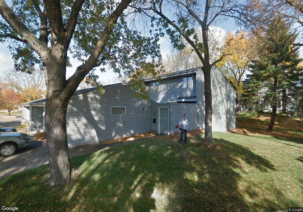
2686 MacKubin St Saint Paul, MN 55113
South Owasso NeighborhoodEstimated Value: $302,000 - $312,179
3
Beds
3
Baths
1,664
Sq Ft
$185/Sq Ft
Est. Value
About This Home
This home is located at 2686 MacKubin St, Saint Paul, MN 55113 and is currently estimated at $307,545, approximately $184 per square foot. 2686 MacKubin St is a home located in Ramsey County with nearby schools including Central Park Elementary School, Roseville Area Middle School, and Roseville Area Senior High School.
Ownership History
Date
Name
Owned For
Owner Type
Purchase Details
Closed on
Oct 5, 2020
Sold by
Medina Carlo and Medina Tara Stone
Bought by
Rhodes Brynn
Current Estimated Value
Home Financials for this Owner
Home Financials are based on the most recent Mortgage that was taken out on this home.
Original Mortgage
$200,000
Outstanding Balance
$160,996
Interest Rate
2.9%
Mortgage Type
New Conventional
Estimated Equity
$146,549
Purchase Details
Closed on
May 19, 2000
Sold by
Johnson Lucille B
Bought by
Stone Daniel L
Create a Home Valuation Report for This Property
The Home Valuation Report is an in-depth analysis detailing your home's value as well as a comparison with similar homes in the area
Home Values in the Area
Average Home Value in this Area
Purchase History
| Date | Buyer | Sale Price | Title Company |
|---|---|---|---|
| Rhodes Brynn | $250,000 | Minnesota Title | |
| Stone Daniel L | $155,000 | -- |
Source: Public Records
Mortgage History
| Date | Status | Borrower | Loan Amount |
|---|---|---|---|
| Open | Rhodes Brynn | $200,000 |
Source: Public Records
Tax History Compared to Growth
Tax History
| Year | Tax Paid | Tax Assessment Tax Assessment Total Assessment is a certain percentage of the fair market value that is determined by local assessors to be the total taxable value of land and additions on the property. | Land | Improvement |
|---|---|---|---|---|
| 2025 | $3,424 | $298,700 | $50,000 | $248,700 |
| 2023 | $3,424 | $254,100 | $50,000 | $204,100 |
| 2022 | $3,016 | $263,400 | $50,000 | $213,400 |
| 2021 | $2,752 | $214,000 | $50,000 | $164,000 |
| 2020 | $3,074 | $210,100 | $50,000 | $160,100 |
| 2019 | $2,972 | $202,800 | $22,900 | $179,900 |
| 2018 | $3,056 | $190,700 | $22,900 | $167,800 |
| 2017 | $2,760 | $190,600 | $22,900 | $167,700 |
| 2016 | $2,310 | $0 | $0 | $0 |
| 2015 | $2,308 | $150,700 | $22,900 | $127,800 |
| 2014 | $2,450 | $0 | $0 | $0 |
Source: Public Records
Map
Nearby Homes
- 2720 MacKubin St
- 540 Woodhill Dr Unit 71
- 2730 Dale St N Unit D309
- 2730 Dale St N Unit D101
- 2710 Dale St N Unit B212
- 2720 Dale St N Unit C208
- 556 County Road C W
- 437 County Road C W
- 2748 Kent St
- 667 County Road C W
- 387 Iona Ln
- 405 Judith Ave
- 350 County Road C W
- 405 Brooks Ave W
- 2687 Galtier St
- 2814 Matilda St
- 2821 Galtier St
- 500 County Road B2 W
- 2802 Marion St
- 2970 Western Ave N
- 2688 MacKubin St
- 2684 MacKubin St
- 2682 MacKubin St
- 2680 MacKubin St
- 0 MacKubin St
- 2678 MacKubin St
- 2690 MacKubin St
- 2692 MacKubin St
- 2670 MacKubin St
- 2672 MacKubin St
- 2666 MacKubin St
- 2674 MacKubin St
- 2694 MacKubin St
- 2676 MacKubin St
- 2700 MacKubin St
- 2664 MacKubin St
- 2696 MacKubin St
- 2702 MacKubin St
- 2662 MacKubin St
- 2704 MacKubin St