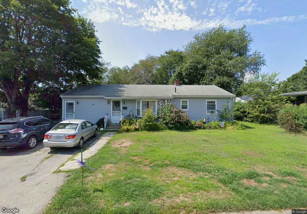
27 Deer St Somerset, MA 02726
Pottersville NeighborhoodEstimated Value: $490,000 - $522,000
3
Beds
2
Baths
1,484
Sq Ft
$339/Sq Ft
Est. Value
About This Home
This home is located at 27 Deer St, Somerset, MA 02726 and is currently estimated at $503,407, approximately $339 per square foot. 27 Deer St is a home located in Bristol County with nearby schools including Chace Street School, Somerset Middle School, and St. Michael's School.
Ownership History
Date
Name
Owned For
Owner Type
Purchase Details
Closed on
Nov 6, 2018
Sold by
Lepage Edith M
Bought by
Lepage Edith L and Torngren Diane M
Current Estimated Value
Purchase Details
Closed on
Jun 17, 1983
Bought by
Lepage Norman J
Create a Home Valuation Report for This Property
The Home Valuation Report is an in-depth analysis detailing your home's value as well as a comparison with similar homes in the area
Home Values in the Area
Average Home Value in this Area
Purchase History
| Date | Buyer | Sale Price | Title Company |
|---|---|---|---|
| Lepage Edith L | -- | -- | |
| Lepage Edith L | -- | -- | |
| Lepage Edith L | -- | -- | |
| Lepage Norman J | $54,000 | -- |
Source: Public Records
Mortgage History
| Date | Status | Borrower | Loan Amount |
|---|---|---|---|
| Previous Owner | Lepage Norman J | $20,000 | |
| Previous Owner | Lepage Norman J | $75,000 | |
| Previous Owner | Lepage Norman J | $66,500 |
Source: Public Records
Tax History Compared to Growth
Tax History
| Year | Tax Paid | Tax Assessment Tax Assessment Total Assessment is a certain percentage of the fair market value that is determined by local assessors to be the total taxable value of land and additions on the property. | Land | Improvement |
|---|---|---|---|---|
| 2025 | $5,406 | $406,500 | $188,200 | $218,300 |
| 2024 | $5,096 | $398,400 | $188,200 | $210,200 |
| 2023 | $4,468 | $352,400 | $163,700 | $188,700 |
| 2022 | $4,140 | $311,500 | $142,300 | $169,200 |
| 2021 | $4,184 | $285,000 | $129,300 | $155,700 |
| 2020 | $4,281 | $281,300 | $129,600 | $151,700 |
| 2019 | $4,864 | $266,500 | $129,600 | $136,900 |
| 2018 | $2,144 | $255,700 | $128,800 | $126,900 |
| 2017 | $4,240 | $243,700 | $122,900 | $120,800 |
| 2016 | $4,267 | $243,700 | $122,900 | $120,800 |
| 2015 | $3,973 | $229,000 | $117,300 | $111,700 |
| 2014 | $5,388 | $223,100 | $114,000 | $109,100 |
Source: Public Records
Map
Nearby Homes
- 95 Brookside Rd
- 345 Chace St
- 190 Gibbs St
- 122 Robin Ln
- 112 Rounseville Ave
- 745 Bark St
- 81 Wood St
- 51 Linden Dr
- 702 Bark St
- 602 Regan Rd
- 54 Grant Ave
- 2714 Riverside Ave
- 1067 Bark St
- 0 Bark St Unit 1342599
- 0 Bark St Unit 73152576
- 53 Riley Ave
- 2396 Riverside Ave
- 95 Samson Ave
- 265 Stevens Rd
- 65 Marvel St