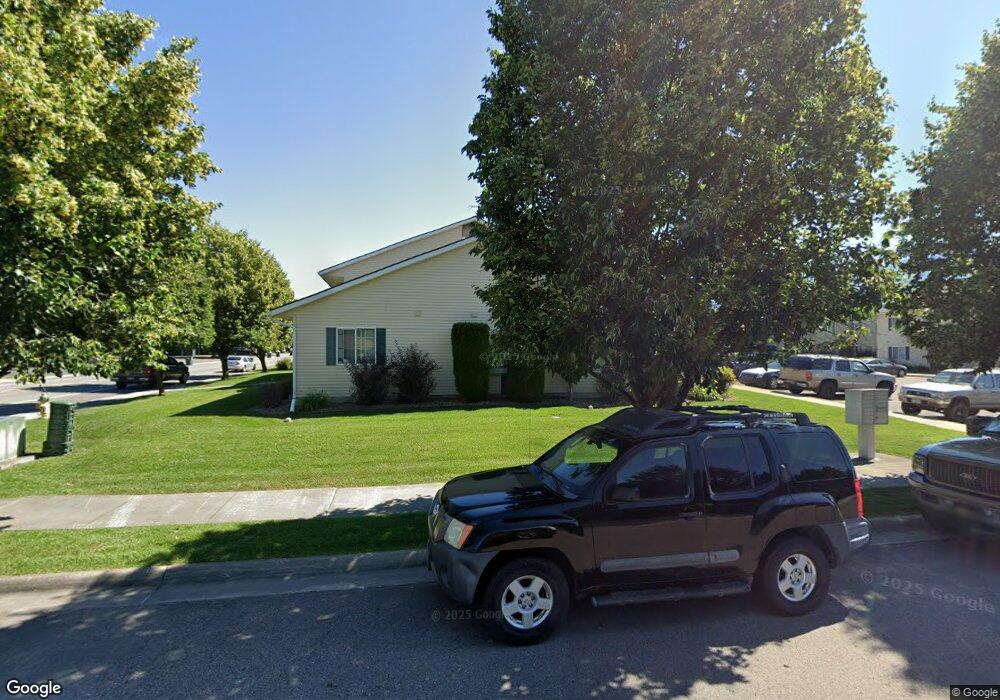
27 Diane Rd Columbia Falls, MT 59912
Estimated Value: $261,000 - $314,000
3
Beds
2
Baths
816
Sq Ft
$356/Sq Ft
Est. Value
About This Home
This home is located at 27 Diane Rd, Columbia Falls, MT 59912 and is currently estimated at $290,295, approximately $355 per square foot. 27 Diane Rd is a home located in Flathead County with nearby schools including Ruder Elementary School, Columbia Falls Junior High School (7-8), and Columbia Falls High School.
Ownership History
Date
Name
Owned For
Owner Type
Purchase Details
Closed on
Jul 31, 2019
Sold by
Baiar Properties Llc
Bought by
Robert W Pero Revocable Trust
Current Estimated Value
Purchase Details
Closed on
Sep 20, 2018
Sold by
Vander Eyk Derek R
Bought by
Bledsoe Rhonda L
Home Financials for this Owner
Home Financials are based on the most recent Mortgage that was taken out on this home.
Original Mortgage
$120,650
Interest Rate
5.37%
Mortgage Type
Adjustable Rate Mortgage/ARM
Purchase Details
Closed on
Jan 29, 2014
Sold by
Baumanns Property Llc
Bought by
Baiar Properties Llc
Purchase Details
Closed on
Aug 10, 2010
Sold by
Federal Home Loan Mortgage Corporation
Bought by
Baumann Property Llc
Purchase Details
Closed on
Apr 22, 2010
Sold by
Martin Winona J
Bought by
Federal Home Loan Mortgage Corp
Create a Home Valuation Report for This Property
The Home Valuation Report is an in-depth analysis detailing your home's value as well as a comparison with similar homes in the area
Home Values in the Area
Average Home Value in this Area
Purchase History
| Date | Buyer | Sale Price | Title Company |
|---|---|---|---|
| Robert W Pero Revocable Trust | -- | First American Title Company | |
| Bledsoe Rhonda L | -- | First American Title Co | |
| Baiar Properties Llc | -- | None Available | |
| Baumann Property Llc | $54,000 | Fidelity National Title | |
| Federal Home Loan Mortgage Corp | $81,201 | First American Title Ins Co |
Source: Public Records
Mortgage History
| Date | Status | Borrower | Loan Amount |
|---|---|---|---|
| Previous Owner | Bledsoe Rhonda L | $120,650 |
Source: Public Records
Tax History
| Year | Tax Paid | Tax Assessment Tax Assessment Total Assessment is a certain percentage of the fair market value that is determined by local assessors to be the total taxable value of land and additions on the property. | Land | Improvement |
|---|---|---|---|---|
| 2025 | $1,186 | $274,100 | $0 | $0 |
| 2024 | $1,420 | $201,600 | $0 | $0 |
| 2023 | $1,502 | $201,600 | $0 | $0 |
| 2022 | $1,341 | $134,100 | $0 | $0 |
| 2021 | $1,484 | $134,100 | $0 | $0 |
| 2020 | $1,257 | $103,800 | $0 | $0 |
| 2019 | $1,194 | $103,800 | $0 | $0 |
| 2018 | $1,213 | $101,300 | $0 | $0 |
| 2017 | $1,170 | $101,300 | $0 | $0 |
| 2016 | $1,171 | $99,800 | $0 | $0 |
| 2015 | $1,161 | $99,800 | $0 | $0 |
| 2014 | $1,085 | $55,968 | $0 | $0 |
Source: Public Records
Map
Nearby Homes
- 22 Diane Rd Unit 172
- 24 Diane Rd Unit C
- 24 Diane Rd Unit 171 A
- 25 Martha Rd
- 26 Martha Rd
- 9 & 11 Diane Rd
- 10 Diane Rd
- 165 Veteran Dr
- 8786 U S 2
- 1615 Ave
- 2060 Rapids Ave
- 330 Meadow Lake Lot 2 Blvd
- 10 Ruder View Ct
- 1398 Waters Edge Way
- 1130 10th Ave W
- 1265 Jellison Rd
- 1005 10th St W
- 929 9th St W
- 1000 Lemburg Ln
- 809 9th St W Unit 1
- 27 Diane Rd Unit 152 C
- 27 Diane Rd
- 27 Diane Rd
- 27 Diane Rd
- 27 Diane Rd
- 27 Diane Rd
- 27 Diane Rd Unit 152c
- 27 Diane Rd Unit D
- 27 Diane Rd Unit F
- 27 Diane Rd Unit E
- 27 Diane Rd Unit 152A
- 27 Diane Rd Unit 152E
- 27 Diane Rd Unit 152D
- 27 Diane Rd Unit F
- 27 Diane Rd Unit B
- 27 Diane Rd Unit B
- 27 Diane Rd Unit 152d
- 27 Diane Rd Unit 152f
- 27 Diane Ln
- 16 Martha Rd
Your Personal Tour Guide
Ask me questions while you tour the home.