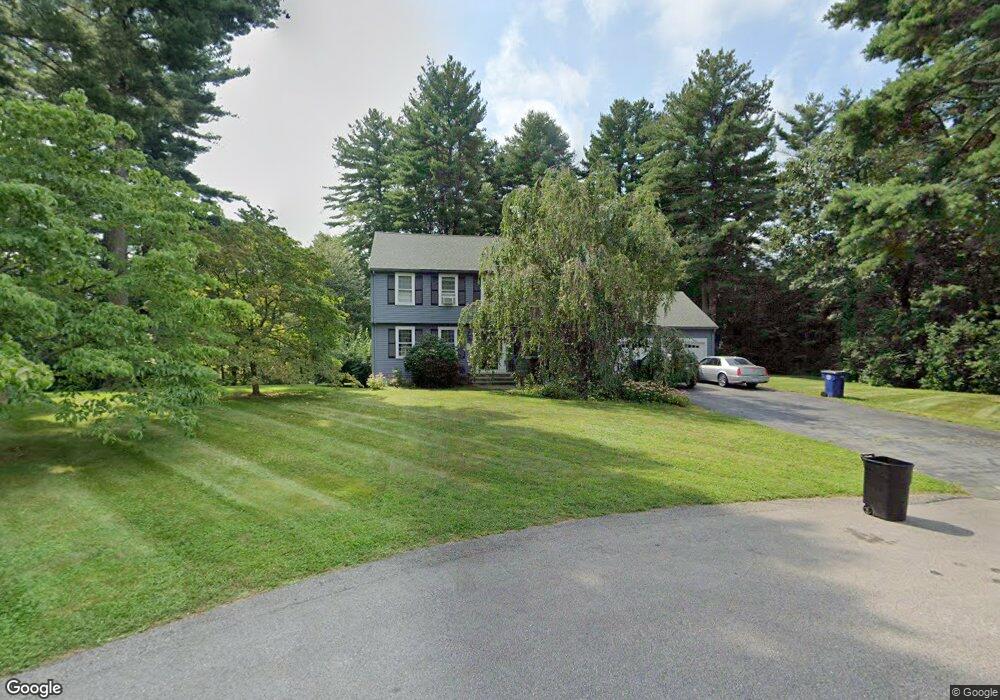
27 Fox Run Rd Medway, MA 02053
Estimated Value: $767,000 - $868,000
4
Beds
3
Baths
2,800
Sq Ft
$286/Sq Ft
Est. Value
About This Home
This home is located at 27 Fox Run Rd, Medway, MA 02053 and is currently estimated at $801,278, approximately $286 per square foot. 27 Fox Run Rd is a home located in Norfolk County with nearby schools including John D. McGovern Elementary School, Burke-Memorial Elementary, and Medway Middle School.
Ownership History
Date
Name
Owned For
Owner Type
Purchase Details
Closed on
Jun 27, 2003
Sold by
Towell Paul J and Towell Jean M
Bought by
Brown John D and Brown Jennifer
Current Estimated Value
Purchase Details
Closed on
Nov 3, 1997
Sold by
Hjerpe Edward A and Hjerpe Macrina G
Bought by
Towell Paul J and Towell Jean M
Create a Home Valuation Report for This Property
The Home Valuation Report is an in-depth analysis detailing your home's value as well as a comparison with similar homes in the area
Home Values in the Area
Average Home Value in this Area
Purchase History
| Date | Buyer | Sale Price | Title Company |
|---|---|---|---|
| Brown John D | $429,900 | -- | |
| Towell Paul J | $280,000 | -- |
Source: Public Records
Mortgage History
| Date | Status | Borrower | Loan Amount |
|---|---|---|---|
| Open | Towell Paul J | $150,000 | |
| Closed | Towell Paul J | $102,450 |
Source: Public Records
Tax History Compared to Growth
Tax History
| Year | Tax Paid | Tax Assessment Tax Assessment Total Assessment is a certain percentage of the fair market value that is determined by local assessors to be the total taxable value of land and additions on the property. | Land | Improvement |
|---|---|---|---|---|
| 2025 | $9,213 | $646,500 | $312,500 | $334,000 |
| 2024 | $9,310 | $646,500 | $312,500 | $334,000 |
| 2023 | $9,228 | $578,900 | $284,400 | $294,500 |
| 2022 | $8,467 | $500,100 | $210,300 | $289,800 |
| 2021 | $8,503 | $487,000 | $196,300 | $290,700 |
| 2020 | $8,481 | $484,600 | $196,300 | $288,300 |
| 2019 | $7,910 | $466,100 | $188,300 | $277,800 |
| 2018 | $7,973 | $451,500 | $180,300 | $271,200 |
| 2017 | $8,066 | $450,100 | $185,600 | $264,500 |
| 2016 | $7,715 | $426,000 | $170,800 | $255,200 |
| 2015 | $7,655 | $419,700 | $168,700 | $251,000 |
| 2014 | $7,429 | $394,300 | $168,700 | $225,600 |
Source: Public Records
Map
Nearby Homes
- 22 Granite St
- 9 Tulip Way
- 6 Rainbow Dr
- 39 West St
- 0 Old Log Lane (Farm St) Unit 73416329
- 4 Deerfield Rd
- 387 Hartford Ave
- 462 Hartford Ave
- 78 Fisher St
- 455 Hartford Ave
- 85 Fisher St
- 48 Black Bear Cir Unit 48
- 43 Black Bear Cir Unit 43
- 11 Black Bear Unit 11
- 9 Black Bear Cir Unit 9
- 7 Black Bear Unit 7
- 3 Black Bear Cir Unit 3
- 29 Rawson Rd
- 10 Black Bear Unit 10
- 33 Brown Bear Ln Unit 33