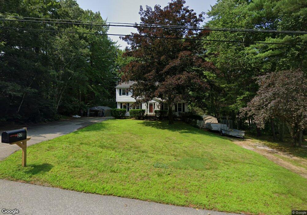
27 Harvest Dr Hooksett, NH 03106
Estimated Value: $444,549 - $652,000
5
Beds
3
Baths
2,100
Sq Ft
$284/Sq Ft
Est. Value
About This Home
This home is located at 27 Harvest Dr, Hooksett, NH 03106 and is currently estimated at $595,387, approximately $283 per square foot. 27 Harvest Dr is a home located in Merrimack County with nearby schools including Fred C. Underhill School, Hooksett Memorial School, and David R. Cawley Middle School.
Ownership History
Date
Name
Owned For
Owner Type
Purchase Details
Closed on
Nov 13, 2017
Sold by
Bibeau Sabrina C
Bought by
Bibeau Donald L
Current Estimated Value
Purchase Details
Closed on
Sep 3, 2003
Sold by
Guimond Bertrand G and Guimond Marianne
Bought by
Bibeau Donald L
Home Financials for this Owner
Home Financials are based on the most recent Mortgage that was taken out on this home.
Original Mortgage
$249,850
Interest Rate
6.02%
Purchase Details
Closed on
Jun 30, 1999
Sold by
Handley Agency I Gerry
Bought by
Guimond Bertrand G and Guimond Marianne
Home Financials for this Owner
Home Financials are based on the most recent Mortgage that was taken out on this home.
Original Mortgage
$116,000
Interest Rate
7.19%
Create a Home Valuation Report for This Property
The Home Valuation Report is an in-depth analysis detailing your home's value as well as a comparison with similar homes in the area
Home Values in the Area
Average Home Value in this Area
Purchase History
| Date | Buyer | Sale Price | Title Company |
|---|---|---|---|
| Bibeau Donald L | -- | -- | |
| Bibeau Donald L | $263,000 | -- | |
| Guimond Bertrand G | $145,000 | -- |
Source: Public Records
Mortgage History
| Date | Status | Borrower | Loan Amount |
|---|---|---|---|
| Previous Owner | Guimond Bertrand G | $249,850 | |
| Previous Owner | Guimond Bertrand G | $116,000 |
Source: Public Records
Tax History Compared to Growth
Tax History
| Year | Tax Paid | Tax Assessment Tax Assessment Total Assessment is a certain percentage of the fair market value that is determined by local assessors to be the total taxable value of land and additions on the property. | Land | Improvement |
|---|---|---|---|---|
| 2024 | $5,809 | $342,500 | $161,100 | $181,400 |
| 2023 | $5,473 | $342,500 | $161,100 | $181,400 |
| 2022 | $6,869 | $285,600 | $109,000 | $176,600 |
| 2021 | $6,346 | $285,600 | $109,000 | $176,600 |
| 2020 | $6,429 | $285,600 | $109,000 | $176,600 |
| 2019 | $6,155 | $285,600 | $109,000 | $176,600 |
| 2018 | $6,623 | $285,600 | $109,000 | $176,600 |
| 2017 | $5,899 | $220,600 | $93,200 | $127,400 |
| 2016 | $6,999 | $220,600 | $93,200 | $127,400 |
| 2015 | $5,453 | $220,600 | $93,200 | $127,400 |
| 2014 | $5,477 | $220,600 | $93,200 | $127,400 |
| 2013 | $5,180 | $220,600 | $93,200 | $127,400 |
Source: Public Records
Map
Nearby Homes
- 286 Londonderry Turnpike Unit A
- 286B Londonderry Turnpike Unit A
- 27 Martins Ferry Rd
- 45 Leonard Ave
- 10 Dewberry Ln
- 192 Londonderry Turnpike
- 34 Lindsay Rd
- 13 Johns Dr
- 190 Chase Way
- 115 Chase Way
- 5 Thistle Ln
- 111 Laurel Rd Unit 35
- 6 Deerhead St
- 104 N Gate Rd
- 199 Whitehall Rd
- 197 Whitehall Rd
- 69 Heather Cir
- 535 Coral Ave
- 605 Straw Hill Rd
- 12 Poplar St