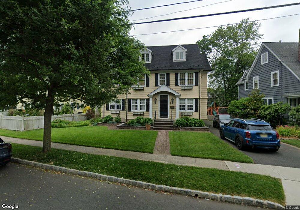
27 Laurel Ave Summit, NJ 07901
Estimated Value: $1,158,383 - $1,703,000
Studio
--
Bath
1,992
Sq Ft
$728/Sq Ft
Est. Value
About This Home
This home is located at 27 Laurel Ave, Summit, NJ 07901 and is currently estimated at $1,450,346, approximately $728 per square foot. 27 Laurel Ave is a home located in Union County with nearby schools including L C Johnson Summit Middle School, Summit Sr High School, and Oak Knoll School of the Holy Child.
Ownership History
Date
Name
Owned For
Owner Type
Purchase Details
Closed on
Nov 6, 2006
Sold by
Bakos Edward P
Bought by
Bakos Edward P
Current Estimated Value
Home Financials for this Owner
Home Financials are based on the most recent Mortgage that was taken out on this home.
Original Mortgage
$724,000
Outstanding Balance
$432,572
Interest Rate
6.39%
Mortgage Type
New Conventional
Estimated Equity
$1,017,774
Purchase Details
Closed on
Jun 19, 1998
Sold by
Bridgefarmer Kyle
Bought by
Bridgefarmer Kyle and Shaw Bridgefarmer Susan
Home Financials for this Owner
Home Financials are based on the most recent Mortgage that was taken out on this home.
Original Mortgage
$276,000
Interest Rate
7.04%
Purchase Details
Closed on
Aug 1, 1995
Sold by
Maquet Diafouka Michael and Maquet Diafouka Annemarie
Bought by
Bridgefarmer Kyle
Purchase Details
Closed on
Jul 15, 1994
Sold by
Stavert Michiko
Bought by
Maquet Diafouka Michael and Maquet Diafouka Anne Marie
Create a Home Valuation Report for This Property
The Home Valuation Report is an in-depth analysis detailing your home's value as well as a comparison with similar homes in the area
Home Values in the Area
Average Home Value in this Area
Purchase History
| Date | Buyer | Sale Price | Title Company |
|---|---|---|---|
| Bakos Edward P | -- | -- | |
| Bridgefarmer Kyle | -- | -- | |
| Bridgefarmer Kyle | $296,500 | -- | |
| Maquet Diafouka Michael | $319,000 | -- |
Source: Public Records
Mortgage History
| Date | Status | Borrower | Loan Amount |
|---|---|---|---|
| Open | Bakos Edward P | $724,000 | |
| Previous Owner | Bridgefarmer Kyle | $276,000 |
Source: Public Records
Tax History
| Year | Tax Paid | Tax Assessment Tax Assessment Total Assessment is a certain percentage of the fair market value that is determined by local assessors to be the total taxable value of land and additions on the property. | Land | Improvement |
|---|---|---|---|---|
| 2025 | $15,599 | $358,100 | $194,800 | $163,300 |
| 2024 | $15,495 | $358,100 | $194,800 | $163,300 |
| 2023 | $15,495 | $358,100 | $194,800 | $163,300 |
| 2022 | $15,337 | $358,100 | $194,800 | $163,300 |
| 2021 | $15,459 | $358,100 | $194,800 | $163,300 |
| 2020 | $15,613 | $358,100 | $194,800 | $163,300 |
| 2019 | $15,631 | $358,100 | $194,800 | $163,300 |
| 2018 | $15,531 | $358,100 | $194,800 | $163,300 |
| 2017 | $15,631 | $358,100 | $194,800 | $163,300 |
| 2016 | $15,402 | $358,100 | $194,800 | $163,300 |
| 2015 | $15,101 | $358,100 | $194,800 | $163,300 |
| 2014 | $14,711 | $358,100 | $194,800 | $163,300 |
Source: Public Records
Map
Nearby Homes
- 105 Larned Rd
- 67 Tulip St
- 64 Tulip St
- 62 Mountain Ave
- 61 Tulip St
- 4 Parkview Terrace
- 40 Prospect St
- 34 Ascot Way
- 68 New England Ave Unit 18
- 29 Ashwood Ave
- 1 Irving Place
- 24 Franklin Place
- 709 Springfield Ave Unit One
- 709 Springfield Ave Unit 4
- 709 Springfield Ave Unit 2
- 709 Springfield Ave Unit 3
- 14 Skylark Rd
- 133 Summit Ave Unit 16A
- 14 Euclid Ave Unit 102
- 23 Euclid Ave
Your Personal Tour Guide
Ask me questions while you tour the home.