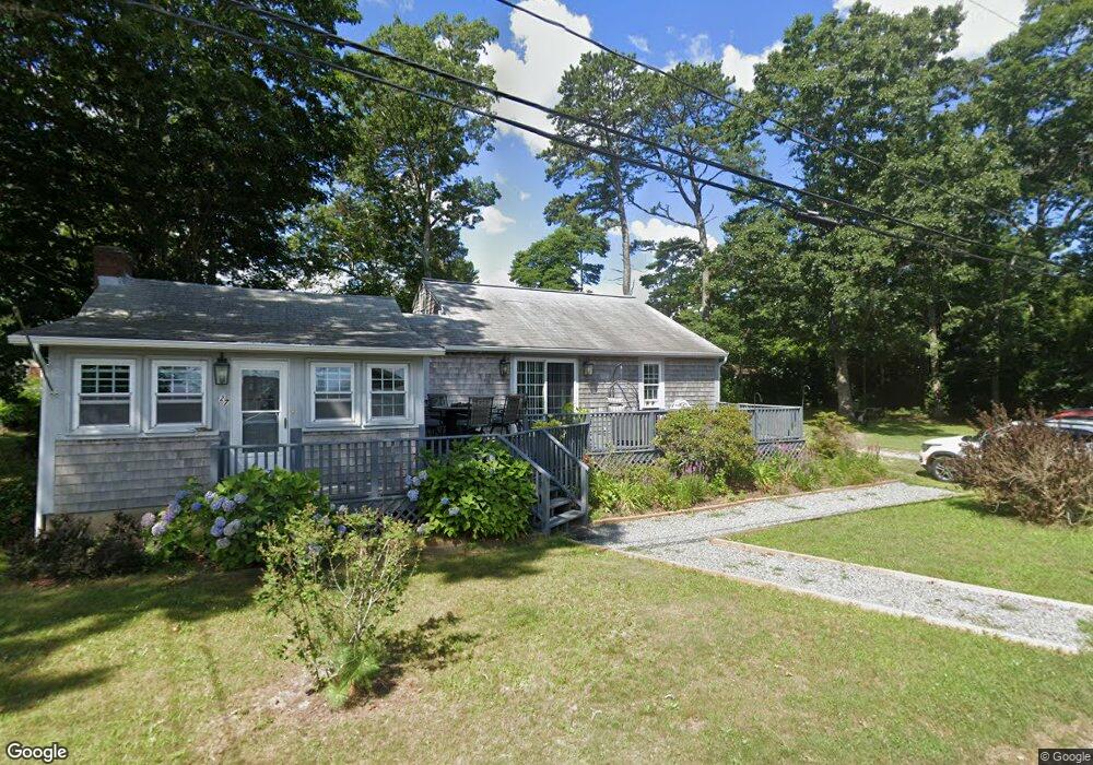
27 Osbone Ave Wareham, MA 02576
Estimated Value: $435,000 - $474,000
3
Beds
1
Bath
1,418
Sq Ft
$322/Sq Ft
Est. Value
About This Home
This home is located at 27 Osbone Ave, Wareham, MA 02576 and is currently estimated at $456,631, approximately $322 per square foot. 27 Osbone Ave is a home located in Plymouth County.
Create a Home Valuation Report for This Property
The Home Valuation Report is an in-depth analysis detailing your home's value as well as a comparison with similar homes in the area
Tax History
| Year | Tax Paid | Tax Assessment Tax Assessment Total Assessment is a certain percentage of the fair market value that is determined by local assessors to be the total taxable value of land and additions on the property. | Land | Improvement |
|---|---|---|---|---|
| 2025 | $3,976 | $381,600 | $102,400 | $279,200 |
| 2024 | $4,149 | $369,500 | $79,400 | $290,100 |
| 2023 | $4,010 | $333,300 | $68,600 | $264,700 |
| 2022 | $3,647 | $276,700 | $68,600 | $208,100 |
| 2021 | $3,341 | $248,400 | $68,600 | $179,800 |
| 2020 | $3,194 | $240,900 | $68,600 | $172,300 |
| 2019 | $78 | $222,500 | $64,400 | $158,100 |
| 2018 | $2,711 | $198,900 | $64,400 | $134,500 |
| 2017 | $2,397 | $178,200 | $64,400 | $113,800 |
| 2016 | $2,163 | $159,900 | $61,800 | $98,100 |
| 2015 | $2,090 | $159,900 | $61,800 | $98,100 |
| 2014 | $2,014 | $156,700 | $57,900 | $98,800 |
Source: Public Records
Map
Nearby Homes
Your Personal Tour Guide
Ask me questions while you tour the home.