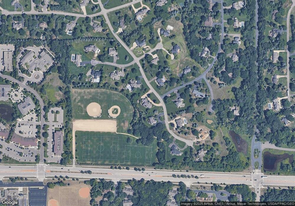
27 Raven Rd Saint Paul, MN 55127
Estimated Value: $1,227,000 - $1,358,000
6
Beds
5
Baths
2,692
Sq Ft
$481/Sq Ft
Est. Value
About This Home
This home is located at 27 Raven Rd, Saint Paul, MN 55127 and is currently estimated at $1,294,212, approximately $480 per square foot. 27 Raven Rd is a home located in Ramsey County with nearby schools including Turtle Lake Elementary School, Chippewa Middle School, and Mounds View Senior High School.
Ownership History
Date
Name
Owned For
Owner Type
Purchase Details
Closed on
May 16, 2023
Sold by
Dean A Klein Trustee Of The Barbara K K
Bought by
Cossack Matthew and Cossack Sarah
Current Estimated Value
Home Financials for this Owner
Home Financials are based on the most recent Mortgage that was taken out on this home.
Original Mortgage
$800,000
Outstanding Balance
$777,470
Interest Rate
6.32%
Mortgage Type
New Conventional
Estimated Equity
$516,742
Purchase Details
Closed on
Sep 23, 2016
Sold by
Klein Dean A and Klein Barbara K
Bought by
Klein Barbara K and Klein Dean A
Purchase Details
Closed on
Nov 17, 1997
Sold by
North Oaks Company Llc
Bought by
Klein Dean A and Klein Barbara K
Purchase Details
Closed on
Jun 10, 1996
Sold by
North Oaks Company Inc
Bought by
Klein Dean A and Klein Barbara K
Create a Home Valuation Report for This Property
The Home Valuation Report is an in-depth analysis detailing your home's value as well as a comparison with similar homes in the area
Home Values in the Area
Average Home Value in this Area
Purchase History
| Date | Buyer | Sale Price | Title Company |
|---|---|---|---|
| Cossack Matthew | $1,100,000 | -- | |
| Klein Barbara K | -- | Attorney | |
| Klein Dean A | $120,500 | -- | |
| Klein Dean A | $120,500 | -- |
Source: Public Records
Mortgage History
| Date | Status | Borrower | Loan Amount |
|---|---|---|---|
| Open | Cossack Matthew | $800,000 | |
| Closed | Klein Dean A | -- |
Source: Public Records
Tax History Compared to Growth
Tax History
| Year | Tax Paid | Tax Assessment Tax Assessment Total Assessment is a certain percentage of the fair market value that is determined by local assessors to be the total taxable value of land and additions on the property. | Land | Improvement |
|---|---|---|---|---|
| 2025 | $13,414 | $1,246,000 | $250,000 | $996,000 |
| 2023 | $13,414 | $1,126,900 | $250,000 | $876,900 |
| 2022 | $10,848 | $950,900 | $210,000 | $740,900 |
| 2021 | $10,874 | $837,600 | $210,000 | $627,600 |
| 2020 | $11,008 | $858,500 | $170,800 | $687,700 |
| 2019 | $10,154 | $808,100 | $170,800 | $637,300 |
| 2018 | $10,204 | $800,300 | $170,800 | $629,500 |
| 2017 | $10,982 | $782,900 | $170,800 | $612,100 |
| 2016 | $11,072 | $0 | $0 | $0 |
| 2015 | $11,146 | $815,100 | $146,600 | $668,500 |
| 2014 | $11,822 | $0 | $0 | $0 |
Source: Public Records
Map
Nearby Homes
- 217 Galtier Place
- 505 Chandler Ct
- 495 Harbor Ct
- 475 Tanglewood Dr
- 3 Hill Farm Cir
- 599 Harbor Ct
- 550 Harbor Ct
- 592 Harbor Ct
- 4715 Chandler Rd
- 276 Dawn Ave
- 23 Evergreen Rd
- 640 Highway 96 W
- 4706 Lorinda Dr
- 4825 Hodgson Connection
- 283 Timberline Trail
- 4151 Rice St
- 171 Red Oaks Dr
- 4268 Reiland Ln
- 4839 Larson Rd
- 240 Cottonwood Dr
