L
Seller's Agent in 2017
LINK Email Cache
LINK
Estimated Value: $1,326,139 - $1,428,000
Not Listed in LINK
Last Agent to Sell the Property
LINK Email Cache
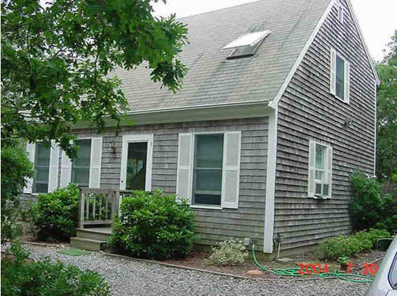
LINK Listed on: 07/21/2017
| Date | Buyer | Sale Price | Title Company |
|---|---|---|---|
| Luddy Ryan P | $650,000 | -- | |
| Housman Edward M | -- | -- | |
| Housman Dorris M | $140,600 | -- |
| Date | Status | Borrower | Loan Amount |
|---|---|---|---|
| Open | Luddy Ryan P | $585,000 | |
| Previous Owner | Housman Dorris M | $108,750 |
| Date | Event | Price | List to Sale | Price per Sq Ft |
|---|---|---|---|---|
| 07/21/2017 07/21/17 | Sold | $650,000 | -- | $476 / Sq Ft |
| Year | Tax Paid | Tax Assessment Tax Assessment Total Assessment is a certain percentage of the fair market value that is determined by local assessors to be the total taxable value of land and additions on the property. | Land | Improvement |
|---|---|---|---|---|
| 2025 | $2,389 | $901,600 | $342,300 | $559,300 |
| 2024 | $2,049 | $803,500 | $342,300 | $461,200 |
| 2023 | $1,966 | $780,300 | $310,500 | $469,800 |
| 2022 | $1,993 | $657,800 | $310,500 | $347,300 |
| 2021 | $7,057 | $657,900 | $310,600 | $347,300 |
| 2020 | $6,680 | $569,900 | $282,400 | $287,500 |
| 2019 | $2,272 | $587,000 | $282,400 | $304,600 |
| 2018 | $1,728 | $510,500 | $282,400 | $228,100 |
| 2017 | $1,680 | $473,300 | $282,400 | $190,900 |
| 2016 | $1,649 | $455,400 | $279,400 | $176,000 |
| 2015 | $1,492 | $430,100 | $279,400 | $150,700 |
L
Seller's Agent in 2017
LINK Email Cache
LINK
Source: LINK (Vineyard)
MLS Number: 32436
APN: EDGA-000010-000029