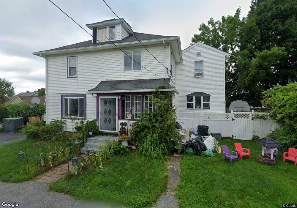
27 Rollinson Rd Worcester, MA 01606
Burncoat NeighborhoodEstimated Value: $421,000 - $485,000
4
Beds
1
Bath
2,014
Sq Ft
$228/Sq Ft
Est. Value
About This Home
This home is located at 27 Rollinson Rd, Worcester, MA 01606 and is currently estimated at $460,179, approximately $228 per square foot. 27 Rollinson Rd is a home located in Worcester County with nearby schools including Belmont Street Community School, Jacob Hiatt Magnet School, and Chandler Magnet.
Ownership History
Date
Name
Owned For
Owner Type
Purchase Details
Closed on
Aug 16, 2023
Sold by
Mcgrath Paul and Mcgrath Coreen
Bought by
Mcgrath Paul
Current Estimated Value
Home Financials for this Owner
Home Financials are based on the most recent Mortgage that was taken out on this home.
Original Mortgage
$317,000
Interest Rate
6.37%
Mortgage Type
Adjustable Rate Mortgage/ARM
Purchase Details
Closed on
Jun 28, 1995
Sold by
Fnma
Bought by
Mcgrath Paul and Mcgrath Coreen
Purchase Details
Closed on
Oct 5, 1994
Sold by
Bourgea Robert J and Federal Natl Mtg Assoc
Bought by
Federal National Mortgage Association
Purchase Details
Closed on
Apr 6, 1990
Sold by
Dadah Charles
Bought by
Bourgea Robert J
Create a Home Valuation Report for This Property
The Home Valuation Report is an in-depth analysis detailing your home's value as well as a comparison with similar homes in the area
Home Values in the Area
Average Home Value in this Area
Purchase History
| Date | Buyer | Sale Price | Title Company |
|---|---|---|---|
| Mcgrath Paul | -- | None Available | |
| Mcgrath Paul | -- | None Available | |
| Mcgrath Paul | $83,500 | -- | |
| Federal National Mortgage Association | $80,750 | -- | |
| Bourgea Robert J | $124,900 | -- | |
| Mcgrath Paul | $83,500 | -- | |
| Federal National Mortgage Association | $80,750 | -- | |
| Bourgea Robert J | $124,900 | -- |
Source: Public Records
Mortgage History
| Date | Status | Borrower | Loan Amount |
|---|---|---|---|
| Previous Owner | Mcgrath Paul | $317,000 | |
| Previous Owner | Bourgea Robert J | $192,000 | |
| Previous Owner | Bourgea Robert J | $10,500 |
Source: Public Records
Tax History Compared to Growth
Tax History
| Year | Tax Paid | Tax Assessment Tax Assessment Total Assessment is a certain percentage of the fair market value that is determined by local assessors to be the total taxable value of land and additions on the property. | Land | Improvement |
|---|---|---|---|---|
| 2025 | $5,136 | $389,400 | $115,100 | $274,300 |
| 2024 | $4,912 | $357,200 | $115,100 | $242,100 |
| 2023 | $4,718 | $329,000 | $100,100 | $228,900 |
| 2022 | $4,344 | $285,600 | $80,100 | $205,500 |
| 2021 | $4,357 | $267,600 | $64,100 | $203,500 |
| 2020 | $4,134 | $243,200 | $64,100 | $179,100 |
| 2019 | $3,967 | $220,400 | $57,600 | $162,800 |
| 2018 | $3,954 | $209,100 | $57,600 | $151,500 |
| 2017 | $3,775 | $196,400 | $57,600 | $138,800 |
| 2016 | $3,759 | $182,400 | $42,300 | $140,100 |
| 2015 | $3,661 | $182,400 | $42,300 | $140,100 |
| 2014 | $3,564 | $182,400 | $42,300 | $140,100 |
Source: Public Records
Map
Nearby Homes
- 15 Inwood Rd
- 68 Housatonic St
- 49 Prudential Rd
- 12 Prudential Rd
- 80 Prudential Rd
- 95 Saint Nicholas Ave
- 43 Fales St
- 89 E Mountain St
- 14 Housatonic St
- 2 Maria Ln Unit 2
- 29 E Mountain
- 13 Fatima Ln
- 80 Clark St
- 14 Fales St
- 40 Francis St
- 314 Burncoat St
- 31 Enaya Cir Unit 31
- 18 Claffey Ave
- 126 Brooks St
- 3 Malden St
- 29 Rollinson Rd
- 18 Arbutus Rd
- 16 Arbutus Rd
- 20 Arbutus Rd
- 26 Rollinson Rd
- 24 Rollinson Rd
- 14 Arbutus Rd
- 31 Rollinson Rd
- 28 Rollinson Rd
- 24 Arbutus Rd
- 19 Rollinson Rd
- 22 Rollinson Rd
- 12 Arbutus Rd
- 17 Rollinson Rd
- 26 Arbutus Rd
- 33 Ascadilla Rd
- 30 Rollinson Rd
- 29 Ascadilla Rd
- 33 Rollinson Rd
- 37 Ascadilla Rd