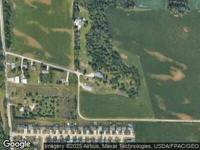
2700 Kenway Blvd SW Cedar Rapids, IA 52404
Estimated Value: $375,000 - $545,282
3
Beds
2
Baths
7,744
Sq Ft
$57/Sq Ft
Est. Value
About This Home
This home is located at 2700 Kenway Blvd SW, Cedar Rapids, IA 52404 and is currently estimated at $444,094, approximately $57 per square foot. 2700 Kenway Blvd SW is a home with nearby schools including Prairie Heights Elementary School, Prairie Crest Elementary School, and Prairie View Elementary School.
Ownership History
Date
Name
Owned For
Owner Type
Purchase Details
Closed on
Dec 24, 1998
Sold by
Rajcevich James M and Rajcevich Colleen A
Bought by
Martin Larry R and Martin Rebecca J
Current Estimated Value
Home Financials for this Owner
Home Financials are based on the most recent Mortgage that was taken out on this home.
Original Mortgage
$171,000
Interest Rate
6.88%
Mortgage Type
Purchase Money Mortgage
Create a Home Valuation Report for This Property
The Home Valuation Report is an in-depth analysis detailing your home's value as well as a comparison with similar homes in the area
Home Values in the Area
Average Home Value in this Area
Purchase History
| Date | Buyer | Sale Price | Title Company |
|---|---|---|---|
| Martin Larry R | $179,500 | -- |
Source: Public Records
Mortgage History
| Date | Status | Borrower | Loan Amount |
|---|---|---|---|
| Open | Martin Larry R | $80,000 | |
| Closed | Martin Larry R | $107,731 | |
| Previous Owner | Martin Larry R | $171,000 |
Source: Public Records
Tax History Compared to Growth
Tax History
| Year | Tax Paid | Tax Assessment Tax Assessment Total Assessment is a certain percentage of the fair market value that is determined by local assessors to be the total taxable value of land and additions on the property. | Land | Improvement |
|---|---|---|---|---|
| 2023 | $5,100 | $316,800 | $32,100 | $284,700 |
| 2022 | $4,974 | $235,400 | $25,600 | $209,800 |
| 2021 | $4,550 | $234,900 | $25,600 | $209,300 |
| 2020 | $4,550 | $209,000 | $24,100 | $184,900 |
| 2019 | $4,126 | $208,500 | $33,400 | $175,100 |
| 2018 | $4,020 | $208,500 | $33,400 | $175,100 |
| 2017 | $3,675 | $184,600 | $18,900 | $165,700 |
| 2016 | $3,675 | $184,600 | $18,900 | $165,700 |
| 2015 | $3,916 | $208,774 | $42,170 | $166,604 |
| 2014 | $3,710 | $208,774 | $42,170 | $166,604 |
| 2013 | $3,510 | $208,774 | $42,170 | $166,604 |
Source: Public Records
Map
Nearby Homes
- 2611 Shaman Ave SW
- 2806 Dawn Ave SW
- 4708 Pueblo St SW
- 0 Sunshine St SW Unit 2305469
- 4908 Harvest Ct SW
- 1506 Wheatland Ct SW
- Lot A-D 41st Avenue Dr SW
- Lot D 41st Avenue Dr SW
- Lot C 41st Avenue Dr SW
- Lot B 41st Avenue Dr SW
- Lot A 41st Avenue Dr SW
- 5722 Wheatland Dr SW
- 5937 Muirfield Dr SW Unit 2
- 5901 Muirfield Dr SW Unit 4
- 2940 Otis Ave SE
- 6212 Hoover Trail Rd SW
- 2426 Kestrel Dr SE
- 6315 Muirfield Dr SW
- 6221 Muirfield Dr SW
- 0 Rompot St SE
- 2700 Kenway Blvd SW
- 2501 Kenway Blvd SW
- 2724 Shaman Ave SW
- 2718 Shaman Ave SW
- 2802 Shaman Ave SW
- 2712 Shaman Ave SW
- 2425 Kenway Blvd SW
- 2808 Shaman Ave SW
- 2706 Shaman Ave SW
- 2814 Shaman Ave SW
- 2700 Shaman Ave SW
- 2600 Kenway Blvd SW
- 2904 Shaman Ave SW
- 2622 Shaman Ave SW
- 2910 Shaman Ave SW
- 2616 Shaman Ave SW
- 2415 Kenway Blvd SW
- 2610 Shaman Ave SW
- 2719 Shaman Ave SW
- 2803 Shaman Ave SW
