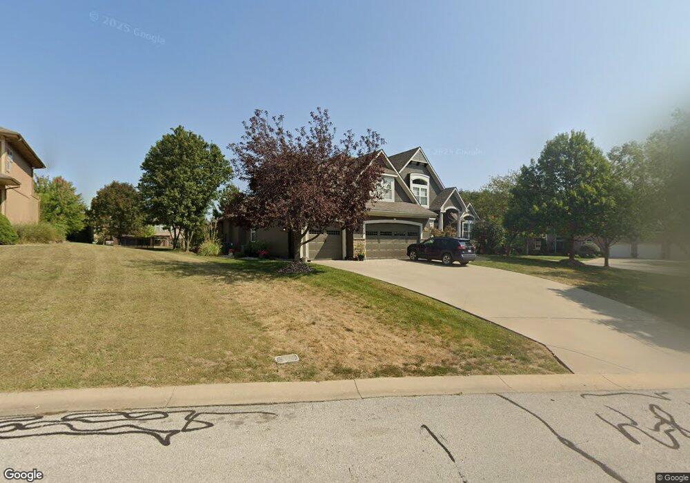
2700 NW Olmstead Dr Lees Summit, MO 64081
Estimated Value: $732,000 - $887,000
4
Beds
5
Baths
3,279
Sq Ft
$242/Sq Ft
Est. Value
About This Home
This home is located at 2700 NW Olmstead Dr, Lees Summit, MO 64081 and is currently estimated at $791,961, approximately $241 per square foot. 2700 NW Olmstead Dr is a home located in Jackson County with nearby schools including Cedar Creek Elementary School, Pleasant Lea Middle School, and Lee's Summit Senior High School.
Ownership History
Date
Name
Owned For
Owner Type
Purchase Details
Closed on
Nov 22, 2006
Sold by
Signature Custom Home Builders Inc
Bought by
Nevins Robert Russell and Nevins Lora Anne
Current Estimated Value
Home Financials for this Owner
Home Financials are based on the most recent Mortgage that was taken out on this home.
Original Mortgage
$395,017
Outstanding Balance
$235,751
Interest Rate
6.37%
Mortgage Type
Purchase Money Mortgage
Estimated Equity
$556,210
Purchase Details
Closed on
Mar 31, 2006
Sold by
Gale Communities Inc
Bought by
Signature Custom Home Builders Inc
Home Financials for this Owner
Home Financials are based on the most recent Mortgage that was taken out on this home.
Original Mortgage
$398,405
Interest Rate
6.24%
Mortgage Type
Construction
Create a Home Valuation Report for This Property
The Home Valuation Report is an in-depth analysis detailing your home's value as well as a comparison with similar homes in the area
Home Values in the Area
Average Home Value in this Area
Purchase History
| Date | Buyer | Sale Price | Title Company |
|---|---|---|---|
| Nevins Robert Russell | -- | Chicago Title | |
| Signature Custom Home Builders Inc | -- | Ctic |
Source: Public Records
Mortgage History
| Date | Status | Borrower | Loan Amount |
|---|---|---|---|
| Open | Nevins Robert Russell | $395,017 | |
| Previous Owner | Signature Custom Home Builders Inc | $398,405 |
Source: Public Records
Tax History Compared to Growth
Tax History
| Year | Tax Paid | Tax Assessment Tax Assessment Total Assessment is a certain percentage of the fair market value that is determined by local assessors to be the total taxable value of land and additions on the property. | Land | Improvement |
|---|---|---|---|---|
| 2025 | $9,293 | $126,894 | $19,232 | $107,662 |
| 2024 | $9,293 | $128,706 | $19,399 | $109,307 |
| 2023 | $9,226 | $128,706 | $19,293 | $109,413 |
| 2022 | $7,746 | $95,950 | $14,564 | $81,386 |
| 2021 | $7,906 | $95,950 | $14,564 | $81,386 |
| 2020 | $7,609 | $91,448 | $14,564 | $76,884 |
| 2019 | $7,401 | $91,448 | $14,564 | $76,884 |
| 2018 | $7,506 | $86,061 | $13,425 | $72,636 |
| 2017 | $7,506 | $86,061 | $13,425 | $72,636 |
| 2016 | $7,393 | $83,904 | $14,896 | $69,008 |
| 2014 | $7,431 | $82,673 | $14,896 | $67,777 |
Source: Public Records
Map
Nearby Homes
- 2704 SW Gray Ln
- 2114 NW Killarney Ln
- 2634 SW Wintervalley Dr
- Mariah Plan at Winterset Valley
- Ashland Plan at Winterset Valley
- Oakleigh Plan at Winterset Valley
- Forrester 2824 Plan at Winterset Valley
- Regency Plan at Winterset Valley
- Bentley Plan at Winterset Valley
- Forrester II Plan at Winterset Valley
- Oakshire Plan at Winterset Valley
- Windsong Plan at Winterset Valley
- Mariner II Plan at Winterset Valley
- Carolina Plan at Winterset Valley
- Mariner Plan at Winterset Valley
- Monticello Plan at Winterset Valley
- Monterey Plan at Winterset Valley
- Monterey 2655 Plan at Winterset Valley
- Oasis Plan at Winterset Valley
- Destiny Plan at Winterset Valley
- 2704 NW Olmstead Dr
- 2701 NW Thoreau Dr
- 209 NW Morton Dr
- 205 NW Morton Dr
- 2708 NW Olmstead Dr
- 2705 NW Olmstead Dr
- 2705 NW Thoreau Dr
- 213 NW Morton Dr
- 201 NW Morton Dr
- 2709 NW Olmstead Dr
- 137 NW Morton Dr
- 2709 NW Thoreau Dr
- 2712 NW Olmstead Dr
- 217 NW Morton Dr
- 2713 NW Olmstead Dr
- 133 NW Morton Dr
- 2713 NW Thoreau Dr
- 2708 NW Thoreau Dr
- 2700 NW Thoreau Dr
- 2230 NW Killarney Ln