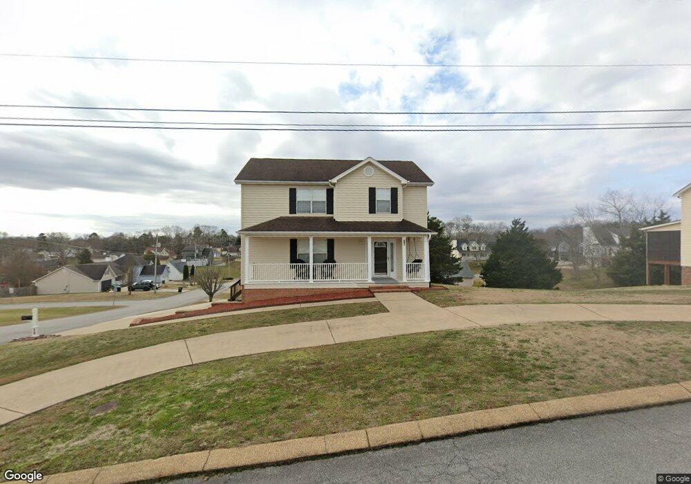
2700 Windtop Ln Soddy Daisy, TN 37379
Estimated Value: $379,989 - $391,000
3
Beds
3
Baths
2,000
Sq Ft
$192/Sq Ft
Est. Value
About This Home
This home is located at 2700 Windtop Ln, Soddy Daisy, TN 37379 and is currently estimated at $384,247, approximately $192 per square foot. 2700 Windtop Ln is a home located in Hamilton County with nearby schools including Loftis Middle School.
Ownership History
Date
Name
Owned For
Owner Type
Purchase Details
Closed on
May 10, 2002
Sold by
Jeffries Kathie Lou
Bought by
Jeffries Albert Ray
Current Estimated Value
Home Financials for this Owner
Home Financials are based on the most recent Mortgage that was taken out on this home.
Original Mortgage
$107,562
Outstanding Balance
$46,026
Interest Rate
7.12%
Estimated Equity
$338,221
Purchase Details
Closed on
Oct 27, 1997
Sold by
Bobby Keyes
Bought by
Jeffries Albert R and Jeffries Kathie L
Home Financials for this Owner
Home Financials are based on the most recent Mortgage that was taken out on this home.
Original Mortgage
$82,900
Interest Rate
7.55%
Create a Home Valuation Report for This Property
The Home Valuation Report is an in-depth analysis detailing your home's value as well as a comparison with similar homes in the area
Home Values in the Area
Average Home Value in this Area
Purchase History
| Date | Buyer | Sale Price | Title Company |
|---|---|---|---|
| Jeffries Albert Ray | -- | -- | |
| Jeffries Albert R | $110,900 | Pioneer Title Agency Inc |
Source: Public Records
Mortgage History
| Date | Status | Borrower | Loan Amount |
|---|---|---|---|
| Open | Jeffries Albert Ray | $107,562 | |
| Closed | Jeffries Albert R | $82,900 |
Source: Public Records
Tax History Compared to Growth
Tax History
| Year | Tax Paid | Tax Assessment Tax Assessment Total Assessment is a certain percentage of the fair market value that is determined by local assessors to be the total taxable value of land and additions on the property. | Land | Improvement |
|---|---|---|---|---|
| 2024 | $1,441 | $64,400 | $0 | $0 |
| 2023 | $1,450 | $64,400 | $0 | $0 |
| 2022 | $1,450 | $64,400 | $0 | $0 |
| 2021 | $1,450 | $64,400 | $0 | $0 |
| 2020 | $1,358 | $48,800 | $0 | $0 |
| 2019 | $1,358 | $48,800 | $0 | $0 |
| 2018 | $1,358 | $48,800 | $0 | $0 |
| 2017 | $1,358 | $48,800 | $0 | $0 |
| 2016 | $1,154 | $0 | $0 | $0 |
| 2015 | $1,154 | $41,425 | $0 | $0 |
| 2014 | $1,154 | $0 | $0 | $0 |
Source: Public Records
Map
Nearby Homes
- 10041 Rolling Wind Dr
- 9901 Breeze Hill Ln
- 2033 Angler Dr
- 10105 Hixson Pike
- 2522 W Wind Dr
- 9802 Shoreline Heights Dr
- 1724 Magnum Ln
- 10160 Hunters Hollow Dr
- 10166 Hunters Hollow Dr
- 9824 Waterside Way
- 11111 Hixson Pike
- 2031 Millard Rd
- 2109 Millard Rd
- 9416 Thrasher Trail
- 2524 Lyons Ln
- 1818 Millard Rd
- 9429 Hackberry Ln
- 1848 Coffee Tree Ln
- 2119 Collins Ln
- 2607 Chimney Lake Cir
- 2704 Windtop Ln
- 2704 Windtop Ln Unit 3
- 10005 Rolling Wind Dr
- 10010 Rolling Wind Dr
- 10135 Rolling Wind Dr
- 2706 Windtop Ln
- 10017 Rolling Wind Dr
- 10014 Rolling Wind Dr
- 2705 Windtop Ln
- 10004 Rolling Wind Dr
- 10004 Rolling Wind Dr Unit 3
- 10016 Rolling Wind Dr
- 10133 Rolling Wind Dr
- 1735 Breeze Dr
- 2710 Windtop Ln
- 10129 Rolling Wind Dr
- 10129 Rolling Wind Dr Unit 3
- 1740 Breeze Dr
- 9955 Rolling Wind Dr
- 9955 Rolling Wind Dr Unit 3