Estimated Value: $259,000 - $357,000
3
Beds
1
Bath
1,085
Sq Ft
$274/Sq Ft
Est. Value
About This Home
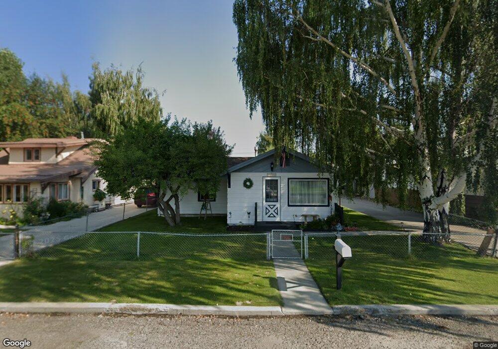
This home is located at 2709 Nettie St, Butte, MT 59701 and is currently estimated at $296,897, approximately $273 per square foot. 2709 Nettie St is a home located in Silver Bow County with nearby schools including Whittier School, East Middle School, and Butte High School.
Ownership History
Date
Name
Owned For
Owner Type
Purchase Details
Closed on
May 24, 2020
Sold by
Gothro Virginia A
Bought by
Gothro Thomas O and Gothro Virginia A
Current Estimated Value
Purchase Details
Closed on
Dec 19, 2019
Sold by
Winston Virginia A
Bought by
Gothro Virginia A
Home Financials for this Owner
Home Financials are based on the most recent Mortgage that was taken out on this home.
Original Mortgage
$50,000
Interest Rate
3.6%
Mortgage Type
New Conventional
Create a Home Valuation Report for This Property
The Home Valuation Report is an in-depth analysis detailing your home's value as well as a comparison with similar homes in the area
Home Values in the Area
Average Home Value in this Area
Purchase History
| Date | Buyer | Sale Price | Title Company |
|---|---|---|---|
| Gothro Thomas O | -- | None Available | |
| Gothro Virginia A | -- | None Available |
Source: Public Records
Mortgage History
| Date | Status | Borrower | Loan Amount |
|---|---|---|---|
| Closed | Gothro Virginia A | $50,000 |
Source: Public Records
Tax History Compared to Growth
Tax History
| Year | Tax Paid | Tax Assessment Tax Assessment Total Assessment is a certain percentage of the fair market value that is determined by local assessors to be the total taxable value of land and additions on the property. | Land | Improvement |
|---|---|---|---|---|
| 2025 | $2,086 | $268,900 | $0 | $0 |
| 2024 | $2,465 | $225,100 | $0 | $0 |
| 2023 | $2,462 | $225,100 | $0 | $0 |
| 2022 | $2,075 | $142,300 | $0 | $0 |
| 2021 | $2,123 | $142,300 | $0 | $0 |
| 2020 | $1,949 | $121,700 | $0 | $0 |
| 2019 | $1,947 | $121,700 | $0 | $0 |
| 2018 | $1,796 | $112,500 | $0 | $0 |
| 2017 | $1,142 | $112,500 | $0 | $0 |
| 2016 | $1,516 | $98,600 | $0 | $0 |
| 2015 | $1,040 | $98,600 | $0 | $0 |
| 2014 | $1,430 | $50,615 | $0 | $0 |
Source: Public Records
Map
Nearby Homes
- 2565 St Ann St
- 1906 Sherman Ave
- 2945 Amherst Ave
- 2320 South Dr
- 2319 Princeton St
- 2925 Bayard St
- 2245 South Dr
- 2809 State St
- 2219 Amherst Ave
- 2725 Edwards St
- 2821 Edwards St
- 2263 West Dr
- 2212 Massachusetts Ave
- 2922 E Edwards
- 2922 Edwards St
- 3120 State St
- 1801 Yale Ave
- 3127 Edwards St
- 2318 Argyle St
- 3101 Phillips St
- 2705 Nettie St
- 2745 Nettie St
- 2750 Moulton St
- 2740 Moulton St
- 2730 Moulton St
- 2760 Moulton St
- 2708 Nettie St
- 2742 Nettie St
- 2701 Nettie St
- 2706 Nettie St
- 2744 Nettie St
- 2700 Moulton St
- 2805 Nettie St
- 2300 Porter Ave
- 2800 Moulton St
- 2715 Ottawa St
- 2725 Moulton St
- 2815 Nettie St
- 2711 Ottawa St
- 2717 Ottawa St