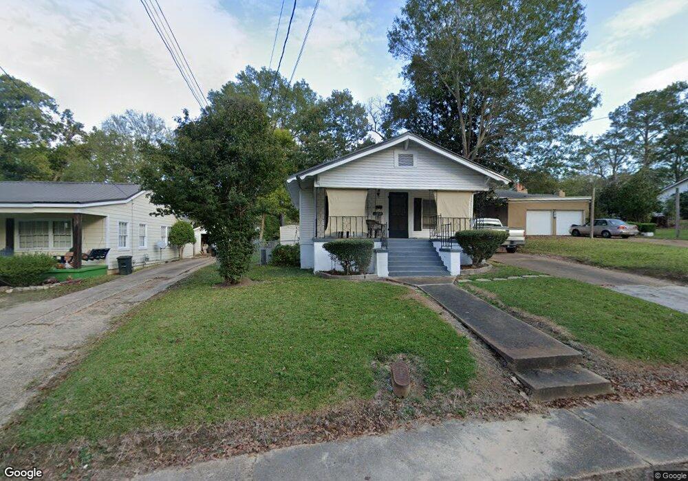
271 Byrd Ave N Unit A Philadelphia, MS 39350
Estimated Value: $73,102 - $93,000
--
Bed
2
Baths
1,690
Sq Ft
$50/Sq Ft
Est. Value
About This Home
This home is located at 271 Byrd Ave N Unit A, Philadelphia, MS 39350 and is currently estimated at $85,034, approximately $50 per square foot. 271 Byrd Ave N Unit A is a home located in Neshoba County with nearby schools including Philadelphia Elementary School, Philadelphia Middle School, and Philadelphia High School.
Ownership History
Date
Name
Owned For
Owner Type
Purchase Details
Closed on
Jun 29, 2012
Sold by
The Citizens Bank Of Philadelphia
Bought by
Wlliott Don and Elliott Ella Dephynee
Current Estimated Value
Purchase Details
Closed on
Mar 10, 2011
Sold by
The Citizens Bank Of Phil
Bought by
The Citizens Bank Of Phil
Purchase Details
Closed on
Mar 11, 2008
Sold by
Rogers Tracy W and Rogers Kara P
Bought by
Rogers Tracy W
Purchase Details
Closed on
Mar 22, 2006
Sold by
Hicks Daniel Brian and Hicks Catherinc Johnson
Bought by
Watson Christopher N
Home Financials for this Owner
Home Financials are based on the most recent Mortgage that was taken out on this home.
Original Mortgage
$75,000
Interest Rate
6.23%
Mortgage Type
Unknown
Create a Home Valuation Report for This Property
The Home Valuation Report is an in-depth analysis detailing your home's value as well as a comparison with similar homes in the area
Home Values in the Area
Average Home Value in this Area
Purchase History
| Date | Buyer | Sale Price | Title Company |
|---|---|---|---|
| Wlliott Don | -- | -- | |
| The Citizens Bank Of Phil | $50,000 | -- | |
| Rogers Tracy W | -- | -- | |
| Watson Christopher N | -- | -- |
Source: Public Records
Mortgage History
| Date | Status | Borrower | Loan Amount |
|---|---|---|---|
| Previous Owner | Watson Christopher N | $75,000 |
Source: Public Records
Tax History Compared to Growth
Tax History
| Year | Tax Paid | Tax Assessment Tax Assessment Total Assessment is a certain percentage of the fair market value that is determined by local assessors to be the total taxable value of land and additions on the property. | Land | Improvement |
|---|---|---|---|---|
| 2025 | $890 | $6,477 | $0 | $0 |
| 2024 | $890 | $6,467 | $0 | $0 |
| 2023 | $817 | $5,915 | $0 | $0 |
| 2022 | $817 | $5,915 | $0 | $0 |
| 2021 | $818 | $5,915 | $0 | $0 |
| 2020 | $815 | $5,915 | $0 | $0 |
| 2019 | $777 | $5,699 | $0 | $0 |
| 2018 | $768 | $5,699 | $0 | $0 |
| 2017 | $799 | $5,699 | $0 | $0 |
| 2016 | $799 | $5,699 | $0 | $0 |
| 2015 | -- | $5,655 | $0 | $0 |
| 2014 | -- | $5,655 | $0 | $0 |
Source: Public Records
Map
Nearby Homes
- 271A Byrd Ave
- 437C Pecan Ave
- 100 Highway 19
- 0 Mississippi 19
- 01 Mississippi 19
- 457 Pecan Ave
- 414 Columbus Ave Unit A
- 423 Pecan Ave
- 738 Forest Park Cir
- 736 Forest Park Cir
- 708 Forest Park Cir
- 0 Columbus Ave
- 408 Hospital St
- 507 Poplar Ave
- 319 Range Ave
- 321 Range Ave
- 517 Holland Ave
- 904 Pecan Ave
- 521 Holland Ave
- 519 Welch St