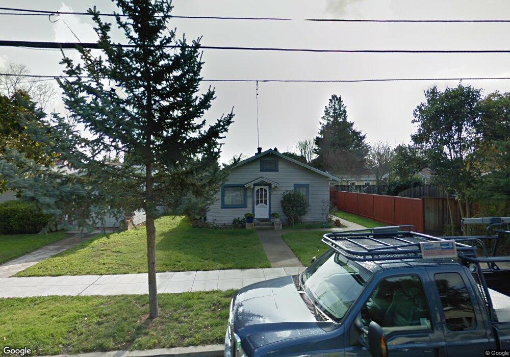
271 Palo Alto Ave Mountain View, CA 94041
Mountain View West NeighborhoodEstimated Value: $2,458,814 - $3,889,000
4
Beds
3
Baths
1,242
Sq Ft
$2,619/Sq Ft
Est. Value
About This Home
This home is located at 271 Palo Alto Ave, Mountain View, CA 94041 and is currently estimated at $3,253,204, approximately $2,619 per square foot. 271 Palo Alto Ave is a home located in Santa Clara County with nearby schools including Benjamin Bubb Elementary School, Isaac Newton Graham Middle School, and Los Altos High School.
Ownership History
Date
Name
Owned For
Owner Type
Purchase Details
Closed on
Nov 30, 1998
Sold by
Fowler Ladd V and Fowler Cathern L
Bought by
Fowler Ladd and Fowler Cathern L
Current Estimated Value
Home Financials for this Owner
Home Financials are based on the most recent Mortgage that was taken out on this home.
Original Mortgage
$200,000
Interest Rate
6.78%
Create a Home Valuation Report for This Property
The Home Valuation Report is an in-depth analysis detailing your home's value as well as a comparison with similar homes in the area
Home Values in the Area
Average Home Value in this Area
Purchase History
| Date | Buyer | Sale Price | Title Company |
|---|---|---|---|
| Fowler Ladd | -- | North American Title Co |
Source: Public Records
Mortgage History
| Date | Status | Borrower | Loan Amount |
|---|---|---|---|
| Closed | Fowler Ladd | $200,000 |
Source: Public Records
Tax History Compared to Growth
Tax History
| Year | Tax Paid | Tax Assessment Tax Assessment Total Assessment is a certain percentage of the fair market value that is determined by local assessors to be the total taxable value of land and additions on the property. | Land | Improvement |
|---|---|---|---|---|
| 2025 | $3,100 | $251,827 | $90,576 | $161,251 |
| 2024 | $3,100 | $246,890 | $88,800 | $158,090 |
| 2023 | $3,067 | $242,050 | $87,059 | $154,991 |
| 2022 | $3,055 | $237,304 | $85,352 | $151,952 |
| 2021 | $2,982 | $232,652 | $83,679 | $148,973 |
| 2020 | $2,983 | $230,267 | $82,821 | $147,446 |
| 2019 | $2,867 | $225,753 | $81,198 | $144,555 |
| 2018 | $2,847 | $221,327 | $79,606 | $141,721 |
| 2017 | $2,737 | $216,989 | $78,046 | $138,943 |
| 2016 | $2,601 | $212,735 | $76,516 | $136,219 |
| 2015 | $2,530 | $209,540 | $75,367 | $134,173 |
| 2014 | $2,508 | $205,436 | $73,891 | $131,545 |
Source: Public Records
Map
Nearby Homes
- 1356 W Dana St
- 236 Higdon Ave
- 0 Elmwood St
- 229 Hope St
- 1542 Canna Ct
- 231 Hope St
- 221 Hope St
- 1945 Mount Vernon Ct Unit 14
- 440 Moffett Blvd Unit 84
- 440 Moffett Blvd Unit 127
- 440 Moffett Blvd Unit 86
- 440 Moffett Blvd
- 440 Moffett Blvd Unit 61
- 505 Cypress Point Dr Unit 213
- 505 Cypress Point Dr Unit 140
- 505 Cypress Point Dr Unit 137
- 505 Cypress Point Dr Unit 40
- 234 Houghton St
- 700 Farley St
- 938 Clark Ave Unit 47
- 263 Palo Alto Ave
- 1380 W Dana St
- 251 Palo Alto Ave
- 1390 W Dana St
- 1336 W Dana St
- 235 Palo Alto Ave
- 272 Mountain View Ave
- 264 Mountain View Ave
- 256 Mountain View Ave
- 284 Mountain View Ave
- 229 Palo Alto Ave
- 272 Palo Alto Ave
- 240 Mountain View Ave
- 286 Palo Alto Ave
- 258 Palo Alto Ave
- 258 Palo Alto Ave Unit 5
- 296 Mountain View Ave
- 250 Palo Alto Ave
- 307 Palo Alto Ave
- 296 Palo Alto Ave