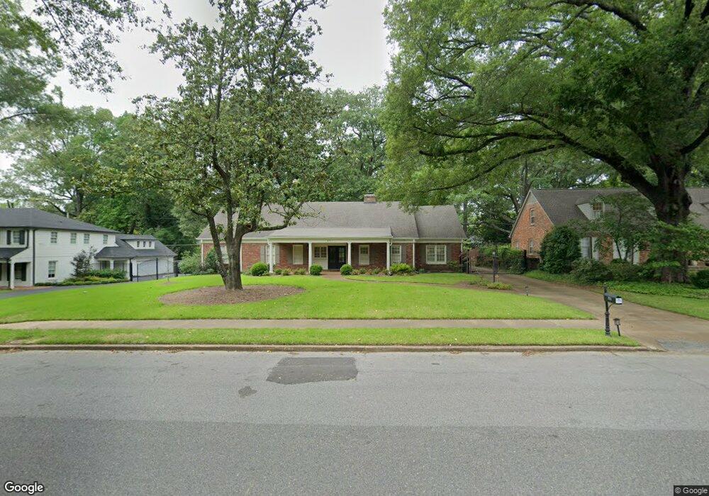
271 S Grove Park Rd Memphis, TN 38117
Audubon Park NeighborhoodEstimated Value: $556,865 - $659,000
4
Beds
3
Baths
3,955
Sq Ft
$154/Sq Ft
Est. Value
About This Home
This home is located at 271 S Grove Park Rd, Memphis, TN 38117 and is currently estimated at $610,716, approximately $154 per square foot. 271 S Grove Park Rd is a home located in Shelby County with nearby schools including White Station Elementary School, White Station High, and White Station Middle.
Ownership History
Date
Name
Owned For
Owner Type
Purchase Details
Closed on
Oct 9, 2012
Sold by
Griffin Elizabeth N
Bought by
Bray Larry R and Elizabeth N Griffin Investment Services
Current Estimated Value
Create a Home Valuation Report for This Property
The Home Valuation Report is an in-depth analysis detailing your home's value as well as a comparison with similar homes in the area
Home Values in the Area
Average Home Value in this Area
Purchase History
| Date | Buyer | Sale Price | Title Company |
|---|---|---|---|
| Bray Larry R | -- | None Available |
Source: Public Records
Tax History Compared to Growth
Tax History
| Year | Tax Paid | Tax Assessment Tax Assessment Total Assessment is a certain percentage of the fair market value that is determined by local assessors to be the total taxable value of land and additions on the property. | Land | Improvement |
|---|---|---|---|---|
| 2025 | $3,581 | $131,900 | $37,300 | $94,600 |
| 2024 | $3,581 | $105,625 | $36,350 | $69,275 |
| 2023 | $6,434 | $105,625 | $36,350 | $69,275 |
| 2022 | $6,434 | $105,625 | $36,350 | $69,275 |
| 2021 | $6,510 | $105,625 | $36,350 | $69,275 |
| 2020 | $7,442 | $102,700 | $36,350 | $66,350 |
| 2019 | $7,442 | $102,700 | $36,350 | $66,350 |
| 2018 | $7,932 | $113,000 | $36,350 | $76,650 |
| 2017 | $4,644 | $113,000 | $36,350 | $76,650 |
| 2016 | $4,284 | $98,025 | $0 | $0 |
| 2014 | $4,284 | $98,025 | $0 | $0 |
Source: Public Records
Map
Nearby Homes
- 271 Wakefield Dr
- 326 Cherry Cir E
- 196 E Cherry Cir
- 4563 Aldersgate Rd
- 4400 Poplar Ave Unit 45
- 4400 Poplar Ave Unit 48
- 4400 Poplar Ave Unit 25
- 4359 W Cherry Place Dr
- 427 S Perkins Rd Unit 427-2
- 4654 Hemlock Ln
- 154 Perkins Extension
- 371 W Cherry Cir
- 137 Perkins Extension
- 135 Cherry Rd
- 405 S Perkins Rd Unit 430
- 4286 Poplar Ave
- 194 S Perkins Rd
- 130 Greenbriar Dr
- 378 Caraway Cove Unit 10A
- 453 S Perkins Rd Unit 453-1
- 261 S Grove Park Rd
- 279 S Grove Park Rd
- 251 S Grove Park Rd
- 287 S Grove Park Rd
- 264 S Grove Park Rd
- 254 S Grove Park Rd
- 284 S Grove Park Rd
- 241 S Grove Park Rd
- 297 S Grove Park Rd
- 280 E Cherry Cir
- 266 E Cherry Cir
- 244 S Grove Park Rd
- 300 S Grove Park Rd
- 307 S Grove Park Rd
- 231 S Grove Park Rd
- 234 S Grove Park Rd
- 4532 Laurelwood Dr
- 290 Cherry Cir E
- 310 E Cherry Cir
- 261 Wakefield Dr