Estimated Value: $428,000 - $515,000
3
Beds
2
Baths
1,395
Sq Ft
$340/Sq Ft
Est. Value
About This Home
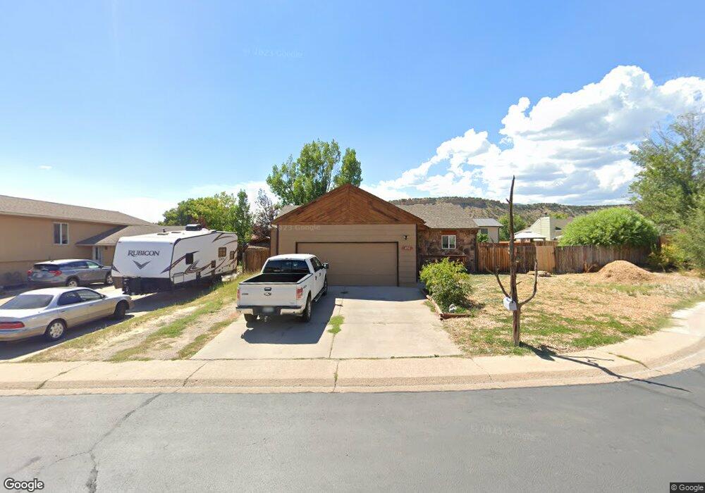
This home is located at 2711 Rail Ave, Rifle, CO 81650 and is currently estimated at $474,185, approximately $339 per square foot. 2711 Rail Ave is a home located in Garfield County with nearby schools including Wamsley Elementary School, Rifle Middle School, and Rifle High School.
Ownership History
Date
Name
Owned For
Owner Type
Purchase Details
Closed on
Jul 24, 2015
Sold by
Stephen P Murphy Revocable Trust
Bought by
Murphy Stephen P and Gonzalez Murphy Theresa L
Current Estimated Value
Purchase Details
Closed on
Jan 29, 2004
Sold by
Murphy Stephen P and Gonzales Murphy Theresa L
Bought by
Stephen P Murphy Revocable Trust and T G Murphy Revocable Trust
Purchase Details
Closed on
Apr 15, 1999
Purchase Details
Closed on
Oct 26, 1988
Create a Home Valuation Report for This Property
The Home Valuation Report is an in-depth analysis detailing your home's value as well as a comparison with similar homes in the area
Home Values in the Area
Average Home Value in this Area
Purchase History
| Date | Buyer | Sale Price | Title Company |
|---|---|---|---|
| Murphy Stephen P | -- | None Available | |
| Stephen P Murphy Revocable Trust | -- | -- | |
| -- | $124,000 | -- | |
| -- | $48,500 | -- |
Source: Public Records
Tax History Compared to Growth
Tax History
| Year | Tax Paid | Tax Assessment Tax Assessment Total Assessment is a certain percentage of the fair market value that is determined by local assessors to be the total taxable value of land and additions on the property. | Land | Improvement |
|---|---|---|---|---|
| 2024 | $1,687 | $22,130 | $4,370 | $17,760 |
| 2023 | $1,687 | $22,130 | $4,370 | $17,760 |
| 2022 | $1,407 | $19,650 | $4,520 | $15,130 |
| 2021 | $1,616 | $20,220 | $4,650 | $15,570 |
| 2020 | $1,344 | $18,370 | $3,150 | $15,220 |
| 2019 | $1,272 | $18,370 | $3,150 | $15,220 |
| 2018 | $1,061 | $14,990 | $2,950 | $12,040 |
| 2017 | $959 | $14,990 | $2,950 | $12,040 |
| 2016 | $750 | $13,280 | $2,870 | $10,410 |
| 2015 | $693 | $13,280 | $2,870 | $10,410 |
| 2014 | $611 | $11,630 | $1,750 | $9,880 |
Source: Public Records
Map
Nearby Homes
- 2638 Shawnee Ct
- 2633 Shawnee Ct
- 405 W 26th St
- 2409 W 24th Place
- 211 W 28th Ct
- 2618 Apache Ct
- 2501 Meadow Cir Unit 1
- 2433 Pine Ln
- 2687 Fairview Heights Ct
- 200 W 20th St Unit A142
- 200 W 20th St Unit E5
- 200 W 20th St Unit A24
- 200 W 20th St Unit E6
- 200 W 20th St Unit A128
- 200 W 20th St Unit A145
- 200 W 20th St Unit A139
- 200 W 20th St Unit E4
- 200 W 20th St Unit D20
- 3053 Coal Mine Ave
- 321 Columbine Dr