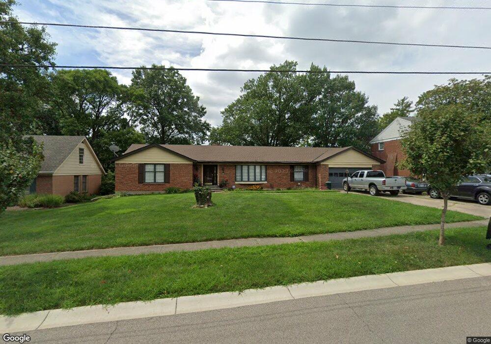
2715 Cyclorama Dr Cincinnati, OH 45211
Westwood NeighborhoodEstimated Value: $280,609 - $318,000
2
Beds
3
Baths
1,953
Sq Ft
$154/Sq Ft
Est. Value
About This Home
This home is located at 2715 Cyclorama Dr, Cincinnati, OH 45211 and is currently estimated at $300,402, approximately $153 per square foot. 2715 Cyclorama Dr is a home located in Hamilton County with nearby schools including Western Hills High School, Gilbert A. Dater High School, and Robert A. Taft Information Technology High School.
Ownership History
Date
Name
Owned For
Owner Type
Purchase Details
Closed on
Sep 30, 2002
Sold by
Schapker Bernard L
Bought by
Rowe Samuel D
Current Estimated Value
Home Financials for this Owner
Home Financials are based on the most recent Mortgage that was taken out on this home.
Original Mortgage
$155,066
Interest Rate
6.13%
Mortgage Type
FHA
Create a Home Valuation Report for This Property
The Home Valuation Report is an in-depth analysis detailing your home's value as well as a comparison with similar homes in the area
Home Values in the Area
Average Home Value in this Area
Purchase History
We collect this data history from publicly available records. To have your information removed, we recommend requesting removal directly through your county’s website.
| Date | Buyer | Sale Price | Title Company |
|---|---|---|---|
| Rowe Samuel D | $158,000 | Scioto Title Agency |
Source: Public Records
Mortgage History
We collect this data history from publicly available records. To have your information removed, we recommend requesting removal directly through your county’s website.
| Date | Status | Borrower | Loan Amount |
|---|---|---|---|
| Previous Owner | Rowe Samuel D | $155,066 |
Source: Public Records
Tax History
| Year | Tax Paid | Tax Assessment Tax Assessment Total Assessment is a certain percentage of the fair market value that is determined by local assessors to be the total taxable value of land and additions on the property. | Land | Improvement |
|---|---|---|---|---|
| 2025 | $4,403 | $71,145 | $9,639 | $61,506 |
| 2024 | $4,270 | $71,145 | $9,639 | $61,506 |
| 2023 | $4,366 | $71,145 | $9,639 | $61,506 |
| 2022 | $3,148 | $45,892 | $8,421 | $37,471 |
| 2021 | $3,023 | $45,892 | $8,421 | $37,471 |
| 2020 | $3,111 | $45,892 | $8,421 | $37,471 |
| 2019 | $3,092 | $41,721 | $7,655 | $34,066 |
| 2018 | $3,097 | $41,721 | $7,655 | $34,066 |
| 2017 | $2,941 | $41,721 | $7,655 | $34,066 |
| 2016 | $3,901 | $54,646 | $9,737 | $44,909 |
| 2015 | $3,518 | $54,646 | $9,737 | $44,909 |
| 2014 | $3,543 | $54,646 | $9,737 | $44,909 |
| 2013 | $3,915 | $59,399 | $10,584 | $48,815 |
Source: Public Records
Map
Nearby Homes
- 2739 Queenswood Dr
- 2504 Forthmann Place
- 2640 Gehrum Ln
- 2525 Homestead Place
- 2725 Orland Ave
- 2824 Lafeuille Ave
- 2400 Homestead Place
- 2473 Wahl Terrace
- 2942 Woodrow Ave
- 2723 Robert Ave
- 2751 Westbrook Dr
- 2551 Harrison Ave
- 2635 Ocosta Ave
- 2545 Harrison Ave
- 2654 Ocosta Ave
- 2843 Robert Ave
- 2962 Aquadale Ln
- 4137 Heyward St
- 1741 Gellenbeck St
- 3041 Westknolls Ln
- 2707 Cyclorama Dr
- 2723 Cyclorama Dr
- 2731 Cyclorama Dr
- 2716 Cyclorama Dr
- 2708 Cyclorama Dr
- 2701 Cyclorama Dr
- 2738 Cyclorama Dr
- 2724 Cyclorama Dr
- 2714 Queenswood Dr
- 2700 Cyclorama Dr
- 2739 Cyclorama Dr
- 2732 Cyclorama Dr
- 2692 Cyclorama Dr
- 2693 Cyclorama Dr
- 2704 Queenswood Dr
- 2740 Cyclorama Dr
- 2684 Cyclorama Dr
- 2702 Queenswood Dr
- 2681 Cyclorama Dr
- 2748 Cyclorama Dr
Your Personal Tour Guide
Ask me questions while you tour the home.