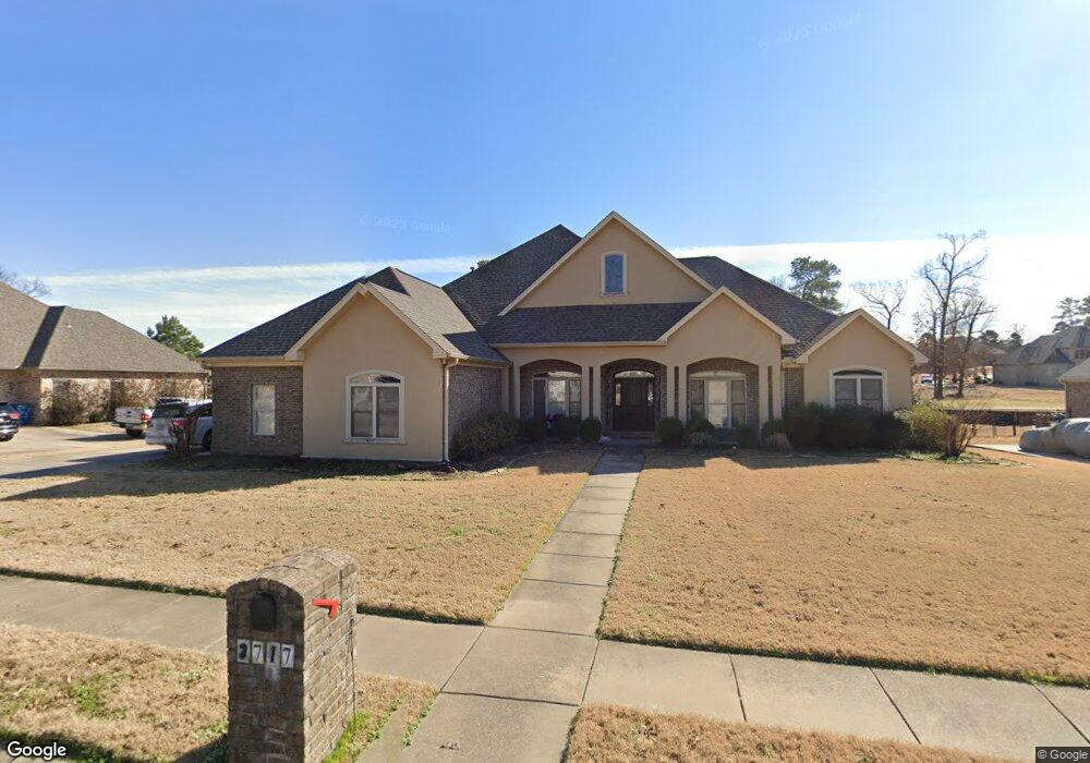
2717 Crooked Stick Benton, AR 72019
Salem NeighborhoodEstimated Value: $521,638 - $593,000
5
Beds
5
Baths
3,539
Sq Ft
$157/Sq Ft
Est. Value
About This Home
This home is located at 2717 Crooked Stick, Benton, AR 72019 and is currently estimated at $555,910, approximately $157 per square foot. 2717 Crooked Stick is a home located in Saline County with nearby schools including Perrin Elementary School, Benton Middle School, and Benton Junior High School.
Ownership History
Date
Name
Owned For
Owner Type
Purchase Details
Closed on
Dec 29, 2020
Sold by
Farmer Thomas Noel and Farmer Sara Elizabeth
Bought by
Huckabee Trina
Current Estimated Value
Purchase Details
Closed on
Dec 9, 2020
Sold by
Farmer Thomas Noel and Farmer Sara Elizabeth
Bought by
Huckabee Trina
Purchase Details
Closed on
Nov 10, 2003
Bought by
Farmer
Create a Home Valuation Report for This Property
The Home Valuation Report is an in-depth analysis detailing your home's value as well as a comparison with similar homes in the area
Home Values in the Area
Average Home Value in this Area
Purchase History
| Date | Buyer | Sale Price | Title Company |
|---|---|---|---|
| Huckabee Trina | $378,000 | Professional Land Title | |
| Huckabee Trina | $378,000 | Professional Land Ttl Co Of | |
| Farmer | $30,000 | -- |
Source: Public Records
Tax History Compared to Growth
Tax History
| Year | Tax Paid | Tax Assessment Tax Assessment Total Assessment is a certain percentage of the fair market value that is determined by local assessors to be the total taxable value of land and additions on the property. | Land | Improvement |
|---|---|---|---|---|
| 2025 | $4,841 | $87,391 | $13,000 | $74,391 |
| 2024 | $4,955 | $87,391 | $13,000 | $74,391 |
| 2023 | $4,416 | $87,391 | $13,000 | $74,391 |
| 2022 | $4,466 | $87,391 | $13,000 | $74,391 |
| 2021 | $3,347 | $67,180 | $10,000 | $57,180 |
| 2020 | $3,347 | $67,180 | $10,000 | $57,180 |
| 2019 | $3,347 | $67,180 | $10,000 | $57,180 |
| 2018 | $3,365 | $67,180 | $10,000 | $57,180 |
| 2017 | $3,365 | $67,180 | $10,000 | $57,180 |
| 2016 | $3,911 | $68,970 | $11,000 | $57,970 |
| 2015 | $3,840 | $68,970 | $11,000 | $57,970 |
| 2014 | $3,867 | $68,970 | $11,000 | $57,970 |
Source: Public Records
Map
Nearby Homes
- 2609 Pinehurst Cove
- 5107 Congressional Dr
- 5006 Colonial Ct
- 2915 Castle Valley Dr
- 2918 Cypress Point Dr
- 2918 Cypress Dr
- 513 Highway 5 N
- 1756 White Oak Ln
- 3901 Spencer Crossing Dr
- 1641 White Oak Cir
- 3892 Spencer Crossing Dr
- 5012 Skilling Cove
- 1810 White Oak Cir
- 3905 Deer Dr
- 3881 Spencer Crossing Dr
- 1725 White Oak Ln
- 6 acres Interstate 30
- 15.31 acres Interstate 30
- 4321 Glenda Ln
- 3851 Spencer Crossing Dr
- 2711 Crooked Stick
- 2721 Crooked Stick
- 2712 Crooked Stick
- 2718 Crooked Stick
- 2707 Crooked Stick
- 2706 Crooked Stick
- 2807 Crooked Stick
- 2703 Crooked Stick
- 2715 Oak Tree Cove
- 4824 Augusta Dr
- 2710 Oak Tree Cove
- 2815 Crooked Stick
- 2806 Crooked Stick
- 4910 Augusta Dr
- 4808 Augusta Dr
- 2722 Cypress Point Dr
- 2808 Cypress Point Dr
- 4724 Augusta Dr
- 2626 Oak Tree Cove
- 2816 Shadow Creek Dr