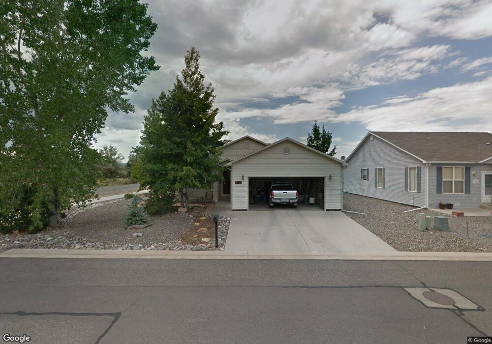
2718 Abrams Ave Montrose, CO 81401
Estimated Value: $379,236 - $401,000
3
Beds
2
Baths
1,399
Sq Ft
$281/Sq Ft
Est. Value
About This Home
This home is located at 2718 Abrams Ave, Montrose, CO 81401 and is currently estimated at $392,809, approximately $280 per square foot. 2718 Abrams Ave is a home located in Montrose County with nearby schools including Cottonwood Elementary School, Columbine Middle School, and Montrose High School.
Ownership History
Date
Name
Owned For
Owner Type
Purchase Details
Closed on
Jul 14, 2006
Sold by
Teansky Rodney L and Teansky Kara L
Bought by
Wood Dennis
Current Estimated Value
Home Financials for this Owner
Home Financials are based on the most recent Mortgage that was taken out on this home.
Original Mortgage
$36,600
Interest Rate
6.62%
Mortgage Type
Stand Alone Second
Purchase Details
Closed on
May 29, 2003
Sold by
Janssen David S and Janssen Roberta L
Bought by
Teansky Rodney L and Teansky Kara L
Purchase Details
Closed on
Oct 6, 2000
Sold by
Highlife Homes Of Montrose Ltd
Bought by
Janssen David S and Janssen Roberta L
Create a Home Valuation Report for This Property
The Home Valuation Report is an in-depth analysis detailing your home's value as well as a comparison with similar homes in the area
Purchase History
| Date | Buyer | Sale Price | Title Company |
|---|---|---|---|
| Wood Dennis | $183,000 | First American Heritage Titl | |
| Teansky Rodney L | $145,000 | -- | |
| Janssen David S | $111,000 | -- |
Source: Public Records
Mortgage History
| Date | Status | Borrower | Loan Amount |
|---|---|---|---|
| Closed | Wood Dennis | $36,600 | |
| Open | Wood Dennis | $146,400 |
Source: Public Records
Tax History
| Year | Tax Paid | Tax Assessment Tax Assessment Total Assessment is a certain percentage of the fair market value that is determined by local assessors to be the total taxable value of land and additions on the property. | Land | Improvement |
|---|---|---|---|---|
| 2025 | $1,223 | $48,470 | $25,690 | $22,780 |
| 2024 | $1,223 | $20,290 | $3,120 | $17,170 |
| 2023 | $980 | $24,870 | $3,820 | $21,050 |
| 2022 | $705 | $17,050 | $2,780 | $14,270 |
| 2021 | $726 | $17,540 | $2,860 | $14,680 |
| 2020 | $545 | $15,170 | $2,470 | $12,700 |
| 2019 | $549 | $15,170 | $2,470 | $12,700 |
| 2018 | $392 | $11,160 | $1,990 | $9,170 |
| 2017 | $389 | $11,160 | $1,990 | $9,170 |
| 2016 | $809 | $11,800 | $2,010 | $9,790 |
| 2015 | $794 | $11,800 | $2,010 | $9,790 |
| 2014 | $668 | $10,600 | $2,010 | $8,590 |
Source: Public Records
Map
Nearby Homes
- 1746 Ironton St
- TBD Odelle Rd
- 1664 Sneffels St
- Lot 2305 Painted Wall Ln
- 2615 Arbor Way
- 1686 Rheims Ct
- 1956 Dubonnet Ct
- 1691 Rheims Ct
- 1649 Sneffels St
- 2303 Painted Wall Ln
- 2509 Bear Lake Dr
- 1638 Ironton Ct
- 2820 Glacier Dr
- 1661 Kellie Dr
- 1649 Hermosa St
- Lot 2403 Fellows Dr
- Lot 2506 Fellows Dr
- 1655 Rhine Ct
- 2211 Fellows Dr
- 2802 Glacier Dr
- 2716 Abrams Ave
- 1692 Ironton St
- 1740 Ironton St
- 1742 Ironton St
- 1688 Ironton St
- 2715 Abrams Ave
- 2712 Abrams Ave
- 1693 Ironton St
- 1744 Ironton St
- 2006 Odelle Rd
- 2713 Abrams Ave
- 1934 Odelle Rd
- 1743 Ironton St
- 2710 Abrams Ave
- 1684 Ironton St
- 1689 Ironton St
- 2711 Abrams Ave
- 1745 Ironton St
- 1692 Wetterhorn St
- 2708 Abrams Ave
Your Personal Tour Guide
Ask me questions while you tour the home.