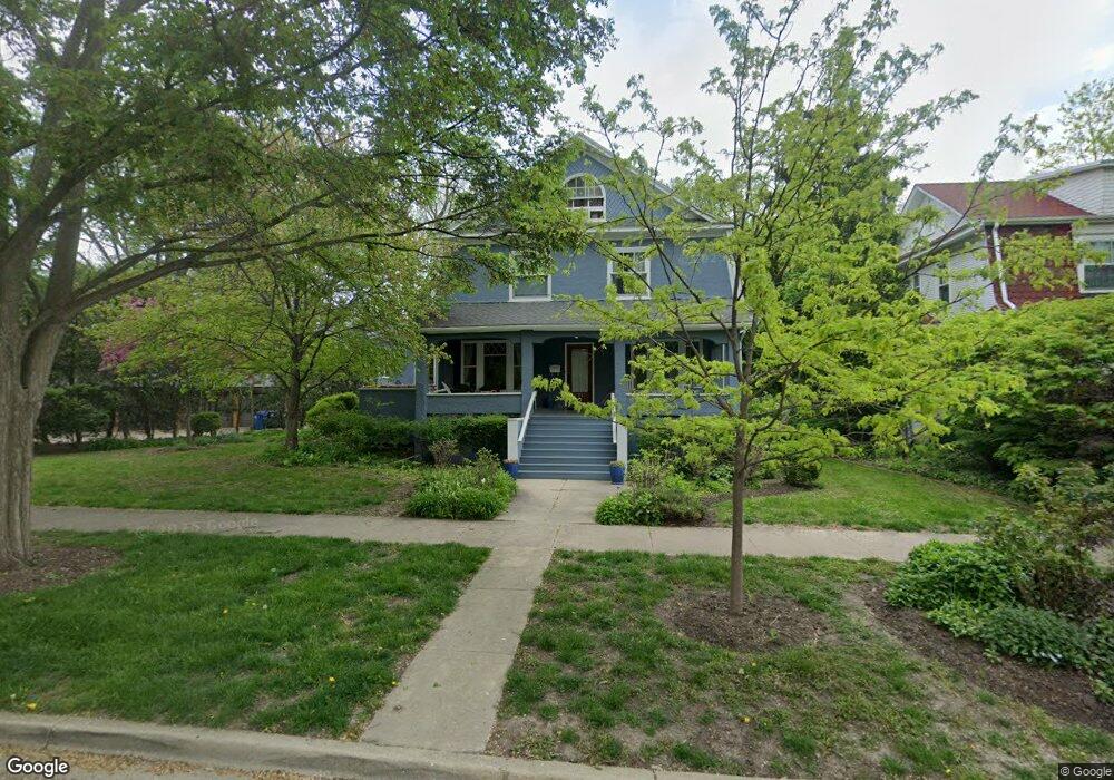
2719 Walnut Ave Evanston, IL 60201
Central Street NeighborhoodEstimated Value: $1,069,924 - $1,261,000
4
Beds
3
Baths
2,437
Sq Ft
$476/Sq Ft
Est. Value
About This Home
This home is located at 2719 Walnut Ave, Evanston, IL 60201 and is currently estimated at $1,160,731, approximately $476 per square foot. 2719 Walnut Ave is a home located in Cook County with nearby schools including Kingsley Elementary School, Haven Middle School, and Evanston Township High School.
Ownership History
Date
Name
Owned For
Owner Type
Purchase Details
Closed on
Jun 6, 2011
Sold by
Balcom Donald R and Pearson Sarah R
Bought by
Beazley David M and Kamen Paula R
Current Estimated Value
Home Financials for this Owner
Home Financials are based on the most recent Mortgage that was taken out on this home.
Original Mortgage
$95,000
Outstanding Balance
$78,053
Interest Rate
4.63%
Mortgage Type
Credit Line Revolving
Estimated Equity
$1,082,678
Purchase Details
Closed on
Aug 15, 1996
Sold by
Brown Steven D and Heath Linda
Bought by
Balcom Donald R and Pearson Sarah R
Home Financials for this Owner
Home Financials are based on the most recent Mortgage that was taken out on this home.
Original Mortgage
$380,000
Interest Rate
7.87%
Create a Home Valuation Report for This Property
The Home Valuation Report is an in-depth analysis detailing your home's value as well as a comparison with similar homes in the area
Home Values in the Area
Average Home Value in this Area
Purchase History
| Date | Buyer | Sale Price | Title Company |
|---|---|---|---|
| Beazley David M | $640,000 | Cti | |
| Balcom Donald R | $400,000 | Centennial Title Incorporate |
Source: Public Records
Mortgage History
| Date | Status | Borrower | Loan Amount |
|---|---|---|---|
| Open | Beazley David M | $95,000 | |
| Open | Beazley David M | $417,000 | |
| Previous Owner | Balcom Donald R | $380,000 |
Source: Public Records
Tax History
| Year | Tax Paid | Tax Assessment Tax Assessment Total Assessment is a certain percentage of the fair market value that is determined by local assessors to be the total taxable value of land and additions on the property. | Land | Improvement |
|---|---|---|---|---|
| 2025 | $16,628 | $98,705 | $22,202 | $76,503 |
| 2024 | $16,628 | $72,000 | $18,913 | $53,087 |
| 2023 | $15,930 | $72,000 | $18,913 | $53,087 |
| 2022 | $15,930 | $72,000 | $18,913 | $53,087 |
| 2021 | $17,223 | $68,231 | $12,334 | $55,897 |
| 2020 | $17,053 | $68,231 | $12,334 | $55,897 |
| 2019 | $16,630 | $74,407 | $12,334 | $62,073 |
| 2018 | $16,502 | $63,667 | $10,278 | $53,389 |
| 2017 | $16,087 | $63,667 | $10,278 | $53,389 |
| 2016 | $15,480 | $63,667 | $10,278 | $53,389 |
| 2015 | $14,662 | $57,306 | $8,634 | $48,672 |
| 2014 | $14,537 | $57,306 | $8,634 | $48,672 |
| 2013 | $14,187 | $57,306 | $8,634 | $48,672 |
Source: Public Records
Map
Nearby Homes
- 2315 Park Place
- 2611 Walnut Ave
- 2500 Thayer St
- 2201 Central St Unit 3N
- 2508 Isabella St
- 111 Park Ave
- 2324 Central St Unit 2B
- 1209 Maple Ave
- 1241 Maple Ave
- 2731 Park Place
- 2515 Prairie Ave Unit 1E
- 2505 Prairie Ave Unit 2K
- 2716 Ewing Ave
- 2726 Central St Unit 3A
- 2726 Central St Unit 2D
- 2717 Harrison St
- 1813 Lincoln St
- 125 15th St
- 2732 Lincolnwood Dr
- 1915 - 2 Grant St
- 2713 Walnut Ave
- 2707 Walnut Ave
- 2304 Thayer St
- 2746 Prairie Ave
- 2742 Prairie Ave
- 2754 Prairie Ave
- 2303 Park Place
- 2306 Thayer St
- 2687 Stewart Ave
- 2736 Prairie Ave
- 2758 Prairie Ave
- 2307 Park Place
- 2734 Prairie Ave
- 2683 Stewart Ave
- 2310 Thayer St
- 2311 Park Place
- 2679 Stewart Ave
- 2766 Prairie Ave
- 2730 Prairie Ave Unit 2
- 2730 Prairie Ave
Your Personal Tour Guide
Ask me questions while you tour the home.