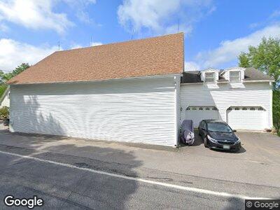
272 Sanborn Rd Unit A Tilton, NH 03276
Tilton NeighborhoodEstimated Value: $604,000 - $796,549
2
Beds
1
Bath
3,052
Sq Ft
$227/Sq Ft
Est. Value
About This Home
This home is located at 272 Sanborn Rd Unit A, Tilton, NH 03276 and is currently estimated at $692,387, approximately $226 per square foot. 272 Sanborn Rd Unit A is a home located in Belknap County with nearby schools including Sanbornton Central School, Winnisquam Regional Middle School, and Winnisquam Regional High School.
Ownership History
Date
Name
Owned For
Owner Type
Purchase Details
Closed on
Aug 29, 2023
Sold by
Chaudhry Tanveer H and Chaudhry Rebecca M
Bought by
Chaudhry
Current Estimated Value
Purchase Details
Closed on
Sep 20, 2018
Sold by
Oliver-Rhudick Joanna A
Bought by
Chaudhry Tanveer H and Chaudhry Rebecca
Home Financials for this Owner
Home Financials are based on the most recent Mortgage that was taken out on this home.
Original Mortgage
$358,150
Interest Rate
4.5%
Mortgage Type
New Conventional
Create a Home Valuation Report for This Property
The Home Valuation Report is an in-depth analysis detailing your home's value as well as a comparison with similar homes in the area
Home Values in the Area
Average Home Value in this Area
Purchase History
| Date | Buyer | Sale Price | Title Company |
|---|---|---|---|
| Chaudhry | -- | None Available | |
| Chaudhry Tanveer H | $377,000 | -- |
Source: Public Records
Mortgage History
| Date | Status | Borrower | Loan Amount |
|---|---|---|---|
| Previous Owner | Chaudhry Tanveer H | $358,150 | |
| Previous Owner | Oliver-Rhudick Joanna A | $495,000 |
Source: Public Records
Tax History Compared to Growth
Tax History
| Year | Tax Paid | Tax Assessment Tax Assessment Total Assessment is a certain percentage of the fair market value that is determined by local assessors to be the total taxable value of land and additions on the property. | Land | Improvement |
|---|---|---|---|---|
| 2024 | $7,384 | $683,742 | $198,242 | $485,500 |
| 2023 | $7,439 | $420,066 | $96,866 | $323,200 |
| 2022 | $5,530 | $344,114 | $84,614 | $259,500 |
| 2021 | $5,636 | $344,520 | $85,020 | $259,500 |
| 2020 | $6,365 | $344,603 | $85,103 | $259,500 |
| 2019 | $6,758 | $344,617 | $85,117 | $259,500 |
| 2018 | $6,385 | $285,952 | $67,152 | $218,800 |
| 2017 | $6,663 | $285,966 | $67,166 | $218,800 |
| 2016 | $5,924 | $285,925 | $67,125 | $218,800 |
| 2015 | $6,568 | $285,959 | $67,159 | $218,800 |
| 2014 | $5,694 | $285,968 | $67,168 | $218,800 |
| 2013 | $5,182 | $283,191 | $134,691 | $148,500 |
| 2012 | $5,173 | $283,456 | $134,956 | $148,500 |
Source: Public Records
Map
Nearby Homes
- 272 Sanborn Rd
- 272 Sanborn Rd Unit A
- 317-1 Lancaster Hill Rd
- 11 Lancaster Hill Rd
- 282 Sanborn Rd
- 253 Sanborn Rd
- 252 Sanborn Rd
- 299 Sanborn Rd
- 35 Bittersweet Ln
- 27 Lancaster Hill Rd
- 35 Lancaster Hill Rd
- 30 Lancaster Hill Rd
- 234 Sanborn Rd
- 41 Lancaster Hill Rd
- 5 Orchard Dr
- 8 Vista Heights
- 46 Lancaster Hill Rd
- 7 Orchard Dr
- 16 Vista Heights
- 45 Lancaster Hill Rd