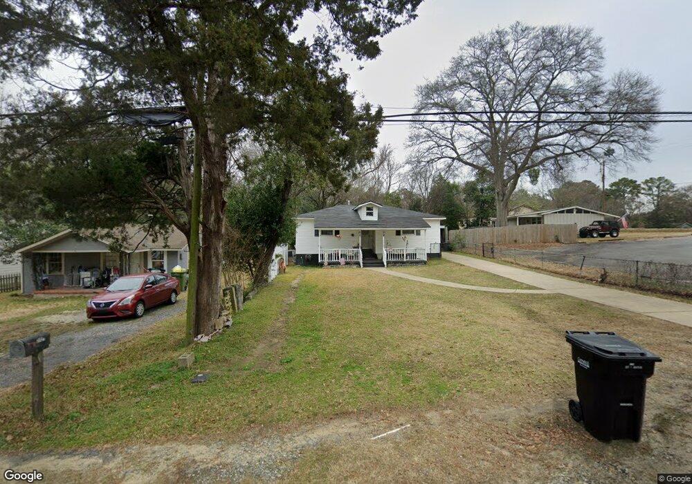
2723 W Britt David Rd Columbus, GA 31909
Estimated Value: $173,774 - $198,000
3
Beds
3
Baths
1,599
Sq Ft
$114/Sq Ft
Est. Value
About This Home
This home is located at 2723 W Britt David Rd, Columbus, GA 31909 and is currently estimated at $182,194, approximately $113 per square foot. 2723 W Britt David Rd is a home located in Muscogee County with nearby schools including Allen Elementary School, Arnold Middle School, and Jordan Vocational High School.
Ownership History
Date
Name
Owned For
Owner Type
Purchase Details
Closed on
Jun 28, 2024
Sold by
Strickland Shirley Gale and Smith Jeffery Wayne
Bought by
Strickland Shirley Gale and Smith Jeffery Wayne
Current Estimated Value
Purchase Details
Closed on
Jun 26, 2024
Sold by
Strickland Shirley Gale
Bought by
Smith Jeffery Wayne
Create a Home Valuation Report for This Property
The Home Valuation Report is an in-depth analysis detailing your home's value as well as a comparison with similar homes in the area
Home Values in the Area
Average Home Value in this Area
Purchase History
| Date | Buyer | Sale Price | Title Company |
|---|---|---|---|
| Strickland Shirley Gale | -- | None Listed On Document | |
| Smith Jeffery Wayne | -- | None Listed On Document | |
| Strickland Shirley Gale | -- | None Listed On Document |
Source: Public Records
Tax History Compared to Growth
Tax History
| Year | Tax Paid | Tax Assessment Tax Assessment Total Assessment is a certain percentage of the fair market value that is determined by local assessors to be the total taxable value of land and additions on the property. | Land | Improvement |
|---|---|---|---|---|
| 2025 | $360 | $49,552 | $8,100 | $41,452 |
| 2024 | -- | $49,552 | $8,100 | $41,452 |
| 2023 | $19 | $49,552 | $8,100 | $41,452 |
| 2022 | $374 | $40,540 | $8,100 | $32,440 |
| 2021 | $367 | $39,200 | $8,100 | $31,100 |
| 2020 | $367 | $39,200 | $8,100 | $31,100 |
| 2019 | $370 | $39,200 | $8,100 | $31,100 |
| 2018 | $370 | $31,556 | $8,100 | $23,456 |
| 2017 | $373 | $31,556 | $8,100 | $23,456 |
| 2016 | $375 | $32,872 | $3,562 | $29,310 |
| 2015 | $151 | $32,872 | $3,562 | $29,310 |
| 2014 | $151 | $32,872 | $3,562 | $29,310 |
| 2013 | -- | $32,872 | $3,562 | $29,310 |
Source: Public Records
Map
Nearby Homes
- 2528 Lorraine St
- 2516 Lorraine St
- 5552 Perry Ave
- 6226 Westbrook Dr
- 6225 Westbrook Dr
- 6232 Westbrook Dr
- 6231 Westbrook Dr
- 5829 Ventura Dr
- 6308 Adams Park Dr
- 2208 Airport Thruway
- 3120 Weems Rd
- 3308 Mustang Dr
- 6138 Seaton Dr
- 2014 Airport Thruway
- 3325 N North Quay Dr
- 6200 Fox Chapel Dr
- 5817 Sherborne Dr
- 3204 Weems Rd
- 6233 Ashwood Dr
- 5836 Sherborne Dr
- 2721 W Britt David Rd
- 5711 Carlton Ave
- 2717 W Britt David Rd
- 5715 Carlton Ave
- 5719 Carlton Ave
- 2707 W Britt David Rd
- 2718 Beech St
- 5725 Carlton Ave
- 2649 W Britt David Rd
- 2710 Beech St
- 2701 W Britt David Rd
- 5729 Carlton Ave
- 5716 Winsloe Ave
- 5726 Carlton Ave
- 2723 Beech St
- 2719 Beech St
- 5743 Carlton Ave
- 2715 Beech St
- 2623 W Britt David Rd
- 5730 Carlton Ave