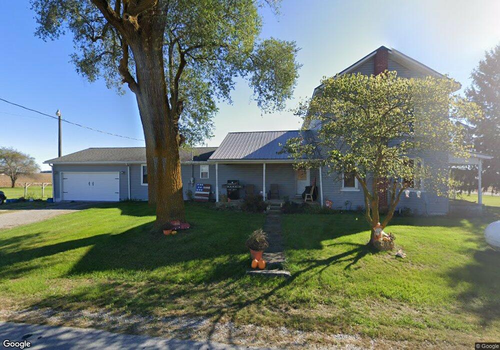
27251 State Route 67 Waynesfield, OH 45896
Estimated Value: $233,868 - $337,000
3
Beds
2
Baths
2,520
Sq Ft
$114/Sq Ft
Est. Value
About This Home
This home is located at 27251 State Route 67, Waynesfield, OH 45896 and is currently estimated at $287,717, approximately $114 per square foot. 27251 State Route 67 is a home located in Auglaize County with nearby schools including Waynesfield-Goshen Local Elementary School and Waynesfield-Goshen Local High School.
Ownership History
Date
Name
Owned For
Owner Type
Purchase Details
Closed on
Jun 10, 2013
Sold by
Gierhart Travis L and Gierhart Amanda L
Bought by
Coy Angela K
Current Estimated Value
Purchase Details
Closed on
Nov 3, 2007
Sold by
Buffenbarger Charles L and Buffenbarger Timothy L
Bought by
Gierhart Travis L and Gierhart Amanda L
Home Financials for this Owner
Home Financials are based on the most recent Mortgage that was taken out on this home.
Original Mortgage
$133,100
Interest Rate
6.38%
Mortgage Type
Purchase Money Mortgage
Purchase Details
Closed on
Oct 31, 2006
Sold by
Arthur Martin B
Bought by
Buffenbarger Charles L and Buffenbarger Timothy L
Purchase Details
Closed on
Oct 28, 1998
Sold by
Neal Kathy A
Bought by
Arthur Martin B
Purchase Details
Closed on
Oct 1, 1986
Create a Home Valuation Report for This Property
The Home Valuation Report is an in-depth analysis detailing your home's value as well as a comparison with similar homes in the area
Home Values in the Area
Average Home Value in this Area
Purchase History
| Date | Buyer | Sale Price | Title Company |
|---|---|---|---|
| Coy Angela K | $132,700 | Attorney | |
| Gierhart Travis L | $136,000 | Northwest Title | |
| Buffenbarger Charles L | $57,000 | None Available | |
| Arthur Martin B | $89,000 | -- | |
| -- | $41,500 | -- |
Source: Public Records
Mortgage History
| Date | Status | Borrower | Loan Amount |
|---|---|---|---|
| Previous Owner | Gierhart Travis L | $133,100 |
Source: Public Records
Tax History Compared to Growth
Tax History
| Year | Tax Paid | Tax Assessment Tax Assessment Total Assessment is a certain percentage of the fair market value that is determined by local assessors to be the total taxable value of land and additions on the property. | Land | Improvement |
|---|---|---|---|---|
| 2024 | $3,489 | $55,470 | $8,980 | $46,490 |
| 2023 | $960 | $55,470 | $8,980 | $46,490 |
| 2022 | $1,709 | $41,270 | $8,420 | $32,850 |
| 2021 | $839 | $41,270 | $8,420 | $32,850 |
| 2020 | $1,674 | $41,269 | $8,421 | $32,848 |
| 2019 | $1,363 | $34,392 | $7,018 | $27,374 |
| 2018 | $1,325 | $34,392 | $7,018 | $27,374 |
| 2017 | $1,320 | $34,392 | $7,018 | $27,374 |
| 2016 | $1,127 | $30,181 | $6,685 | $23,496 |
| 2015 | $1,128 | $30,181 | $6,685 | $23,496 |
| 2014 | $1,126 | $30,181 | $6,685 | $23,496 |
| 2013 | $1,250 | $30,181 | $6,685 | $23,496 |
Source: Public Records
Map
Nearby Homes
- 25836 Ohio 67
- 202 W Mulberry St
- 105 Guthrie St
- 8150 Amherst Rd
- 0 Ohio 235
- 22275 Buckland Holden Rd
- 5065 Amherst Rd
- 13793 Ohio 235 Unit 75
- 11352 N Township Road 88
- 2444 County Road 200
- 11524 Powhatan Path
- 11588 Blackhawk Path
- 11496 Powhatan Path
- 12102 Shannon Dr Unit 89
- 13501 Eagle Path
- 12015 Holly Dr
- 11372 Kickapoo Path
- 11579 Cooper Ave
- 11344 Mohawk Path
- 11773 Sunview Ave
- 27388 State Route 67
- 27128 Ohio 67
- 16895 Pepple Rd
- 16849 Pepple Rd
- 26938 State Route 67
- 16791 Pepple Rd
- 27683 State Route 67
- 16718 Pepple Rd
- 16755 Pepple Rd
- 0 Waynesfield Unit 102134
- 25434 W Us Rt 33a
- 0 State Route 67 Unit 344633
- 0 Buckland-Holden Rd Unit 349409
- 0 Center St Unit 364541
- 0 Waynesfield Unit 378568
- xxx Gant Rd
- 17704 State Route 117
- 17496 Smith Rd
- 26770 State Route 67
- 17104 Heit Rd