Estimated Value: $389,000 - $493,000
4
Beds
2
Baths
2,175
Sq Ft
$198/Sq Ft
Est. Value
About This Home
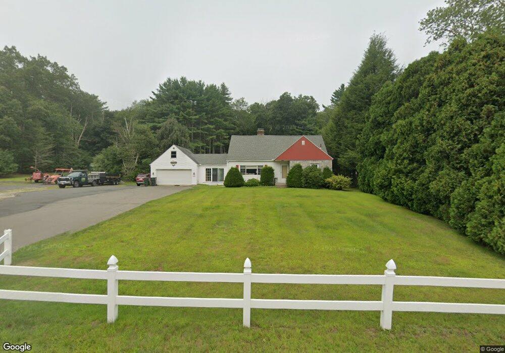
This home is located at 273 Palmer Rd, Ware, MA 01082 and is currently estimated at $429,683, approximately $197 per square foot. 273 Palmer Rd is a home located in Hampshire County with nearby schools including Stanley M. Koziol Elementary School, Ware Middle School, and Ware Junior/Senior High School.
Ownership History
Date
Name
Owned For
Owner Type
Purchase Details
Closed on
Jun 2, 2011
Sold by
Daignault Patricia E
Bought by
Mcguire Jonathan R
Current Estimated Value
Home Financials for this Owner
Home Financials are based on the most recent Mortgage that was taken out on this home.
Original Mortgage
$180,000
Outstanding Balance
$123,578
Interest Rate
4.85%
Mortgage Type
Purchase Money Mortgage
Estimated Equity
$306,105
Create a Home Valuation Report for This Property
The Home Valuation Report is an in-depth analysis detailing your home's value as well as a comparison with similar homes in the area
Home Values in the Area
Average Home Value in this Area
Purchase History
| Date | Buyer | Sale Price | Title Company |
|---|---|---|---|
| Mcguire Jonathan R | $225,000 | -- |
Source: Public Records
Mortgage History
| Date | Status | Borrower | Loan Amount |
|---|---|---|---|
| Open | Mcguire Jonathan R | $180,000 |
Source: Public Records
Tax History
| Year | Tax Paid | Tax Assessment Tax Assessment Total Assessment is a certain percentage of the fair market value that is determined by local assessors to be the total taxable value of land and additions on the property. | Land | Improvement |
|---|---|---|---|---|
| 2025 | $4,869 | $323,300 | $58,700 | $264,600 |
| 2024 | $4,664 | $285,600 | $55,300 | $230,300 |
| 2023 | $4,636 | $268,600 | $54,000 | $214,600 |
| 2022 | $4,462 | $230,700 | $49,900 | $180,800 |
| 2021 | $4,369 | $216,500 | $49,900 | $166,600 |
| 2020 | $4,180 | $202,600 | $49,900 | $152,700 |
| 2019 | $4,095 | $202,600 | $49,900 | $152,700 |
| 2018 | $3,931 | $189,800 | $48,700 | $141,100 |
| 2017 | $3,793 | $182,600 | $48,700 | $133,900 |
| 2016 | $3,690 | $182,600 | $48,700 | $133,900 |
| 2015 | $3,588 | $182,600 | $48,700 | $133,900 |
| 2014 | $3,591 | $196,100 | $52,300 | $143,800 |
Source: Public Records
Map
Nearby Homes
- 310 Palmer Rd
- 201 West St
- LOT 3 Monson Turnpike Rd
- 201 Belchertown Rd
- 24 Clinton St
- 87 W Main St
- 30 Warebrook Village
- 375 Belchertown Rd
- 67 Babcock Tavern Rd
- 23 West St Unit 25
- 7 Webb Ct
- 60 Quaboag Valley Co Op St
- Lot 16 Coldbrook Dr
- Lot 20 Coldbrook Dr
- Lot 22 Coldbrook Dr
- Lot 13 Coldbrook Dr
- Lot 25 Coldbrook Dr
- 44 South St
- 48 North St Unit 1
- 79 Pleasant St
Your Personal Tour Guide
Ask me questions while you tour the home.