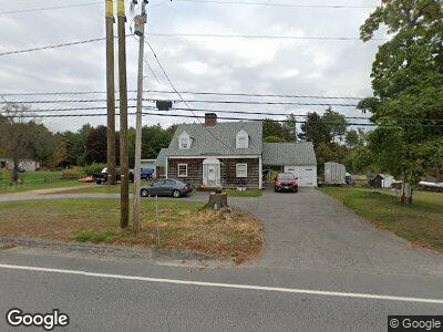
273 Stark Hwy N Dunbarton, NH 03046
Estimated Value: $371,485 - $497,000
2
Beds
2
Baths
1,260
Sq Ft
$347/Sq Ft
Est. Value
About This Home
This home is located at 273 Stark Hwy N, Dunbarton, NH 03046 and is currently estimated at $437,121, approximately $346 per square foot. 273 Stark Hwy N is a home located in Merrimack County with nearby schools including Dunbarton Elementary School, Bow Memorial School, and Bow High School.
Create a Home Valuation Report for This Property
The Home Valuation Report is an in-depth analysis detailing your home's value as well as a comparison with similar homes in the area
Home Values in the Area
Average Home Value in this Area
Tax History Compared to Growth
Tax History
| Year | Tax Paid | Tax Assessment Tax Assessment Total Assessment is a certain percentage of the fair market value that is determined by local assessors to be the total taxable value of land and additions on the property. | Land | Improvement |
|---|---|---|---|---|
| 2024 | $5,661 | $214,600 | $74,400 | $140,200 |
| 2023 | $5,505 | $215,300 | $75,100 | $140,200 |
| 2022 | $4,902 | $213,300 | $75,100 | $138,200 |
| 2021 | $4,993 | $213,300 | $75,100 | $138,200 |
| 2020 | $4,752 | $213,300 | $75,100 | $138,200 |
| 2018 | $3,864 | $171,500 | $61,200 | $110,300 |
| 2017 | $4,392 | $171,500 | $61,200 | $110,300 |
| 2016 | $4,113 | $171,500 | $61,200 | $110,300 |
| 2015 | $4,046 | $171,500 | $61,200 | $110,300 |
| 2014 | $3,687 | $174,400 | $61,200 | $113,200 |
| 2013 | $3,664 | $174,400 | $61,200 | $113,200 |
Source: Public Records
Map
Nearby Homes
- 324 Stark Hwy N
- 12 Old Fort Ln
- 21 Old Fort Ln
- 51 Overlook Dr
- 6 Samuels Ct
- I3-03-05 Clinton St
- 31 Jewett Rd
- 165 Concord Stage Rd
- 5 Sullivan Dr
- 95 Sherwood Forest Rd
- 4 Longview Dr
- 167 Branch Londonderry Turnpike
- 6 Sherwood Forest Rd
- 470 Jewett Rd
- 256-0-17 Jewett Rd
- 28 Brown Hill Rd
- 20 Clement Rd
- 18 Brockway Rd
- 1003 School St
- 35 Fox Hollow Dr
- 273 Stark Hwy N
- 275 Stark Hwy N
- 281 Stark Hwy N
- 285 Stark Hwy N
- 282 Stark Hwy N
- 260 Stark Hwy N
- 291A Stark Hwy N
- 291 Stark Hwy N
- 259 Stark Hwy N
- 293 Stark Hwy N
- 251 Stark Hwy N
- 294 Stark Hwy N
- 261 Stark Hwy N
- 244 Stark Hwy N
- 300 Stark Hwy N
- 301 Stark Hwy N
- 18 Jean Dr
- 240 Stark Hwy N
- 17 Jean Dr
- 310 Stark Hwy N