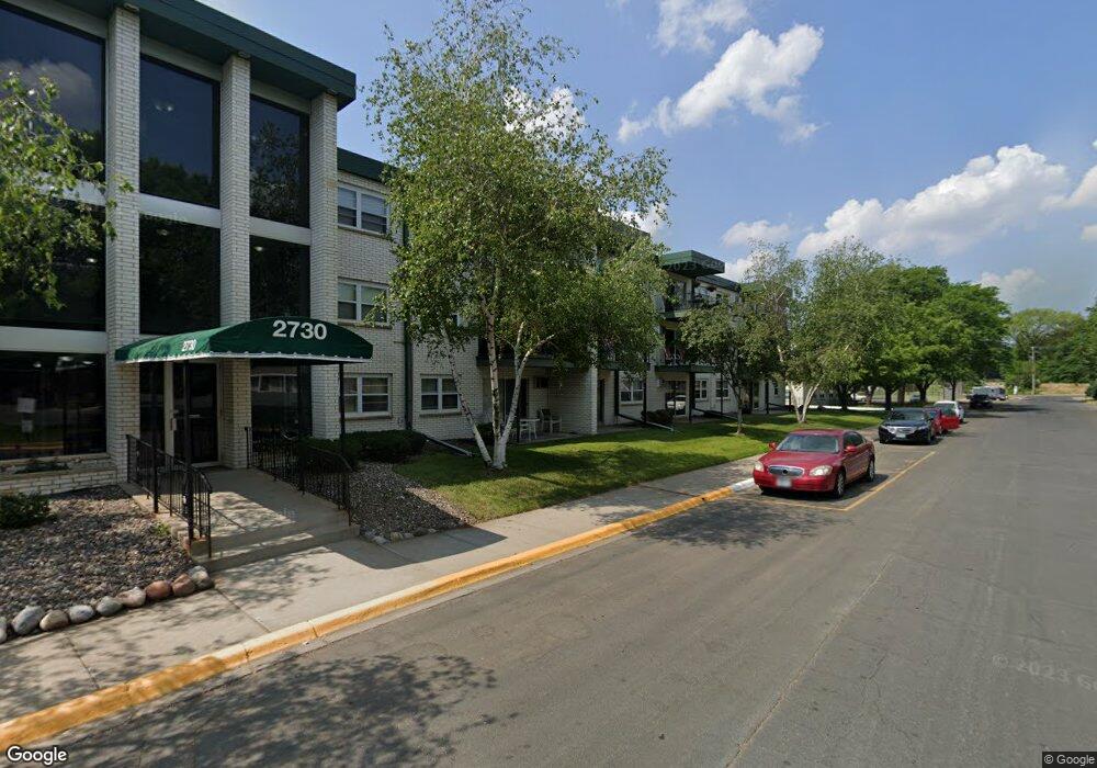
2730 Dale St N Unit D114 Saint Paul, MN 55113
South Owasso NeighborhoodEstimated Value: $148,297 - $186,000
2
Beds
2
Baths
1,024
Sq Ft
$163/Sq Ft
Est. Value
About This Home
This home is located at 2730 Dale St N Unit D114, Saint Paul, MN 55113 and is currently estimated at $166,824, approximately $162 per square foot. 2730 Dale St N Unit D114 is a home located in Ramsey County with nearby schools including Central Park Elementary School, Roseville Area Middle School, and Roseville Area Senior High School.
Ownership History
Date
Name
Owned For
Owner Type
Purchase Details
Closed on
Sep 27, 2024
Sold by
Tenner Doris M and Tenner-Lewis Doris M
Bought by
Tenner-Lewis Doris M
Current Estimated Value
Home Financials for this Owner
Home Financials are based on the most recent Mortgage that was taken out on this home.
Original Mortgage
$112,000
Outstanding Balance
$110,847
Interest Rate
6.46%
Mortgage Type
Credit Line Revolving
Estimated Equity
$55,977
Purchase Details
Closed on
Nov 17, 2017
Sold by
Tenner Lewis Doris M and Lewis Joe Berkley
Bought by
Tenner Myloi Donnell and Tenner Mylaissia Shannon
Purchase Details
Closed on
May 15, 1998
Sold by
Maile Mark J and Maile Ann M
Bought by
Buckley Azariah and Buckly Asboune
Create a Home Valuation Report for This Property
The Home Valuation Report is an in-depth analysis detailing your home's value as well as a comparison with similar homes in the area
Home Values in the Area
Average Home Value in this Area
Purchase History
| Date | Buyer | Sale Price | Title Company |
|---|---|---|---|
| Tenner-Lewis Doris M | $485 | None Listed On Document | |
| Tenner Myloi Donnell | -- | None Available | |
| Buckley Azariah | $68,000 | -- |
Source: Public Records
Mortgage History
| Date | Status | Borrower | Loan Amount |
|---|---|---|---|
| Open | Tenner-Lewis Doris M | $112,000 |
Source: Public Records
Tax History Compared to Growth
Tax History
| Year | Tax Paid | Tax Assessment Tax Assessment Total Assessment is a certain percentage of the fair market value that is determined by local assessors to be the total taxable value of land and additions on the property. | Land | Improvement |
|---|---|---|---|---|
| 2025 | $1,946 | $142,700 | $1,000 | $141,700 |
| 2023 | $1,946 | $137,000 | $1,000 | $136,000 |
| 2022 | $1,406 | $123,400 | $1,000 | $122,400 |
| 2021 | $1,210 | $114,400 | $1,000 | $113,400 |
| 2020 | $1,082 | $108,800 | $1,000 | $107,800 |
| 2019 | $1,036 | $95,600 | $1,000 | $94,600 |
| 2018 | $988 | $90,400 | $1,000 | $89,400 |
| 2017 | $728 | $86,100 | $1,000 | $85,100 |
| 2016 | $674 | $0 | $0 | $0 |
| 2015 | $32 | $65,500 | $9,800 | $55,700 |
| 2014 | $586 | $0 | $0 | $0 |
Source: Public Records
Map
Nearby Homes
- 2730 Dale St N Unit D309
- 2730 Dale St N Unit D101
- 2720 Dale St N Unit C208
- 2710 Dale St N Unit B212
- 540 Woodhill Dr Unit 71
- 2748 Kent St
- 556 County Road C W
- 2720 MacKubin St
- 667 County Road C W
- 437 County Road C W
- 387 Iona Ln
- 405 Judith Ave
- 350 County Road C W
- 405 Brooks Ave W
- 2687 Galtier St
- 500 County Road B2 W
- 2814 Matilda St
- 2821 Galtier St
- 719 Grandview Ave W
- 2939 W Owasso Blvd
- 2730 Dale St N Unit D209
- 2730 Dale St N Unit D313
- 2730 Dale St N Unit D106
- 2730 Dale St N Unit D113
- 2730 Dale St N Unit D206
- 2730 Dale St N Unit D312
- 2730 Dale St N Unit D212
- 2730 Dale St N Unit D310
- 2730 Dale St N Unit D305
- 2730 Dale St N Unit D109
- 2730 Dale St N Unit D306
- 2730 Dale St N Unit D210
- 2730 Dale St N Unit D301
- 2730 Dale St N Unit D315
- 2730 Dale St N Unit D111
- 2730 Dale St N Unit D307
- 2730 Dale St N Unit D304
- 2730 Dale St N Unit D211
- 2730 Dale St N Unit 208
- 2730 Dale St N Unit D311