Estimated Value: $459,000 - $523,000
3
Beds
2
Baths
1,360
Sq Ft
$351/Sq Ft
Est. Value
About This Home
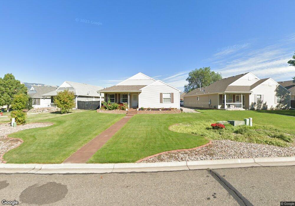
This home is located at 2733 Acacia Ave, Rifle, CO 81650 and is currently estimated at $477,212, approximately $350 per square foot. 2733 Acacia Ave is a home located in Garfield County with nearby schools including Wamsley Elementary School, Rifle Middle School, and Rifle High School.
Ownership History
Date
Name
Owned For
Owner Type
Purchase Details
Closed on
Dec 6, 2002
Sold by
Deerfield Park Llc
Bought by
Chastain Michael R and Chastain Teri E
Current Estimated Value
Home Financials for this Owner
Home Financials are based on the most recent Mortgage that was taken out on this home.
Original Mortgage
$136,000
Outstanding Balance
$63,461
Interest Rate
7.45%
Estimated Equity
$413,751
Purchase Details
Closed on
Aug 30, 2002
Sold by
Bianco Joaquin N and Bianco Teresa L
Bought by
Deerfield Park Llc
Purchase Details
Closed on
Aug 8, 2001
Sold by
Deerfield Park Llc
Bought by
Bianco Joaquin N and Bianco Teresa L
Home Financials for this Owner
Home Financials are based on the most recent Mortgage that was taken out on this home.
Original Mortgage
$155,200
Interest Rate
7.14%
Create a Home Valuation Report for This Property
The Home Valuation Report is an in-depth analysis detailing your home's value as well as a comparison with similar homes in the area
Home Values in the Area
Average Home Value in this Area
Purchase History
| Date | Buyer | Sale Price | Title Company |
|---|---|---|---|
| Chastain Michael R | $170,000 | Stewart Title | |
| Deerfield Park Llc | $165,400 | Stewart Title | |
| Bianco Joaquin N | $163,400 | Stewart Title |
Source: Public Records
Mortgage History
| Date | Status | Borrower | Loan Amount |
|---|---|---|---|
| Open | Chastain Michael R | $136,000 | |
| Previous Owner | Bianco Joaquin N | $155,200 | |
| Closed | Chastain Michael R | $34,000 |
Source: Public Records
Tax History Compared to Growth
Tax History
| Year | Tax Paid | Tax Assessment Tax Assessment Total Assessment is a certain percentage of the fair market value that is determined by local assessors to be the total taxable value of land and additions on the property. | Land | Improvement |
|---|---|---|---|---|
| 2024 | -- | $23,660 | $3,480 | $20,180 |
| 2023 | $1,580 | $23,660 | $3,480 | $20,180 |
| 2022 | $1,441 | $20,120 | $3,820 | $16,300 |
| 2021 | $1,655 | $20,700 | $3,930 | $16,770 |
| 2020 | $1,426 | $19,490 | $2,860 | $16,630 |
| 2019 | $1,349 | $19,490 | $2,860 | $16,630 |
| 2018 | $1,158 | $16,350 | $2,660 | $13,690 |
| 2017 | $1,046 | $16,350 | $2,660 | $13,690 |
| 2016 | $877 | $15,520 | $2,550 | $12,970 |
| 2015 | $810 | $15,520 | $2,550 | $12,970 |
| 2014 | -- | $10,810 | $1,750 | $9,060 |
Source: Public Records
Map
Nearby Homes
- 321 Columbine Dr
- Phase 2 Rifle Creek
- 2659 Acacia Ave Unit 2C
- Phase 1B Tbd Creekside Dr
- 148 W 26th St
- 2501 Meadow Cir Unit 1
- 2203 Ute Ave
- 211 W 28th Ct
- 1103 E 18th St
- 3053 Coal Mine Ave
- 1783 Anvil View Ave
- 405 W 26th St
- 1663 Walnut
- 1173 E 17th St
- 2409 W 24th Place
- 1205 E 17th St
- 1607 Balsam Loop
- 1279 E 17th St
- 200 W 20th St Unit A142
- 200 W 20th St Unit E5
- 2729 Acacia Ct
- 2739 Acacia Ave
- 445 Evergreen Dr
- 451 Evergreen Dr
- 437 Evergreen Dr
- 2757 Acacia Ave
- 2705 Acacia Ct
- 425 Evergreen Dr
- 413 Evergreen Dr
- 401 Evergreen Dr
- 0 Evergreen Dr Unit 640635
- 448 Evergreen Dr
- 452 Evergreen Dr
- 440 Evergreen Dr
- 2703 Acacia Ct
- 434 Evergreen Dr
- 2807 Acacia Ave
- 422 Evergreen Dr
- 2701 Acacia Ct
- 410 Evergreen Dr