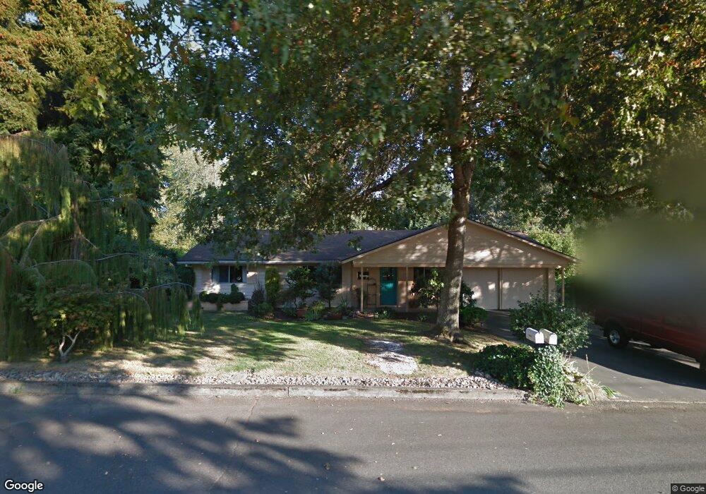
2735 Mark Ln West Linn, OR 97068
Bolton NeighborhoodEstimated Value: $471,000 - $597,000
3
Beds
2
Baths
1,192
Sq Ft
$431/Sq Ft
Est. Value
About This Home
This home is located at 2735 Mark Ln, West Linn, OR 97068 and is currently estimated at $513,764, approximately $431 per square foot. 2735 Mark Ln is a home located in Clackamas County with nearby schools including Cedaroak Park Primary School, West Linn High School, and Harmony Academy.
Ownership History
Date
Name
Owned For
Owner Type
Purchase Details
Closed on
Aug 24, 2017
Sold by
Welsh Clint
Bought by
Welsh Clinton W and Welsh Melissa A
Current Estimated Value
Home Financials for this Owner
Home Financials are based on the most recent Mortgage that was taken out on this home.
Original Mortgage
$257,000
Outstanding Balance
$214,341
Interest Rate
4.03%
Mortgage Type
New Conventional
Estimated Equity
$299,423
Purchase Details
Closed on
Jun 29, 2017
Sold by
Tolliver Michelle J
Bought by
Welsh Clint
Home Financials for this Owner
Home Financials are based on the most recent Mortgage that was taken out on this home.
Original Mortgage
$257,000
Outstanding Balance
$214,341
Interest Rate
4.03%
Mortgage Type
New Conventional
Estimated Equity
$299,423
Create a Home Valuation Report for This Property
The Home Valuation Report is an in-depth analysis detailing your home's value as well as a comparison with similar homes in the area
Home Values in the Area
Average Home Value in this Area
Purchase History
| Date | Buyer | Sale Price | Title Company |
|---|---|---|---|
| Welsh Clinton W | -- | Wfg Title | |
| Welsh Clint | $280,000 | Wfg Title |
Source: Public Records
Mortgage History
| Date | Status | Borrower | Loan Amount |
|---|---|---|---|
| Open | Welsh Clinton W | $257,000 | |
| Closed | Welsh Clint | $252,000 |
Source: Public Records
Tax History Compared to Growth
Tax History
| Year | Tax Paid | Tax Assessment Tax Assessment Total Assessment is a certain percentage of the fair market value that is determined by local assessors to be the total taxable value of land and additions on the property. | Land | Improvement |
|---|---|---|---|---|
| 2025 | $4,098 | $212,656 | -- | -- |
| 2024 | $3,945 | $206,463 | -- | -- |
| 2023 | $3,945 | $200,450 | $0 | $0 |
| 2022 | $3,723 | $194,612 | $0 | $0 |
| 2021 | $3,535 | $188,944 | $0 | $0 |
| 2020 | $3,559 | $183,441 | $0 | $0 |
| 2019 | $3,394 | $178,099 | $0 | $0 |
| 2018 | $3,242 | $172,912 | $0 | $0 |
| 2017 | $3,116 | $167,876 | $0 | $0 |
| 2016 | $3,036 | $162,986 | $0 | $0 |
| 2015 | $2,949 | $158,239 | $0 | $0 |
| 2014 | $2,812 | $153,630 | $0 | $0 |
Source: Public Records
Map
Nearby Homes
- 2700 Underhill Ln Unit 1
- 2488 Tulane St
- 20120 Larkspur Ln Unit 85
- 20080 Larkspur Ln Unit 50
- 20070 Larkspur Ln Unit 61
- 19623 White Cloud Cir
- 20930 Fawn Ct Unit 26
- 2583 Pimlico Dr
- 4622 Mapleton Dr
- 19885 Willamette Dr
- 6403 Tompkins Ct
- 4610 Kenthorpe Way
- 4050 Serango Ct
- 6345 Caufield St
- 19155 Nixon Ave
- 3820 Kenthorpe Way
- 1954 Buck St
- 19788 Wildwood Dr
- 19697 SE Cottonwood St
- 3893 Cedaroak Dr