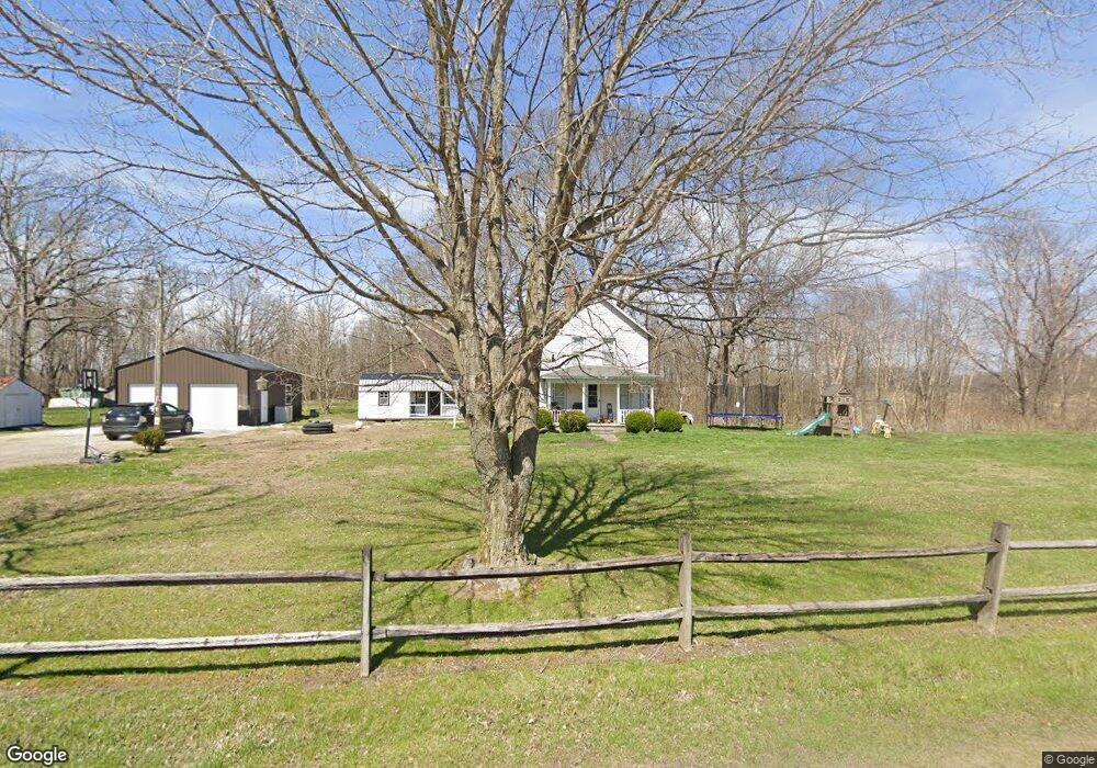
274 W Oard Spring Rd Austin, IN 47102
Estimated Value: $155,484 - $211,000
3
Beds
1
Bath
1,360
Sq Ft
$134/Sq Ft
Est. Value
About This Home
This home is located at 274 W Oard Spring Rd, Austin, IN 47102 and is currently estimated at $182,121, approximately $133 per square foot. 274 W Oard Spring Rd is a home located in Scott County with nearby schools including Austin Elementary School, Austin Middle School, and Austin High School.
Ownership History
Date
Name
Owned For
Owner Type
Purchase Details
Closed on
Sep 9, 2020
Sold by
Dt Holdings Llc
Bought by
Mcintosh Timothy James Aston and Mcintosh Kelsie Shyan
Current Estimated Value
Purchase Details
Closed on
Feb 7, 2013
Sold by
Dt Holdings Llc
Bought by
Mcintosh Timothy James Ashton and Mcintosh Kelsie Shyan
Purchase Details
Closed on
Apr 27, 2011
Sold by
Campbell Danny and Campbell Douglas
Bought by
Dt Holdings Llc
Purchase Details
Closed on
Mar 7, 2006
Sold by
The Scott Co State Bank
Bought by
Campbell Douglas and Campbell Danny
Home Financials for this Owner
Home Financials are based on the most recent Mortgage that was taken out on this home.
Original Mortgage
$58,000
Interest Rate
6.2%
Mortgage Type
Commercial
Purchase Details
Closed on
Nov 29, 2005
Sold by
Hazelwood Kenneth W and Hazelwood Ronda M
Bought by
The Scott Co State Bank
Create a Home Valuation Report for This Property
The Home Valuation Report is an in-depth analysis detailing your home's value as well as a comparison with similar homes in the area
Purchase History
We collect this data history from publicly available records. To have your information removed, we recommend requesting removal directly through your county’s website.
| Date | Buyer | Sale Price | Title Company |
|---|---|---|---|
| Mcintosh Timothy James Aston | -- | None Available | |
| Mcintosh Timothy James Ashton | $45,000 | None Available | |
| Dt Holdings Llc | -- | None Available | |
| Campbell Douglas | -- | None Available | |
| The Scott Co State Bank | -- | None Available |
Source: Public Records
Mortgage History
We collect this data history from publicly available records. To have your information removed, we recommend requesting removal directly through your county’s website.
| Date | Status | Borrower | Loan Amount |
|---|---|---|---|
| Previous Owner | Campbell Douglas | $58,000 | |
| Closed | Mcintosh Timothy James Ashton | $0 |
Source: Public Records
Tax History
| Year | Tax Paid | Tax Assessment Tax Assessment Total Assessment is a certain percentage of the fair market value that is determined by local assessors to be the total taxable value of land and additions on the property. | Land | Improvement |
|---|---|---|---|---|
| 2025 | $438 | $87,200 | $16,000 | $71,200 |
| 2024 | $438 | $77,100 | $16,000 | $61,100 |
| 2023 | $436 | $76,900 | $16,000 | $60,900 |
| 2022 | $426 | $64,100 | $16,000 | $48,100 |
| 2021 | $251 | $47,600 | $16,000 | $31,600 |
| 2020 | $206 | $47,300 | $16,000 | $31,300 |
| 2019 | $188 | $45,900 | $16,000 | $29,900 |
| 2018 | $157 | $40,900 | $13,000 | $27,900 |
| 2017 | $150 | $41,100 | $13,000 | $28,100 |
| 2016 | $154 | $40,800 | $13,000 | $27,800 |
| 2014 | $222 | $51,800 | $13,000 | $38,800 |
| 2013 | $222 | $51,800 | $13,000 | $38,800 |
Source: Public Records
Map
Nearby Homes
- TBD E Oard Spring Rd
- 1130 & 1140 N Church St
- 0 S County Road 910 W
- 5727 N Terry Rd
- 1868 E Harrod Rd
- 4604 N Bogardus Rd
- 1254 N Church St
- 6000 S Block Us Hwy 31
- 1118 Wade St
- 1130 Mann Ave
- 605 E Bard St
- 1116 Mann Ave
- 1130 N Church St
- 400 E Main St
- 1927 W Booe Rd
- 560 North St
- 403 N Jackson St
- 502 E Bard St
- 404 Oak St
- 1020 N Church St
- 6878 N Jack Morgan Rd
- 7037 N Jack Morgan Rd
- 6995 N Jack Morgan Rd
- 166 E Oard Spring Rd
- 164 W Crothersville Rd
- 1 W Crothersville Rd
- 270 E Oard Spring Rd
- 186 E Crothersville Rd
- 296 E Oard Spring Rd
- 23 E Crothersville Rd
- 181 E Crothersville Rd
- 379 E Oard Spring Rd
- 6371 N Jack Morgan Rd
- 466 E Oard Spring Rd
- 6357 N Jack Morgan Rd
- 206 E Crothersville Rd
- 505 E Oard Spring Rd
- 6206 N Jack Morgan Rd
- 6211 N Jack Morgan Rd
- 910 W Crothersville Rd
Your Personal Tour Guide
Ask me questions while you tour the home.