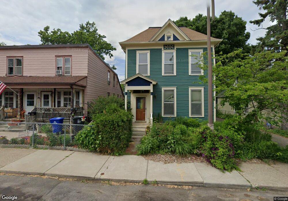
275 Banfil St Saint Paul, MN 55102
West Seventh NeighborhoodEstimated Value: $347,882 - $379,000
3
Beds
2
Baths
1,856
Sq Ft
$192/Sq Ft
Est. Value
About This Home
This home is located at 275 Banfil St, Saint Paul, MN 55102 and is currently estimated at $357,221, approximately $192 per square foot. 275 Banfil St is a home located in Ramsey County with nearby schools including Randolph Heights Elementary School, Hidden River Middle School, and Central Senior High School.
Ownership History
Date
Name
Owned For
Owner Type
Purchase Details
Closed on
Sep 2, 2021
Sold by
Seiberlich Michael and Seiberlich Deborah A
Bought by
Seiberlich Michael and Seiberlich Deborah A
Current Estimated Value
Purchase Details
Closed on
Apr 7, 2020
Sold by
Chesser Fridy Adrianne S and Chesser Fridy Sade
Bought by
Chesser Fridy Adrienne S and Chesser Fridy Sade
Purchase Details
Closed on
Jun 6, 2017
Sold by
Weicht Lisa M and Brien Timothy P O
Bought by
Chesser Adrianne S
Home Financials for this Owner
Home Financials are based on the most recent Mortgage that was taken out on this home.
Original Mortgage
$200,000
Interest Rate
4.03%
Mortgage Type
New Conventional
Purchase Details
Closed on
Apr 30, 1999
Sold by
West 7Th/Fort Road Federation Inc
Bought by
Obrien Timothy P and Weight Lisa M
Purchase Details
Closed on
Jan 15, 1998
Sold by
Brindley Terry C and Brindley Lynette
Bought by
West 7Th/Fort Road Federation Inc
Create a Home Valuation Report for This Property
The Home Valuation Report is an in-depth analysis detailing your home's value as well as a comparison with similar homes in the area
Home Values in the Area
Average Home Value in this Area
Purchase History
| Date | Buyer | Sale Price | Title Company |
|---|---|---|---|
| Seiberlich Michael | -- | None Listed On Document | |
| Chesser Fridy Adrienne S | -- | Partners Title Llc | |
| Chesser Adrianne S | $257,576 | Partners Title Llc | |
| Obrien Timothy P | $132,000 | -- | |
| West 7Th/Fort Road Federation Inc | $36,000 | -- |
Source: Public Records
Mortgage History
| Date | Status | Borrower | Loan Amount |
|---|---|---|---|
| Previous Owner | Chesser Adrianne S | $200,000 |
Source: Public Records
Tax History Compared to Growth
Tax History
| Year | Tax Paid | Tax Assessment Tax Assessment Total Assessment is a certain percentage of the fair market value that is determined by local assessors to be the total taxable value of land and additions on the property. | Land | Improvement |
|---|---|---|---|---|
| 2025 | $4,844 | $338,100 | $40,000 | $298,100 |
| 2023 | $4,844 | $311,100 | $40,000 | $271,100 |
| 2022 | $3,452 | $266,200 | $40,000 | $226,200 |
| 2021 | $3,872 | $225,500 | $40,000 | $185,500 |
| 2020 | $4,068 | $258,200 | $16,600 | $241,600 |
| 2019 | $3,972 | $253,100 | $16,600 | $236,500 |
| 2018 | $3,318 | $244,700 | $16,600 | $228,100 |
| 2017 | $2,864 | $214,500 | $16,600 | $197,900 |
| 2016 | $3,082 | $0 | $0 | $0 |
| 2015 | $2,814 | $188,200 | $16,600 | $171,600 |
| 2014 | $3,092 | $0 | $0 | $0 |
Source: Public Records
Map
Nearby Homes
- 275 Cliff St
- 89 Douglas St
- 212 McBoal St
- 398 Banfil St
- 103 Western Ave S
- 383 Grand Ave Unit 1
- 383 Grand Ave Unit 9
- 391 Grand Ave Unit 304
- 380 Ramsey St Unit 1B
- 310 Ryan Ave
- 185 Elm St
- 360 Sherman St Unit 1607
- 190 Elm St
- 312 Spring St Unit 309
- 175 Sherman St Unit 204
- 11 Summit Ct Unit 11
- 442 Summit Ave Unit 4
- 442 Summit Ave Unit 6
- 311 Pleasant Ave Unit 301
- 415 Summit Ave Unit 2