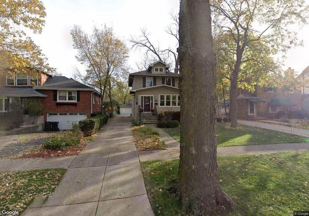
275 Bartram Rd Riverside, IL 60546
Estimated Value: $490,121 - $639,000
3
Beds
2
Baths
1,650
Sq Ft
$338/Sq Ft
Est. Value
About This Home
This home is located at 275 Bartram Rd, Riverside, IL 60546 and is currently estimated at $557,030, approximately $337 per square foot. 275 Bartram Rd is a home located in Cook County with nearby schools including A F Ames Elementary School, L J Hauser Jr High School, and Riverside Brookfield High School.
Ownership History
Date
Name
Owned For
Owner Type
Purchase Details
Closed on
Apr 21, 2011
Sold by
Conrad Michael P and Conrad Janet
Bought by
Standard Bank & Trust Company and Trust #21019
Current Estimated Value
Create a Home Valuation Report for This Property
The Home Valuation Report is an in-depth analysis detailing your home's value as well as a comparison with similar homes in the area
Home Values in the Area
Average Home Value in this Area
Purchase History
| Date | Buyer | Sale Price | Title Company |
|---|---|---|---|
| Standard Bank & Trust Company | -- | None Available |
Source: Public Records
Tax History
| Year | Tax Paid | Tax Assessment Tax Assessment Total Assessment is a certain percentage of the fair market value that is determined by local assessors to be the total taxable value of land and additions on the property. | Land | Improvement |
|---|---|---|---|---|
| 2025 | $7,006 | $42,000 | $10,920 | $31,080 |
| 2024 | $7,006 | $42,000 | $10,920 | $31,080 |
| 2023 | $8,654 | $42,000 | $10,920 | $31,080 |
| 2022 | $8,654 | $38,721 | $9,555 | $29,166 |
| 2021 | $8,096 | $38,721 | $9,555 | $29,166 |
| 2020 | $7,295 | $38,721 | $9,555 | $29,166 |
| 2019 | $7,973 | $37,307 | $8,736 | $28,571 |
| 2018 | $7,752 | $37,307 | $8,736 | $28,571 |
| 2017 | $7,370 | $37,307 | $8,736 | $28,571 |
| 2016 | $9,052 | $29,985 | $7,644 | $22,341 |
| 2015 | $9,415 | $29,985 | $7,644 | $22,341 |
| 2014 | $9,273 | $29,985 | $7,644 | $22,341 |
| 2013 | $11,045 | $38,034 | $7,644 | $30,390 |
Source: Public Records
Map
Nearby Homes
- 231 Bartram Rd
- 315 Bartram Rd
- 305 Desplaines Ave
- 101 Southcote Rd
- 367 Bartram Rd
- 410 Repton Rd
- 8117 W 30th St
- 236 Maplewood Rd
- 220 Maplewood Rd
- 269 Shenstone Rd
- 2527 Keystone Ave
- 108 E Burlington St Unit B
- 10 E Burlington St Unit 2C
- 10 E Burlington St Unit 2B
- 2433 Keystone Ave
- 78 Pine Ave
- 369 Addison Rd
- 478 Kent Rd
- 2311 Park Ave
- 562 Byrd Rd
Your Personal Tour Guide
Ask me questions while you tour the home.