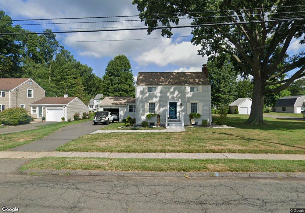
275 Brimfield Rd Wethersfield, CT 06109
Estimated Value: $425,572 - $465,000
3
Beds
2
Baths
1,540
Sq Ft
$289/Sq Ft
Est. Value
About This Home
This home is located at 275 Brimfield Rd, Wethersfield, CT 06109 and is currently estimated at $445,143, approximately $289 per square foot. 275 Brimfield Rd is a home located in Hartford County with nearby schools including Emerson-Williams School, Silas Deane Middle School, and Wethersfield High School.
Ownership History
Date
Name
Owned For
Owner Type
Purchase Details
Closed on
Jul 11, 2011
Sold by
Okeefe Melissa A
Bought by
Brothers Sheryl
Current Estimated Value
Home Financials for this Owner
Home Financials are based on the most recent Mortgage that was taken out on this home.
Original Mortgage
$216,000
Outstanding Balance
$149,231
Interest Rate
4.6%
Estimated Equity
$295,912
Purchase Details
Closed on
Jan 26, 1999
Sold by
Morrissey Gerald F and Morrissey Joan E
Bought by
Mytych Melissa
Create a Home Valuation Report for This Property
The Home Valuation Report is an in-depth analysis detailing your home's value as well as a comparison with similar homes in the area
Home Values in the Area
Average Home Value in this Area
Purchase History
| Date | Buyer | Sale Price | Title Company |
|---|---|---|---|
| Brothers Sheryl | $270,000 | -- | |
| Mytych Melissa | $138,000 | -- |
Source: Public Records
Mortgage History
| Date | Status | Borrower | Loan Amount |
|---|---|---|---|
| Open | Mytych Melissa | $216,000 | |
| Previous Owner | Mytych Melissa | $86,500 | |
| Previous Owner | Mytych Melissa | $30,000 | |
| Previous Owner | Mytych Melissa | $15,000 |
Source: Public Records
Tax History
| Year | Tax Paid | Tax Assessment Tax Assessment Total Assessment is a certain percentage of the fair market value that is determined by local assessors to be the total taxable value of land and additions on the property. | Land | Improvement |
|---|---|---|---|---|
| 2025 | $10,342 | $250,890 | $93,800 | $157,090 |
| 2024 | $7,337 | $169,770 | $74,240 | $95,530 |
| 2023 | $7,093 | $169,770 | $74,240 | $95,530 |
| 2022 | $6,974 | $169,770 | $74,240 | $95,530 |
| 2021 | $6,905 | $169,770 | $74,240 | $95,530 |
| 2020 | $6,908 | $169,770 | $74,240 | $95,530 |
| 2019 | $6,916 | $169,770 | $74,240 | $95,530 |
| 2018 | $6,827 | $167,400 | $71,100 | $96,300 |
| 2017 | $6,657 | $167,400 | $71,100 | $96,300 |
| 2016 | $6,452 | $167,400 | $71,100 | $96,300 |
| 2015 | $6,393 | $167,400 | $71,100 | $96,300 |
| 2014 | $6,150 | $167,400 | $71,100 | $96,300 |
Source: Public Records
Map
Nearby Homes
- 137 Dale Rd
- 38 Wheeler Rd
- 250 Edward St
- 750 Wolcott Hill Rd
- 89 Merriman Rd
- 455 Brimfield Rd
- 108 Chamberlain Rd
- 131 Coleman Rd
- 31 Ox Yoke Dr
- 35 Stillwold Dr
- 764 Ridge Rd
- 147 Spring St
- 11 Charter Rd
- 91 Somerset St
- 195 Middletown Ave
- 87 Somerset St
- 0 Collier Rd
- 101 Collier Rd
- 20 Forest Dr
- 23 Hillcrest Ave
- 283 Brimfield Rd
- 267 Brimfield Rd
- 60 Clearfield Rd
- 287 Brimfield Rd
- 54 Clearfield Rd
- 68 Clearfield Rd
- 263 Brimfield Rd
- 280 Brimfield Rd
- 270 Brimfield Rd
- 48 Clearfield Rd
- 268 Brimfield Rd
- 284 Brimfield Rd
- 78 Clearfield Rd
- 264 Brimfield Rd
- 255 Brimfield Rd
- 964 Folly Brook Blvd
- 40 Clearfield Rd
- 65 Clearfield Rd
- 61 Clearfield Rd
- 67 Clearfield Rd
Your Personal Tour Guide
Ask me questions while you tour the home.