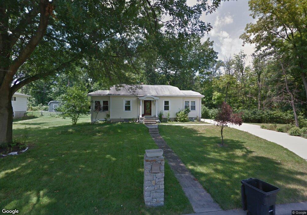
275 N Gersam Ave Hamilton, OH 45013
Estimated Value: $181,000 - $250,000
2
Beds
2
Baths
1,636
Sq Ft
$135/Sq Ft
Est. Value
About This Home
This home is located at 275 N Gersam Ave, Hamilton, OH 45013 and is currently estimated at $220,581, approximately $134 per square foot. 275 N Gersam Ave is a home located in Butler County with nearby schools including Brookwood Elementary School, Wilson Middle School, and Hamilton High School Main Campus.
Ownership History
Date
Name
Owned For
Owner Type
Purchase Details
Closed on
Oct 30, 2014
Sold by
Nunn John M
Bought by
Rucker Mary L
Current Estimated Value
Home Financials for this Owner
Home Financials are based on the most recent Mortgage that was taken out on this home.
Original Mortgage
$97,850
Outstanding Balance
$75,587
Interest Rate
4.23%
Mortgage Type
New Conventional
Estimated Equity
$144,994
Purchase Details
Closed on
Aug 7, 2014
Sold by
Warren James D and Warren Carol A
Bought by
Nunn John M
Purchase Details
Closed on
May 1, 1993
Create a Home Valuation Report for This Property
The Home Valuation Report is an in-depth analysis detailing your home's value as well as a comparison with similar homes in the area
Home Values in the Area
Average Home Value in this Area
Purchase History
| Date | Buyer | Sale Price | Title Company |
|---|---|---|---|
| Rucker Mary L | $103,000 | None Available | |
| Nunn John M | $76,000 | None Available | |
| -- | $69,000 | -- |
Source: Public Records
Mortgage History
| Date | Status | Borrower | Loan Amount |
|---|---|---|---|
| Open | Rucker Mary L | $97,850 |
Source: Public Records
Tax History Compared to Growth
Tax History
| Year | Tax Paid | Tax Assessment Tax Assessment Total Assessment is a certain percentage of the fair market value that is determined by local assessors to be the total taxable value of land and additions on the property. | Land | Improvement |
|---|---|---|---|---|
| 2024 | $2,123 | $50,300 | $10,550 | $39,750 |
| 2023 | $2,113 | $50,300 | $10,550 | $39,750 |
| 2022 | $2,151 | $43,340 | $10,550 | $32,790 |
| 2021 | $1,900 | $41,960 | $10,550 | $31,410 |
| 2020 | $2,190 | $41,960 | $10,550 | $31,410 |
| 2019 | $2,793 | $38,140 | $11,500 | $26,640 |
| 2018 | $2,004 | $38,140 | $11,500 | $26,640 |
| 2017 | $1,788 | $38,140 | $11,500 | $26,640 |
| 2016 | $1,980 | $35,140 | $11,500 | $23,640 |
| 2015 | $1,719 | $35,140 | $11,500 | $23,640 |
| 2014 | $7,653 | $35,140 | $11,500 | $23,640 |
| 2013 | $7,653 | $36,630 | $11,500 | $25,130 |
Source: Public Records
Map
Nearby Homes
- 1063 Westview Ave
- 15 Ohio Ave
- 732 Millville Ave
- 1317 Goodman Ave
- 1241 Millville Ave
- 1231 Franklin St
- 65 W Persimmon Dr
- 1281 Millville Ave
- 16 Rockford Dr
- 2073 Sunset Dr
- 560 Springvale Dr
- 997 Millikin St
- 1150 Franklin St
- 570 Harrison Ave
- 1122 Franklin St
- 885 Carlisle Ave
- 781 Springvale Dr
- 1278 Elizabeth Dr
- 1280 Elizabeth Dr
- 451 Millville Ave
- 253 N Gersam Ave
- 241 N Gersam Ave
- 227 N Gersam Ave
- 215 N Gersam Ave
- 1021 Westview Ave
- 1005 Westview Ave
- 1025 Westview Ave
- 1031 Westview Ave
- 1039 Westview Ave
- 1002 Westview Ave
- 1008 Westview Ave
- 1020 Westview Ave
- 994 Westview Ave
- 986 Westview Ave
- 1034 Westview Ave
- 1034 Westview Ave
- 980 Westview Ave
- 1051 Westview Ave
- 1040 Westview Ave
- 1057 Westview Ave