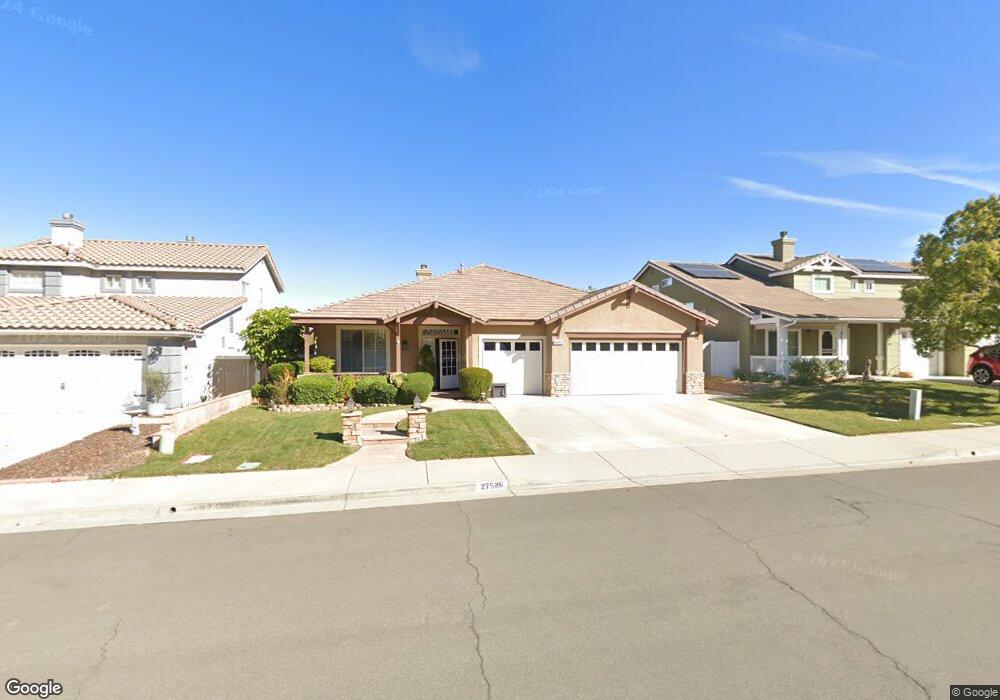
27526 Wild Fire Ct Corona, CA 92883
Horsethief Canyon Ranch NeighborhoodEstimated Value: $662,541 - $736,000
4
Beds
2
Baths
2,176
Sq Ft
$322/Sq Ft
Est. Value
About This Home
This home is located at 27526 Wild Fire Ct, Corona, CA 92883 and is currently estimated at $699,885, approximately $321 per square foot. 27526 Wild Fire Ct is a home located in Riverside County with nearby schools including Luiseno School and Temescal Canyon High School.
Ownership History
Date
Name
Owned For
Owner Type
Purchase Details
Closed on
Sep 11, 2023
Sold by
Putjenter Scott and Putjenter Debbi
Bought by
Putjenter Family Living Trust and Putjenter
Current Estimated Value
Purchase Details
Closed on
Jul 28, 1999
Sold by
Presley Homes
Bought by
Putjenter Scott and Putjenter Debbi
Home Financials for this Owner
Home Financials are based on the most recent Mortgage that was taken out on this home.
Original Mortgage
$196,500
Interest Rate
7.82%
Mortgage Type
Purchase Money Mortgage
Create a Home Valuation Report for This Property
The Home Valuation Report is an in-depth analysis detailing your home's value as well as a comparison with similar homes in the area
Home Values in the Area
Average Home Value in this Area
Purchase History
| Date | Buyer | Sale Price | Title Company |
|---|---|---|---|
| Putjenter Family Living Trust | -- | None Listed On Document | |
| Putjenter Scott | $207,000 | First American Title Co |
Source: Public Records
Mortgage History
| Date | Status | Borrower | Loan Amount |
|---|---|---|---|
| Previous Owner | Putjenter Scott | $196,500 |
Source: Public Records
Tax History
| Year | Tax Paid | Tax Assessment Tax Assessment Total Assessment is a certain percentage of the fair market value that is determined by local assessors to be the total taxable value of land and additions on the property. | Land | Improvement |
|---|---|---|---|---|
| 2025 | $3,221 | $318,122 | $92,203 | $225,919 |
| 2023 | $3,221 | $305,772 | $88,624 | $217,148 |
| 2022 | $3,080 | $299,778 | $86,887 | $212,891 |
| 2021 | $3,018 | $293,901 | $85,184 | $208,717 |
| 2020 | $2,987 | $290,888 | $84,311 | $206,577 |
| 2019 | $2,927 | $285,185 | $82,658 | $202,527 |
| 2018 | $2,869 | $279,594 | $81,039 | $198,555 |
| 2017 | $2,812 | $274,112 | $79,450 | $194,662 |
Source: Public Records
Map
Nearby Homes
- 13698 Buckskin Trail Dr
- 27410 Barcelona Dr
- 27658 Trailhead Ct
- 27678 Trailhead Ct
- 13633 Silver Stirrup Dr
- 27298 Buffalo Trail
- 13416 Silver Stirrup Dr
- 27452 Eagles Nest Dr
- 27859 Cirrus Cir
- 27069 Dawnview Ct
- 13219 Gold Rush Dr
- 27051 Featherhill Dr
- 13624 Palomino Creek Dr
- 27285 Colt Dr
- 27381 Echo Canyon Ct
- 27353 Echo Canyon Ct
- 26879 Eagle Run St
- 13410 Crystal Springs Dr
- 27258 Denali Ct
- 27234 Denali Ct
- 27536 Wild Fire Ct
- 27516 Wild Fire Ct
- 27546 Wild Fire Ct
- 27506 Wild Fire Ct
- 27529 Hopi Springs Ct
- 27519 Hopi Springs Ct
- 27539 Hopi Springs Ct
- 27523 Wild Fire Ct
- 27549 Hopi Springs Ct
- 27509 Hopi Springs Ct
- 27556 Wild Fire Ct
- 27533 Wild Fire Ct
- 27559 Hopi Springs Ct
- 27513 Wild Fire Ct
- 27565 Hopi Springs Ct
- 27566 Wild Fire Ct
- 27522 Fallbrook Ct
- 27503 Wild Fire Ct
- 13708 Buckskin Trail Dr
- 27531 Fallbrook Ct
Your Personal Tour Guide
Ask me questions while you tour the home.