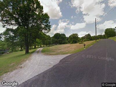
2760 Mclemore Rd Franklin, TN 37064
McLemore NeighborhoodEstimated Value: $571,144 - $747,000
--
Bed
2
Baths
1,715
Sq Ft
$404/Sq Ft
Est. Value
About This Home
This home is located at 2760 Mclemore Rd, Franklin, TN 37064 and is currently estimated at $693,286, approximately $404 per square foot. 2760 Mclemore Rd is a home located in Williamson County with nearby schools including Oak View Elementary School and Legacy Middle School.
Ownership History
Date
Name
Owned For
Owner Type
Purchase Details
Closed on
Dec 13, 2004
Sold by
Hood Howard L
Bought by
Hood Wanda M
Current Estimated Value
Home Financials for this Owner
Home Financials are based on the most recent Mortgage that was taken out on this home.
Original Mortgage
$80,000
Interest Rate
5.67%
Mortgage Type
Purchase Money Mortgage
Create a Home Valuation Report for This Property
The Home Valuation Report is an in-depth analysis detailing your home's value as well as a comparison with similar homes in the area
Home Values in the Area
Average Home Value in this Area
Purchase History
| Date | Buyer | Sale Price | Title Company |
|---|---|---|---|
| Hood Wanda M | $42,000 | Priority |
Source: Public Records
Mortgage History
| Date | Status | Borrower | Loan Amount |
|---|---|---|---|
| Closed | Hood Wanda M | $45,000 | |
| Closed | Hood Wanda M | $45,000 | |
| Closed | Hood Wanda M | $30,000 | |
| Closed | Hood Wanda M | $115,000 | |
| Closed | Hood Wanda M | $15,000 | |
| Closed | Hood Wanda M | $136,000 | |
| Closed | Hood Wanda M | $49,999 | |
| Closed | Hood Wanda M | $40,000 | |
| Closed | Hood Wanda M | $80,000 |
Source: Public Records
Tax History Compared to Growth
Tax History
| Year | Tax Paid | Tax Assessment Tax Assessment Total Assessment is a certain percentage of the fair market value that is determined by local assessors to be the total taxable value of land and additions on the property. | Land | Improvement |
|---|---|---|---|---|
| 2024 | $1,358 | $72,225 | $30,850 | $41,375 |
| 2023 | $1,358 | $72,225 | $30,850 | $41,375 |
| 2022 | $1,358 | $72,225 | $30,850 | $41,375 |
| 2021 | $1,358 | $72,225 | $30,850 | $41,375 |
| 2020 | $1,218 | $54,875 | $20,550 | $34,325 |
| 2019 | $1,218 | $54,875 | $20,550 | $34,325 |
| 2018 | $1,180 | $54,875 | $20,550 | $34,325 |
| 2017 | $1,180 | $54,875 | $20,550 | $34,325 |
| 2016 | $1,180 | $54,875 | $20,550 | $34,325 |
| 2015 | -- | $46,725 | $15,825 | $30,900 |
| 2014 | -- | $46,725 | $15,825 | $30,900 |
Source: Public Records
Map
Nearby Homes
- 1615 Lewisburg Pike
- 1621 Callie Way Dr
- 2060 Bushnell Farm Dr
- 102 Crystal Falls Cir
- 8001 Southvale Blvd
- 5028 Rockport Ave
- 4006 Forestside Dr
- 8034 Southvale Blvd
- 7018 Southvale Blvd
- 7031 Southvale Blvd
- 7013 Southvale Blvd
- 7007 Southvale Blvd
- 8007 Southvale Blvd
- 8013 Southvale Blvd
- 8025 Southvale Blvd
- 1726 Lewisburg Pike
- 4019 Mossy Rock Ln
- 8024 Southvale Blvd
- 1037 Southbrooke Blvd
- 1043 Southbrooke Blvd
- 2760 Mclemore Rd
- 1604 Lewisburg Pike
- 1620 Lewisburg Pike
- 1605 Lewisburg Pike
- 1611 Lewisburg Pike
- 1590 Lewisburg Pike
- 1619 Lewisburg Pike
- 2744 Mclemore Rd
- 1622 Lewisburg Pike
- 2742 Mclemore Rd
- 2740 Mclemore Rd
- 2718 Mclemore Rd
- 1584 Lewisburg Pike
- 2743 Mclemore Rd
- 1623 Lewisburg Pike
- 2716 Mclemore Rd
- 1578 Lewisburg Pike
- 2736 Mclemore Rd
- 1633 Lewisburg Pike
