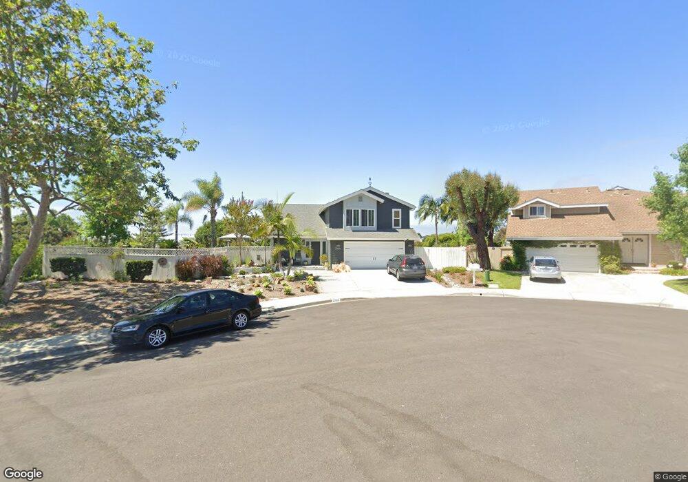
2766 Dundee Ct Carlsbad, CA 92010
Calavera Hills NeighborhoodEstimated Value: $1,174,000 - $1,558,000
4
Beds
3
Baths
2,189
Sq Ft
$651/Sq Ft
Est. Value
About This Home
This home is located at 2766 Dundee Ct, Carlsbad, CA 92010 and is currently estimated at $1,426,025, approximately $651 per square foot. 2766 Dundee Ct is a home located in San Diego County with nearby schools including Hope Elementary School, Calavera Hills Middle, and Sage Creek High.
Ownership History
Date
Name
Owned For
Owner Type
Purchase Details
Closed on
Dec 12, 2009
Sold by
Peterson Robert Frederick and Peterson Jann Ellen
Bought by
Peterson Robert Frederick and Peterson Jann Ellen
Current Estimated Value
Home Financials for this Owner
Home Financials are based on the most recent Mortgage that was taken out on this home.
Original Mortgage
$260,000
Outstanding Balance
$133,937
Interest Rate
4.88%
Mortgage Type
New Conventional
Estimated Equity
$1,292,088
Purchase Details
Closed on
Sep 25, 1998
Sold by
Peterson Robert Frederick and Peterson Jann Ellen
Bought by
Peterson Robert Frederick and Peterson Jann Ellen
Home Financials for this Owner
Home Financials are based on the most recent Mortgage that was taken out on this home.
Original Mortgage
$215,800
Interest Rate
6.6%
Purchase Details
Closed on
Feb 20, 1998
Sold by
Peterson Robert Frederick and Peterson Jann Ellen
Bought by
Peterson Robert Frederick and Peterson Jann Ellen
Home Financials for this Owner
Home Financials are based on the most recent Mortgage that was taken out on this home.
Original Mortgage
$227,150
Interest Rate
6.9%
Purchase Details
Closed on
Nov 12, 1996
Sold by
Peterson Robert F and Peterson Jann E
Bought by
Peterson Robert Frederick and Peterson Jann Ellen
Home Financials for this Owner
Home Financials are based on the most recent Mortgage that was taken out on this home.
Original Mortgage
$233,700
Interest Rate
8.14%
Purchase Details
Closed on
Sep 17, 1996
Sold by
Richard Walters C and Richard Judith A
Bought by
Peterson Robert F and Peterson Jann E
Home Financials for this Owner
Home Financials are based on the most recent Mortgage that was taken out on this home.
Original Mortgage
$233,700
Interest Rate
8.14%
Purchase Details
Closed on
Dec 29, 1989
Purchase Details
Closed on
Dec 5, 1988
Purchase Details
Closed on
Jun 30, 1983
Create a Home Valuation Report for This Property
The Home Valuation Report is an in-depth analysis detailing your home's value as well as a comparison with similar homes in the area
Home Values in the Area
Average Home Value in this Area
Purchase History
| Date | Buyer | Sale Price | Title Company |
|---|---|---|---|
| Peterson Robert Frederick | -- | None Available | |
| Peterson Robert Frederick | -- | Tsi | |
| Peterson Robert Frederick | -- | First American Title Ins Co | |
| Peterson Robert Frederick | -- | Commonwealth Land Title Co | |
| Peterson Robert Frederick | -- | Commonwealth Land Title Co | |
| Peterson Robert Frederick | -- | -- | |
| Peterson Robert F | $260,000 | Fidelity National Title Co | |
| -- | $290,000 | -- | |
| -- | $232,000 | -- | |
| -- | $150,000 | -- |
Source: Public Records
Mortgage History
| Date | Status | Borrower | Loan Amount |
|---|---|---|---|
| Open | Peterson Robert Frederick | $260,000 | |
| Closed | Peterson Robert Frederick | $215,800 | |
| Closed | Peterson Robert Frederick | $227,150 | |
| Previous Owner | Peterson Robert F | $233,700 |
Source: Public Records
Tax History
| Year | Tax Paid | Tax Assessment Tax Assessment Total Assessment is a certain percentage of the fair market value that is determined by local assessors to be the total taxable value of land and additions on the property. | Land | Improvement |
|---|---|---|---|---|
| 2025 | $4,555 | $437,801 | $192,465 | $245,336 |
| 2024 | $4,555 | $429,218 | $188,692 | $240,526 |
| 2023 | $4,529 | $420,803 | $184,993 | $235,810 |
| 2022 | $4,458 | $412,553 | $181,366 | $231,187 |
| 2021 | $4,424 | $404,464 | $177,810 | $226,654 |
| 2020 | $4,393 | $400,317 | $175,987 | $224,330 |
| 2019 | $4,313 | $392,469 | $172,537 | $219,932 |
| 2018 | $4,131 | $384,774 | $169,154 | $215,620 |
| 2017 | $4,061 | $377,231 | $165,838 | $211,393 |
| 2016 | $3,897 | $369,836 | $162,587 | $207,249 |
| 2015 | $3,880 | $364,281 | $160,145 | $204,136 |
| 2014 | $3,815 | $357,146 | $157,008 | $200,138 |
Source: Public Records
Map
Nearby Homes
- 2835 Hillsboro Ct
- 4375 Stanford St
- 2823 Andover Ave
- 4378 Shasta Place
- 3652 Jetty Point
- 2808 Winthrop Ave
- 2822 Winthrop Ave
- 3434 Ravine Dr
- 3522 Buck Ridge Ave
- 3505 N Fork Ave
- 2622 Half Dome Place
- 4822 Nelson Ct
- 3019 Glenbrook St
- 3492 Corvallis St
- 4843 Nelson Ct
- 3722 Bergen Peak Place
- 2726 Naples Ct
- 4600 Catmint Ln
- 2500 Thyme Way
- 2536 Elderberry Ln
- 2768 Dundee Ct
- 2752 Banff Ct
- 2765 Glasgow Dr
- 2770 Dundee Ct
- 2769 Glasgow Dr
- 2761 Glasgow Dr
- 2750 Banff Ct
- 2774 Dundee Ct
- 2773 Glasgow Dr
- 2772 Dundee Ct
- 2757 Glasgow Dr
- 2777 Glasgow Dr
- 2753 Glasgow Dr
- 2762 Inverness Dr
- 4713 Edinburgh Dr
- 2748 Banff Ct
- 4709 Edinburgh Dr
- 2758 Inverness Dr
- 4717 Edinburgh Dr
- 2766 Inverness Dr
Your Personal Tour Guide
Ask me questions while you tour the home.