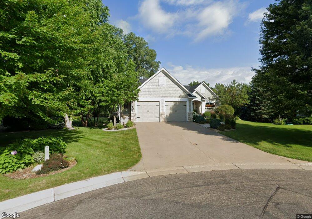
2775 Cohansey Cir Saint Paul, MN 55113
South Owasso NeighborhoodEstimated Value: $570,998 - $786,000
3
Beds
3
Baths
2,028
Sq Ft
$315/Sq Ft
Est. Value
About This Home
This home is located at 2775 Cohansey Cir, Saint Paul, MN 55113 and is currently estimated at $638,750, approximately $314 per square foot. 2775 Cohansey Cir is a home located in Ramsey County with nearby schools including Central Park Elementary School, Roseville Area Middle School, and Roseville Area Senior High School.
Ownership History
Date
Name
Owned For
Owner Type
Purchase Details
Closed on
Apr 29, 2020
Sold by
Schmidt Eugene D and Schmidt Linda D
Bought by
Schmidt Eugene David and Schmidt Linda Diane
Current Estimated Value
Purchase Details
Closed on
Sep 29, 2003
Sold by
Vanguard Builders Inc
Bought by
Schmidt Eugene D and Schmidt Linda D
Create a Home Valuation Report for This Property
The Home Valuation Report is an in-depth analysis detailing your home's value as well as a comparison with similar homes in the area
Home Values in the Area
Average Home Value in this Area
Purchase History
| Date | Buyer | Sale Price | Title Company |
|---|---|---|---|
| Schmidt Eugene David | -- | None Available | |
| Schmidt Eugene D | $508,286 | -- |
Source: Public Records
Tax History Compared to Growth
Tax History
| Year | Tax Paid | Tax Assessment Tax Assessment Total Assessment is a certain percentage of the fair market value that is determined by local assessors to be the total taxable value of land and additions on the property. | Land | Improvement |
|---|---|---|---|---|
| 2025 | $8,426 | $602,600 | $100,000 | $502,600 |
| 2023 | $8,426 | $579,000 | $100,000 | $479,000 |
| 2022 | $7,308 | $567,200 | $100,000 | $467,200 |
| 2021 | $6,780 | $482,600 | $100,000 | $382,600 |
| 2020 | $7,278 | $477,800 | $100,000 | $377,800 |
| 2019 | $7,362 | $480,200 | $63,000 | $417,200 |
| 2018 | $7,212 | $472,300 | $63,000 | $409,300 |
| 2017 | $6,204 | $449,800 | $63,000 | $386,800 |
| 2016 | $6,590 | $0 | $0 | $0 |
| 2015 | $6,526 | $430,000 | $63,000 | $367,000 |
| 2014 | $5,574 | $0 | $0 | $0 |
Source: Public Records
Map
Nearby Homes
- 405 Judith Ave
- 387 Iona Ln
- 540 Woodhill Dr Unit 71
- 2720 MacKubin St
- 2748 Kent St
- 2730 Dale St N Unit D101
- 2730 Dale St N Unit D309
- 437 County Road C W
- 2720 Dale St N Unit C208
- 2710 Dale St N Unit B212
- 556 County Road C W
- 2814 Matilda St
- 2970 Western Ave N
- 350 County Road C W
- 667 County Road C W
- 2687 Galtier St
- 2580 Western Ave N
- 2802 Marion St
- 255 County Road C2 W
- 405 Brooks Ave W
- 2769 Cohansey Cir
- 2780 Cohansey Cir
- 494 Judith Ave
- 2765 Cohansey Cir
- 511 Iona Ln
- 0 Cohansey Cir
- 484 Judith Ave
- 2776 Cohansey Cir
- 2770 Cohansey Cir
- 2766 Cohansey Cir
- 476 Judith Ave
- 2805 Hillscourte S
- 523 Iona Ln
- 2809 Hillscourte S
- 468 Judith Ave
- 493 Judith Ave
- 483 Judith Ave
- 2752 MacKubin St
- 2765 Iona Cir
- 2777 Iona Cir