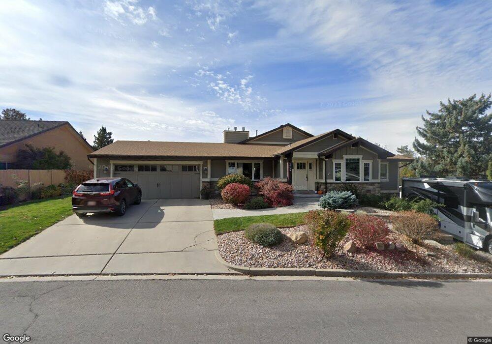
2793 Arapahoe Ln Provo, UT 84604
Rock Canyon NeighborhoodEstimated Value: $880,000 - $1,072,000
3
Beds
3
Baths
2,693
Sq Ft
$358/Sq Ft
Est. Value
About This Home
This home is located at 2793 Arapahoe Ln, Provo, UT 84604 and is currently estimated at $964,014, approximately $357 per square foot. 2793 Arapahoe Ln is a home located in Utah County with nearby schools including Rock Canyon Elementary School, Centennial Middle School, and Timpview High School.
Ownership History
Date
Name
Owned For
Owner Type
Purchase Details
Closed on
Mar 7, 2022
Sold by
Ranck Jeffrey and Ranck Michelle
Bought by
Jeffrey & Michelle Ranck Family Trust
Current Estimated Value
Purchase Details
Closed on
Dec 5, 2012
Sold by
Persson Lee C and Carol P Hone Family Trust
Bought by
Ranck Jeffrey and Ranck Michelle
Home Financials for this Owner
Home Financials are based on the most recent Mortgage that was taken out on this home.
Original Mortgage
$130,000
Interest Rate
3.36%
Mortgage Type
New Conventional
Purchase Details
Closed on
Dec 6, 2011
Sold by
Hone Carol P
Bought by
Hone Carol P and Carol P Hone Family Trust
Create a Home Valuation Report for This Property
The Home Valuation Report is an in-depth analysis detailing your home's value as well as a comparison with similar homes in the area
Home Values in the Area
Average Home Value in this Area
Purchase History
| Date | Buyer | Sale Price | Title Company |
|---|---|---|---|
| Jeffrey & Michelle Ranck Family Trust | -- | -- | |
| Ranck Jeffrey | -- | First American Title Co Llc | |
| Hone Carol P | -- | None Available |
Source: Public Records
Mortgage History
| Date | Status | Borrower | Loan Amount |
|---|---|---|---|
| Previous Owner | Ranck Jeffrey | $130,000 |
Source: Public Records
Tax History Compared to Growth
Tax History
| Year | Tax Paid | Tax Assessment Tax Assessment Total Assessment is a certain percentage of the fair market value that is determined by local assessors to be the total taxable value of land and additions on the property. | Land | Improvement |
|---|---|---|---|---|
| 2025 | $4,426 | $504,790 | $346,900 | $570,900 |
| 2024 | $4,426 | $435,655 | $0 | $0 |
| 2023 | $4,138 | $401,555 | $0 | $0 |
| 2022 | $3,976 | $389,070 | $0 | $0 |
| 2021 | $2,824 | $482,000 | $201,300 | $280,700 |
| 2020 | $2,727 | $436,200 | $161,000 | $275,200 |
| 2019 | $2,622 | $436,200 | $161,000 | $275,200 |
| 2018 | $2,539 | $428,500 | $153,300 | $275,200 |
| 2017 | $2,192 | $203,280 | $0 | $0 |
| 2016 | $1,930 | $166,815 | $0 | $0 |
| 2015 | $1,738 | $151,800 | $0 | $0 |
| 2014 | $1,486 | $135,355 | $0 | $0 |
Source: Public Records
Map
Nearby Homes
- 3006 Indian Hills Dr
- 895 E 2620 N
- 3021 Bannock Dr
- 3129 Cherokee Ln
- 724 E 3230 N
- 664 E 2320 N
- 3411 N Piute Dr
- 2774 N 370 E
- 1636 N 320 E Unit 5
- 1660 N 320 E Unit 3
- 1648 N 320 E Unit 4
- 1625 N 320 E Unit 1
- 1624 N 320 E Unit 6
- 1615 N 320 E Unit 1
- 1612 N 320 E Unit RES
- 2040 Oakcrest Terrace
- 2295 N 470 E
- 597 E 3400 N
- 553 E 3400 N
- 2254 N 390 E
- 2781 Arapahoe Ln
- 2811 Arapahoe Ln
- 2778 Oneida Ln
- 2762 Oneida Ln
- 2767 Arapahoe Ln
- 2819 Arapahoe Ln
- 2808 Arapahoe Ln
- 2816 Arapahoe Ln
- 2790 Oneida Ln
- 2740 Oneida Ln
- 2824 Arapahoe Ln
- 2796 Arapahoe Ln
- 2741 Arapahoe Ln
- 2827 Arapahoe Ln
- 2836 Arapahoe Ln
- 2814 Oneida Ln
- 2831 Apache Ln
- 2728 Oneida Ln
- 2839 Apache Ln
- 2805 Apache Ln