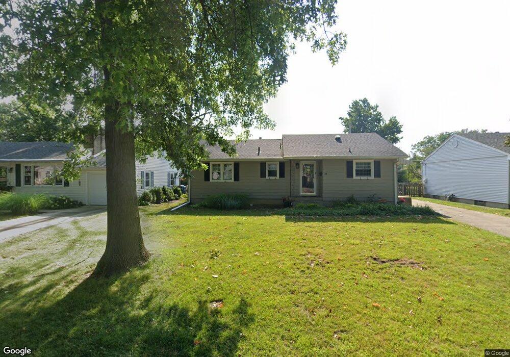
28 Bob o Link Dr Springfield, IL 62702
Estimated Value: $117,000 - $169,725
--
Bed
--
Bath
--
Sq Ft
7,013
Sq Ft Lot
About This Home
This home is located at 28 Bob o Link Dr, Springfield, IL 62702 and is currently estimated at $140,181. 28 Bob o Link Dr is a home located in Sangamon County with nearby schools including Jane Addams Elementary School, U.S. Grant Middle School, and Springfield High School.
Ownership History
Date
Name
Owned For
Owner Type
Purchase Details
Closed on
Jun 1, 2022
Sold by
Komperda Annette B
Bought by
Stevens Matthew A and Spear Tabitha L
Current Estimated Value
Home Financials for this Owner
Home Financials are based on the most recent Mortgage that was taken out on this home.
Original Mortgage
$142,500
Outstanding Balance
$135,399
Interest Rate
5.11%
Mortgage Type
New Conventional
Estimated Equity
$4,782
Purchase Details
Closed on
Jun 14, 2012
Create a Home Valuation Report for This Property
The Home Valuation Report is an in-depth analysis detailing your home's value as well as a comparison with similar homes in the area
Home Values in the Area
Average Home Value in this Area
Purchase History
| Date | Buyer | Sale Price | Title Company |
|---|---|---|---|
| Stevens Matthew A | $150,000 | Barber Segatto Hoffee Wilke & | |
| -- | $105,000 | -- |
Source: Public Records
Mortgage History
| Date | Status | Borrower | Loan Amount |
|---|---|---|---|
| Open | Stevens Matthew A | $142,500 |
Source: Public Records
Tax History Compared to Growth
Tax History
| Year | Tax Paid | Tax Assessment Tax Assessment Total Assessment is a certain percentage of the fair market value that is determined by local assessors to be the total taxable value of land and additions on the property. | Land | Improvement |
|---|---|---|---|---|
| 2024 | $2,685 | $37,962 | $7,715 | $30,247 |
| 2023 | $2,535 | $34,675 | $7,047 | $27,628 |
| 2022 | $2,410 | $32,893 | $6,685 | $26,208 |
| 2021 | $2,310 | $31,662 | $6,435 | $25,227 |
| 2020 | $2,265 | $31,710 | $6,445 | $25,265 |
| 2019 | $2,221 | $31,600 | $6,423 | $25,177 |
| 2018 | $2,280 | $32,990 | $6,392 | $26,598 |
| 2017 | $2,227 | $32,563 | $6,309 | $26,254 |
| 2016 | $2,176 | $32,088 | $6,217 | $25,871 |
| 2015 | $2,149 | $31,705 | $6,143 | $25,562 |
| 2014 | $2,013 | $31,500 | $6,103 | $25,397 |
| 2013 | $1,968 | $30,292 | $6,104 | $24,188 |
Source: Public Records
Map
Nearby Homes
- 75 Meadowlark Ln
- 2011 W Jefferson St
- 2102 W Jefferson St
- 846 Roanoke Dr
- 852 N Oxford Rd
- 1320 Churchill Rd
- 1910 Jeanette Ln Unit 2
- 105 Timberridge Dr
- 22 Babiak Ln
- 700 Country Meadows Dr
- 108 Cartwright Dr
- 409 N Durkin Dr
- 1751 N Grand Ave W Unit 2
- 1751 N Grand Ave W Unit 103
- 1751 N Grand Ave W Unit 5
- 130 Dickinson Rd
- 2071 W Monroe St Unit 1/A
- 301 Collier Dr
- 2205 Whitefield Rd
- 112 Stange Ave
- 24 Bob o Link Dr
- 32 Bob o Link Dr
- 20 Bob o Link Dr
- 13 Sunnyside Dr
- 13 Sunny Side Dr
- 9 Sunnyside Dr
- 19 Bob o Link Dr
- 23 Bob o Link Dr
- 15 Bob o Link Dr
- 15 Sunnyside Dr
- 16 Bob o Link Dr
- 27 Bob o Link Dr
- 27 Bob-O-link Dr
- 40 Bob o Link Dr
- 40 Bob-O-link Dr
- 11 Sonny Dr
- 10 Sonny Dr
- 17 Sunnyside Dr
- 31 Bob o Link Dr
- 12 Bob o Link Dr