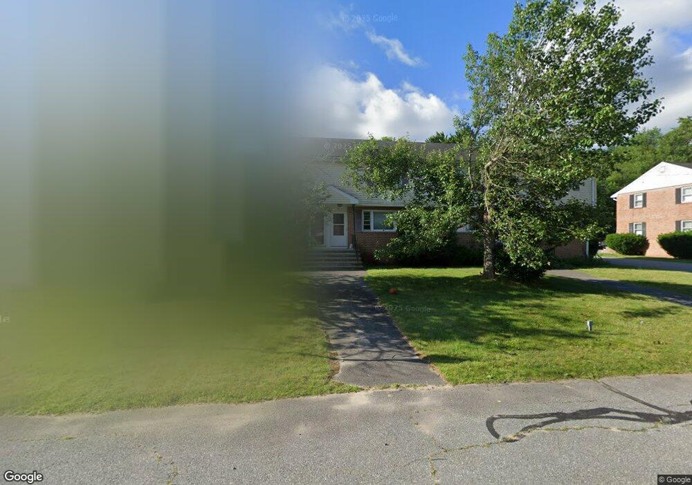
28 Frank St Dracut, MA 01826
Estimated Value: $337,000 - $362,697
2
Beds
1
Bath
1,340
Sq Ft
$259/Sq Ft
Est. Value
About This Home
This home is located at 28 Frank St, Dracut, MA 01826 and is currently estimated at $347,174, approximately $259 per square foot. 28 Frank St is a home located in Middlesex County with nearby schools including Greenmont Avenue School, Richardson Middle School, and Dracut Senior High School.
Ownership History
Date
Name
Owned For
Owner Type
Purchase Details
Closed on
Jan 31, 2011
Sold by
Fnma
Bought by
Lepine Richard L
Current Estimated Value
Purchase Details
Closed on
Mar 22, 2010
Sold by
Cosgrove Susan
Bought by
Federal National Mortgage Association
Purchase Details
Closed on
Jul 23, 2002
Sold by
Gorman Frank J
Bought by
Lavallee Russell R
Home Financials for this Owner
Home Financials are based on the most recent Mortgage that was taken out on this home.
Original Mortgage
$123,405
Interest Rate
6.39%
Create a Home Valuation Report for This Property
The Home Valuation Report is an in-depth analysis detailing your home's value as well as a comparison with similar homes in the area
Home Values in the Area
Average Home Value in this Area
Purchase History
| Date | Buyer | Sale Price | Title Company |
|---|---|---|---|
| Lepine Richard L | $82,000 | -- | |
| Federal National Mortgage Association | $179,412 | -- | |
| Lavallee Russell R | $119,900 | -- |
Source: Public Records
Mortgage History
| Date | Status | Borrower | Loan Amount |
|---|---|---|---|
| Previous Owner | Lavallee Russell R | $123,405 | |
| Previous Owner | Lavallee Russell R | $95,900 |
Source: Public Records
Tax History Compared to Growth
Tax History
| Year | Tax Paid | Tax Assessment Tax Assessment Total Assessment is a certain percentage of the fair market value that is determined by local assessors to be the total taxable value of land and additions on the property. | Land | Improvement |
|---|---|---|---|---|
| 2025 | $3,012 | $297,600 | $0 | $297,600 |
| 2024 | $2,917 | $279,100 | $0 | $279,100 |
| 2023 | $2,724 | $235,200 | $0 | $235,200 |
| 2022 | $2,586 | $210,400 | $0 | $210,400 |
| 2021 | $2,599 | $199,800 | $0 | $199,800 |
| 2020 | $2,494 | $186,800 | $0 | $186,800 |
| 2019 | $2,325 | $169,100 | $0 | $169,100 |
| 2018 | $2,275 | $160,900 | $0 | $160,900 |
| 2017 | $2,179 | $160,900 | $0 | $160,900 |
| 2016 | $2,202 | $148,400 | $0 | $148,400 |
| 2015 | $1,995 | $133,600 | $0 | $133,600 |
| 2014 | $1,716 | $118,400 | $0 | $118,400 |
Source: Public Records
Map
Nearby Homes
- 26 Frank St
- 1572 Bridge St
- 167 Betty Ann Ln
- 20 Esther Way Unit 11
- 321 Old Marsh Hill Rd
- 19 Esther Way Unit Lot 10
- 81 Spring Park Ave
- 67 Lincoln Ln
- 190 Old Rd
- 174 Old Rd
- 18 Stone St
- 157 Old Rd
- 999 Hildreth St
- 315 Broadway Rd Unit 7
- 109 Meadow Creek Dr
- 100 Cass Ave Unit A13
- 50 Stephen Ave
- 77 Christy Ave
- 12 Pemberton St
- 35 Thissell Ave
- 24 Frank St
- 18 Frank St
- 16 Frank St
- 24 Frank St Unit 24 $179,900
- 14 Frank St
- 40 Frank St
- 52 Frank St
- 50 Frank St
- 48 Frank St
- 38 Frank St
- 36 Frank St
- 50 Frank St Unit 50
- 1686 Bridge St Unit 1688
- 1688 Bridge St
- 1686 Bridge St
- 15 Mary Ave
- 23 Mary Ave
- 15 Frank St Unit 6
- 15 Frank St Unit 5
- 15 Frank St Unit 4