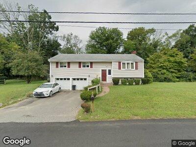
28 Larson Rd Stoughton, MA 02072
Estimated Value: $618,433 - $645,000
3
Beds
2
Baths
1,744
Sq Ft
$362/Sq Ft
Est. Value
About This Home
This home is located at 28 Larson Rd, Stoughton, MA 02072 and is currently estimated at $632,108, approximately $362 per square foot. 28 Larson Rd is a home located in Norfolk County with nearby schools including Joseph R Dawe Jr Elementary School, O'Donnell Middle School, and Stoughton High School.
Ownership History
Date
Name
Owned For
Owner Type
Purchase Details
Closed on
Aug 19, 1988
Sold by
Webb B Joseph
Bought by
Kinan Albert P
Current Estimated Value
Home Financials for this Owner
Home Financials are based on the most recent Mortgage that was taken out on this home.
Original Mortgage
$37,000
Interest Rate
10.32%
Mortgage Type
Purchase Money Mortgage
Purchase Details
Closed on
Mar 30, 1987
Sold by
Carr Lawrence D
Bought by
Webb B Joseph
Create a Home Valuation Report for This Property
The Home Valuation Report is an in-depth analysis detailing your home's value as well as a comparison with similar homes in the area
Home Values in the Area
Average Home Value in this Area
Purchase History
| Date | Buyer | Sale Price | Title Company |
|---|---|---|---|
| Kinan Albert P | $187,000 | -- | |
| Webb B Joseph | $172,000 | -- |
Source: Public Records
Mortgage History
| Date | Status | Borrower | Loan Amount |
|---|---|---|---|
| Closed | Webb B Joseph | $37,000 |
Source: Public Records
Tax History Compared to Growth
Tax History
| Year | Tax Paid | Tax Assessment Tax Assessment Total Assessment is a certain percentage of the fair market value that is determined by local assessors to be the total taxable value of land and additions on the property. | Land | Improvement |
|---|---|---|---|---|
| 2025 | $6,854 | $553,600 | $222,200 | $331,400 |
| 2024 | $6,663 | $523,400 | $203,000 | $320,400 |
| 2023 | $6,409 | $473,000 | $185,500 | $287,500 |
| 2022 | $6,296 | $436,900 | $178,500 | $258,400 |
| 2021 | $6,008 | $397,900 | $157,500 | $240,400 |
| 2020 | $5,783 | $388,400 | $157,500 | $230,900 |
| 2019 | $5,831 | $380,100 | $157,500 | $222,600 |
| 2018 | $5,077 | $342,800 | $150,500 | $192,300 |
| 2017 | $4,861 | $335,500 | $148,700 | $186,800 |
| 2016 | $4,624 | $308,900 | $134,700 | $174,200 |
| 2015 | $4,568 | $301,900 | $127,700 | $174,200 |
| 2014 | $4,476 | $284,400 | $117,200 | $167,200 |
Source: Public Records
Map
Nearby Homes
- 111 E Vanston Rd
- 349 Central St
- 60 Brewster Rd Unit 60
- 15 Harwich Ln Unit 15
- 15 Harwich Ln
- 453 Turnpike St
- 121 Bassick Cir
- 0 Old Maple St
- 336 Lincoln St
- 192 Corbett Rd
- 393 Walnut St
- 31 7th St
- 68 Boylston St
- 600-R Pleasant St
- 20 Walnut Ct
- Lot 9 Lawler Ln
- 710 Central St
- 827 Park St
- 287 Walnut St
- 19 Camelot Ct