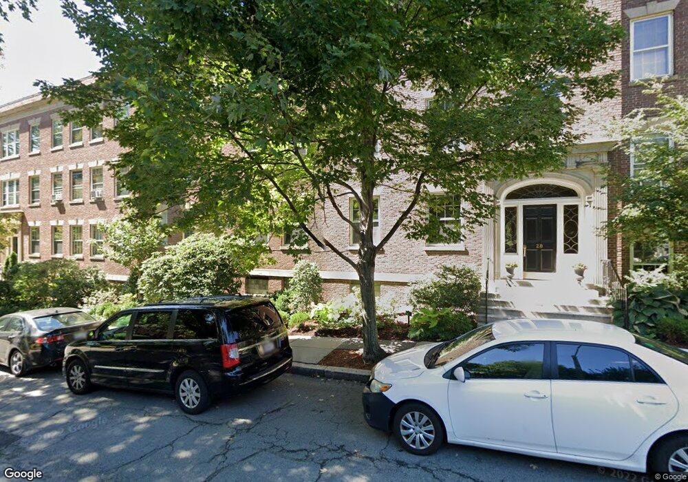
28 Marshal St Unit 2,28 Brookline, MA 02446
Coolidge Corner NeighborhoodEstimated Value: $1,725,000 - $2,113,000
4
Beds
3
Baths
2,158
Sq Ft
$916/Sq Ft
Est. Value
About This Home
This home is located at 28 Marshal St Unit 2,28, Brookline, MA 02446 and is currently estimated at $1,975,831, approximately $915 per square foot. 28 Marshal St Unit 2,28 is a home located in Norfolk County with nearby schools including Amos A. Lawrence School, St. Mary of the Assumption Elementary School, and Winsor School.
Ownership History
Date
Name
Owned For
Owner Type
Purchase Details
Closed on
Jun 4, 2021
Sold by
Gollon Roberta J Est
Bought by
Carvajal Juan and Carvajal Angelina
Current Estimated Value
Home Financials for this Owner
Home Financials are based on the most recent Mortgage that was taken out on this home.
Original Mortgage
$1,104,000
Outstanding Balance
$999,534
Interest Rate
2.9%
Mortgage Type
Purchase Money Mortgage
Estimated Equity
$976,297
Purchase Details
Closed on
Jan 13, 1986
Bought by
Gollon Roberta J
Create a Home Valuation Report for This Property
The Home Valuation Report is an in-depth analysis detailing your home's value as well as a comparison with similar homes in the area
Home Values in the Area
Average Home Value in this Area
Purchase History
| Date | Buyer | Sale Price | Title Company |
|---|---|---|---|
| Carvajal Juan | $1,380,000 | None Available | |
| Gollon Roberta J | $285,000 | -- |
Source: Public Records
Mortgage History
| Date | Status | Borrower | Loan Amount |
|---|---|---|---|
| Open | Carvajal Juan | $1,104,000 |
Source: Public Records
Tax History Compared to Growth
Tax History
| Year | Tax Paid | Tax Assessment Tax Assessment Total Assessment is a certain percentage of the fair market value that is determined by local assessors to be the total taxable value of land and additions on the property. | Land | Improvement |
|---|---|---|---|---|
| 2025 | $16,827 | $1,704,900 | $0 | $1,704,900 |
| 2024 | $16,060 | $1,643,800 | $0 | $1,643,800 |
| 2023 | $15,541 | $1,558,800 | $0 | $1,558,800 |
| 2022 | $15,248 | $1,496,400 | $0 | $1,496,400 |
| 2021 | $14,521 | $1,481,700 | $0 | $1,481,700 |
| 2020 | $13,863 | $1,467,000 | $0 | $1,467,000 |
| 2019 | $13,092 | $1,397,200 | $0 | $1,397,200 |
| 2018 | $12,586 | $1,330,400 | $0 | $1,330,400 |
| 2017 | $12,171 | $1,231,900 | $0 | $1,231,900 |
| 2016 | $11,669 | $1,119,900 | $0 | $1,119,900 |
| 2015 | $10,873 | $1,018,100 | $0 | $1,018,100 |
| 2014 | $10,527 | $924,200 | $0 | $924,200 |
Source: Public Records
Map
Nearby Homes
- 151 Longwood Ave Unit 1
- 60 Longwood Ave Unit 802
- 60 Longwood Ave Unit 307
- 60 Longwood Ave Unit 403
- 50 Longwood Ave Unit 611
- 20 Chapel St Unit APH4
- 20 Chapel St Unit B712
- 20 Chapel St Unit B811
- 65 Francis St Unit 65
- 65 Francis St
- 98 Saint Paul St Unit A1
- 45 Longwood Ave Unit 812
- 45 Longwood Ave Unit PHA
- 15 James St Unit 2
- 17 James St Unit 1
- 18 Browne St Unit 2
- 30 Stearns Rd Unit 302
- 79 Pleasant St Unit 4
- 63 Green St Unit 3
- 63 Green St Unit 2
- 28 Marshal St Unit 4
- 28 Marshal St Unit 3
- 28 Marshal St Unit 2
- 28 Marshal St Unit 1
- 20 Marshal St Unit 2
- 20 Marshal St Unit 3
- 20 Marshal St Unit 1A
- 20 Marshal St Unit 4
- 32 Marshal St Unit 4
- 32 Marshal St Unit 3
- 32 Marshal St Unit 2
- 32 Marshal St Unit 1
- 32 Marshal St Unit 1
- 32 Marshal St Unit 1,32
- 137 Sewall Ave
- 137 Sewall Ave Unit 1
- 137 Sewall Ave Unit 4
- 137 Sewall Ave Unit 3
- 137 Sewall Ave Unit 2
- 137 Sewall Ave Unit 2,137