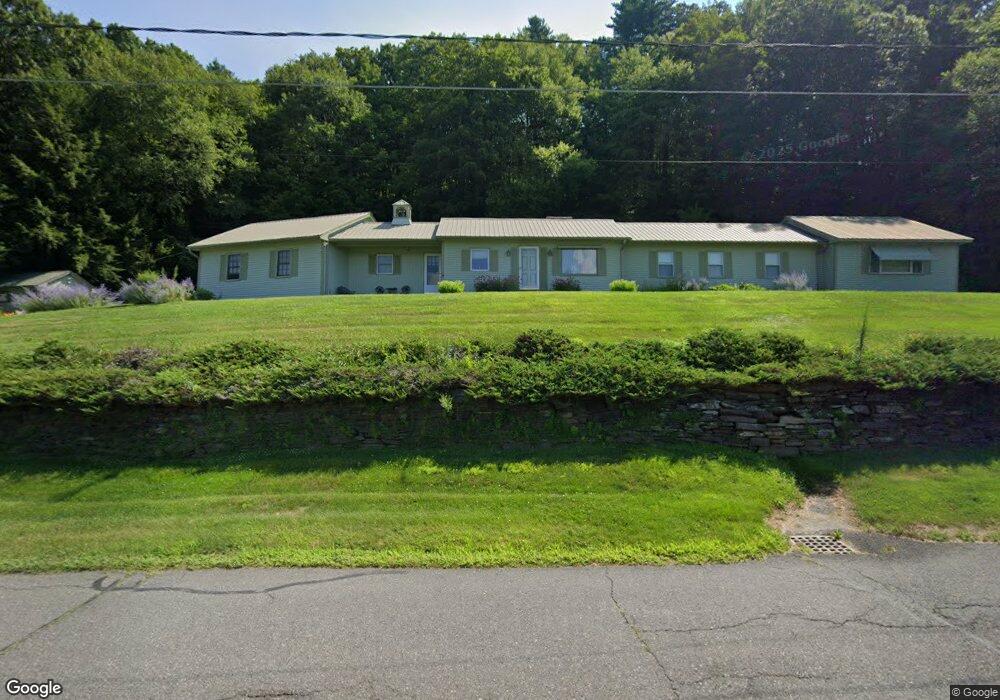
28 N Silver Ln Sunderland, MA 01375
Estimated Value: $464,759 - $516,000
2
Beds
2
Baths
2,011
Sq Ft
$243/Sq Ft
Est. Value
About This Home
This home is located at 28 N Silver Ln, Sunderland, MA 01375 and is currently estimated at $488,940, approximately $243 per square foot. 28 N Silver Ln is a home located in Franklin County with nearby schools including Sunderland Elementary School and Frontier Regional School.
Ownership History
Date
Name
Owned For
Owner Type
Purchase Details
Closed on
May 13, 1994
Sold by
Goodyear Mildred A
Bought by
Thurston William E
Current Estimated Value
Home Financials for this Owner
Home Financials are based on the most recent Mortgage that was taken out on this home.
Original Mortgage
$105,000
Interest Rate
7.93%
Mortgage Type
Purchase Money Mortgage
Create a Home Valuation Report for This Property
The Home Valuation Report is an in-depth analysis detailing your home's value as well as a comparison with similar homes in the area
Home Values in the Area
Average Home Value in this Area
Purchase History
| Date | Buyer | Sale Price | Title Company |
|---|---|---|---|
| Thurston William E | $135,000 | -- |
Source: Public Records
Mortgage History
| Date | Status | Borrower | Loan Amount |
|---|---|---|---|
| Open | Thurston William E | $100,000 | |
| Closed | Thurston William E | $75,000 | |
| Closed | Thurston William E | $105,000 |
Source: Public Records
Tax History
| Year | Tax Paid | Tax Assessment Tax Assessment Total Assessment is a certain percentage of the fair market value that is determined by local assessors to be the total taxable value of land and additions on the property. | Land | Improvement |
|---|---|---|---|---|
| 2025 | $53 | $406,900 | $117,500 | $289,400 |
| 2024 | $5,347 | $406,900 | $117,500 | $289,400 |
| 2023 | $4,909 | $383,500 | $107,300 | $276,200 |
| 2022 | $4,966 | $337,800 | $92,300 | $245,500 |
| 2021 | $4,659 | $300,800 | $84,500 | $216,300 |
| 2020 | $4,649 | $301,100 | $84,500 | $216,600 |
| 2019 | $4,498 | $293,400 | $82,200 | $211,200 |
| 2018 | $4,281 | $285,400 | $77,400 | $208,000 |
| 2017 | $4,012 | $279,800 | $79,000 | $200,800 |
| 2016 | $4,134 | $282,000 | $77,200 | $204,800 |
| 2015 | $4,027 | $281,400 | $77,200 | $204,200 |
| 2014 | $3,934 | $281,400 | $77,200 | $204,200 |
Source: Public Records
Map
Nearby Homes
- 358 S Silver Ln
- 10 Depot Rd
- 200 Long Plain Rd
- 14 Sugarloaf St
- 0 Greenfield Rd Unit 73472322
- 274 Sunderland Rd
- 117 N Main St
- 34 Comins Rd
- 113 Juggler Meadow Rd
- 45 Comins Rd
- 0 Pocumtuck Dr Unit 73379330
- 36 Swamp Rd
- 90 Whately Rd
- 79 State Rd
- 180 Summer St
- 0 North St Unit 73407299
- 37 Harris St
- 208 Pine St Unit 53
- 435 Montague Rd
- 33 Bridge St
- 28 S Silver Ln
- 22 N Silver Ln
- 34 S Silver Ln
- 22 S Silver Ln
- 38 S Silver Ln
- 243 Amherst Rd
- 239 Amherst Rd
- 16 S Silver Ln
- 41 S Silver Ln
- 253 Amherst Rd
- 44 S Silver Ln
- 10 S Silver Ln
- 240 Amherst Rd
- 49 S Silver Ln
- 50 S Silver Ln
- 267 Amherst Rd Unit Suite 1
- 267 Amherst Rd Unit Suite 3
- 267 Amherst Rd Unit 1
- 267 Amherst Rd Unit 3
- 267 Amherst Rd
Your Personal Tour Guide
Ask me questions while you tour the home.